

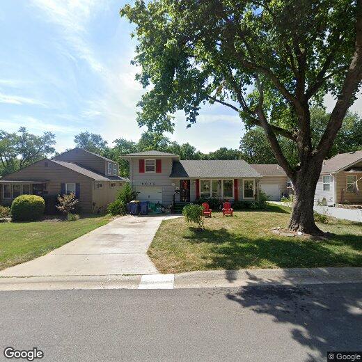
6025 W 53rd Pl
6025 W 53rd Pl
Mission, KS 66202
2 Weeks Ago
|
Edit
Favorites
6025 W 53rd Pl

Favorites
Check Back Soon for Upcoming Availability
| Beds | Baths | Average SF |
|---|---|---|
| 3 Bedrooms 3 Bedrooms 3 Br | 2 Baths 2 Baths 2 Ba | — |
Location
Get Directions
Located in Johnson County, the city of Mission features a plethora of community parks, including Streamway Park and Broadmoor Park – both in walking distance of quaint Mission apartments and houses.
Along Johnson Drive, you’ll find an abundance of restaurants, coffee shops, and retailers. The Johnson County Motor Vehicle building resides in Mission, a few short blocks from the Sylvester Powell Jr. Community Center. Just like its excellent schools, Mission residents are appreciative of their direct access to Interstate 35. The city is only 15 minutes from Kansas City as well as the shopping opportunities at Oak Park Mall.
Learn more about living in Mission
Education
| Colleges & Universities | Distance | ||
|---|---|---|---|
| Colleges & Universities | Distance | ||
| Drive: | 12 min | 4.9 mi | |
| Drive: | 12 min | 5.2 mi | |
| Drive: | 12 min | 5.3 mi | |
| Drive: | 18 min | 11.2 mi |
6025 W 53rd Pl is within 12 minutes or 4.9 miles from Kansas City Art Institute. It is also near UM Kansas City and Rockhurst University.
Transportation options available in Mission include Crossroads On Main At 19Th St Sb, located 6.6 miles from 6025 W 53rd Pl. 6025 W 53rd Pl is near Kansas City International, located 26.3 miles or 34 minutes away.
| Transit / Subway | Distance | ||
|---|---|---|---|
| Transit / Subway | Distance | ||
| Drive: | 10 min | 6.6 mi | |
| Drive: | 11 min | 6.9 mi | |
| Drive: | 11 min | 6.9 mi | |
| Drive: | 11 min | 7.1 mi | |
| Drive: | 11 min | 7.1 mi |
| Commuter Rail | Distance | ||
|---|---|---|---|
| Commuter Rail | Distance | ||
|
|
Drive: | 12 min | 7.1 mi |
|
|
Drive: | 28 min | 16.7 mi |
|
|
Drive: | 35 min | 21.8 mi |
|
|
Drive: | 48 min | 40.3 mi |
| Airports | Distance | ||
|---|---|---|---|
| Airports | Distance | ||
|
Kansas City International
|
Drive: | 34 min | 26.3 mi |
Time and distance from 6025 W 53rd Pl.
| Shopping Centers | Distance | ||
|---|---|---|---|
| Shopping Centers | Distance | ||
| Walk: | 14 min | 0.8 mi | |
| Walk: | 15 min | 0.8 mi | |
| Drive: | 3 min | 1.2 mi |
6025 W 53rd Pl has 3 shopping centers within 1.2 miles, which is about a 3-minute walk. The miles and minutes will be for the farthest away property.
| Parks and Recreation | Distance | ||
|---|---|---|---|
| Parks and Recreation | Distance | ||
|
Antioch Park
|
Drive: | 7 min | 3.2 mi |
|
Wonderscope Children's Museum
|
Drive: | 9 min | 4.1 mi |
|
Loose Park
|
Drive: | 11 min | 4.5 mi |
|
Mill Creek Park
|
Drive: | 11 min | 4.8 mi |
|
Theis Park
|
Drive: | 11 min | 4.9 mi |
6025 W 53rd Pl has 5 parks within 4.9 miles, including Antioch Park, Wonderscope Children's Museum, and Loose Park.
| Hospitals | Distance | ||
|---|---|---|---|
| Hospitals | Distance | ||
| Drive: | 11 min | 4.5 mi | |
| Drive: | 10 min | 4.7 mi | |
| Drive: | 10 min | 5.3 mi |
6025 W 53rd Pl has 3 hospitals within 5.3 miles, the nearest is St. Lukes Hospital of Kansas City which is 4.5 miles away and a 11 minute drive.
| Military Bases | Distance | ||
|---|---|---|---|
| Military Bases | Distance | ||
| Drive: | 54 min | 38.6 mi |
6025 W 53rd Pl is 38.6 miles and a 54 minute drive from Fort Leavenworth.
You May Also Like
Similar Rentals Nearby


What Are Walk Score®, Transit Score®, and Bike Score® Ratings?
Walk Score® measures the walkability of any address. Transit Score® measures access to public transit. Bike Score® measures the bikeability of any address.
What is a Sound Score Rating?
A Sound Score Rating aggregates noise caused by vehicle traffic, airplane traffic and local sources
6025 W 53rd Pl
Mission, KS 66202