
Edgewood Heights
10303 20th St E,
Edgewood, WA 98372
$1,790 - $2,325
1-3 Beds
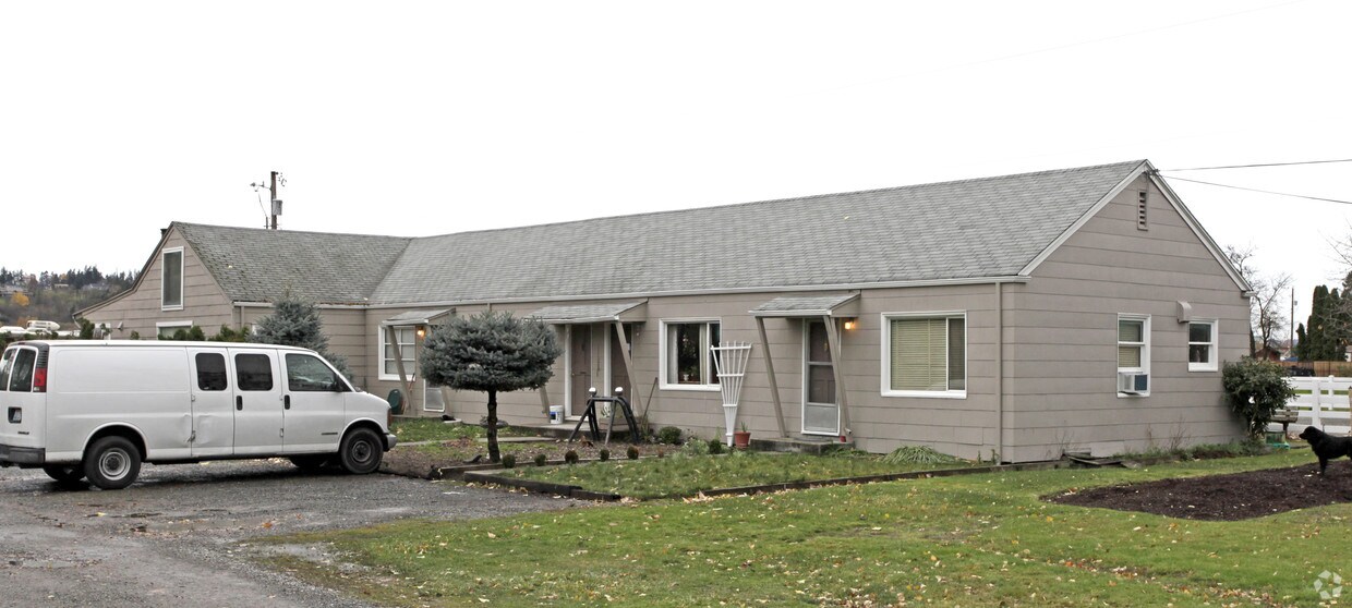

6020 66th Ave E in Puyallup, WA is ready for you to move in. This apartment community is located in Puyallup at 6020 66th Ave E. in the 98371 area. Come by to check out the current floorplan options. The professional leasing staff is waiting to show you all that this community has in store. Get moving on finding your next place. Contact or stop by 6020 66th Ave E to find out current pricing!
6020 66th Ave E is an apartment community located in Pierce County and the 98371 ZIP Code. This area is served by the Puyallup School District attendance zone.
Located in the Puyallup Valley, this western Washington city combines suburban living with historic character. The community of 43,000 residents offers various housing options from downtown apartments to residential neighborhoods, with rental rates averaging $1,583 for one-bedroom units and $1,937 for two-bedroom homes. Downtown's Meridian Street features an antique district where local shops and restaurants create a welcoming atmosphere. Pioneer Park, a central community gathering place, includes a public library, walking paths, and hosts one of Washington state's largest farmers' markets from April through October.
Puyallup celebrates its agricultural roots while embracing contemporary life, highlighted by the Washington State Fair, which draws visitors from across the region to the fairgrounds. Outdoor enthusiasts enjoy easy access to Mount Rainier and the Pierce County Foothills Trail.
Learn more about living in PuyallupCompare neighborhood and city base rent averages by bedroom.
| Waller | Puyallup, WA | |
|---|---|---|
| Studio | - | $1,334 |
| 1 Bedroom | $1,290 | $1,608 |
| 2 Bedrooms | $1,442 | $1,921 |
| 3 Bedrooms | - | $2,440 |
| Colleges & Universities | Distance | ||
|---|---|---|---|
| Colleges & Universities | Distance | ||
| Drive: | 13 min | 6.2 mi | |
| Drive: | 11 min | 6.4 mi | |
| Drive: | 18 min | 9.0 mi | |
| Drive: | 20 min | 12.8 mi |


Transportation options available in Puyallup include South 25Th, located 6.2 miles from 6020 66th Ave E. 6020 66th Ave E is near Seattle-Tacoma International, located 21.0 miles or 36 minutes away.
| Transit / Subway | Distance | ||
|---|---|---|---|
| Transit / Subway | Distance | ||
|
|
Drive: | 11 min | 6.2 mi |
|
|
Drive: | 11 min | 6.6 mi |
| Drive: | 12 min | 6.8 mi | |
|
|
Drive: | 12 min | 7.1 mi |
| Drive: | 12 min | 7.1 mi |
| Commuter Rail | Distance | ||
|---|---|---|---|
| Commuter Rail | Distance | ||
|
|
Drive: | 10 min | 5.6 mi |
| Drive: | 16 min | 10.1 mi | |
| Drive: | 19 min | 10.9 mi | |
|
|
Drive: | 45 min | 31.5 mi |
|
Olympia-Lacey Amtrak Station
|
Drive: | 52 min | 34.4 mi |
| Airports | Distance | ||
|---|---|---|---|
| Airports | Distance | ||
|
Seattle-Tacoma International
|
Drive: | 36 min | 21.0 mi |
Scores provided by
Traffic
-Airport
-Businesses
-Scores provided by
HowLoud What is a Sound Score Rating? A Sound Score Rating aggregates noise caused by vehicle traffic, airplane traffic and local sources. How It WorksTime and distance from 6020 66th Ave E.
| Shopping Centers | Distance | ||
|---|---|---|---|
| Shopping Centers | Distance | ||
| Drive: | 5 min | 2.2 mi | |
| Drive: | 5 min | 2.6 mi | |
| Drive: | 7 min | 3.1 mi |
| Parks and Recreation | Distance | ||
|---|---|---|---|
| Parks and Recreation | Distance | ||
|
Orangegate Park
|
Drive: | 7 min | 2.8 mi |
|
Puyallup Riverfront Trail
|
Drive: | 8 min | 3.4 mi |
|
Swan Creek Park
|
Drive: | 10 min | 4.8 mi |
|
Wildwood Park
|
Drive: | 11 min | 4.8 mi |
|
Bradley Lake Park
|
Drive: | 10 min | 4.9 mi |
| Hospitals | Distance | ||
|---|---|---|---|
| Hospitals | Distance | ||
| Drive: | 8 min | 3.7 mi | |
| Drive: | 12 min | 6.9 mi | |
| Drive: | 15 min | 7.4 mi |
| Military Bases | Distance | ||
|---|---|---|---|
| Military Bases | Distance | ||
| Drive: | 24 min | 15.5 mi | |
| Drive: | 26 min | 17.7 mi | |
| Drive: | 41 min | 22.9 mi |
What Are Walk Score®, Transit Score®, and Bike Score® Ratings?
Walk Score® measures the walkability of any address. Transit Score® measures access to public transit. Bike Score® measures the bikeability of any address.
What is a Sound Score Rating?
A Sound Score Rating aggregates noise caused by vehicle traffic, airplane traffic and local sources.


