
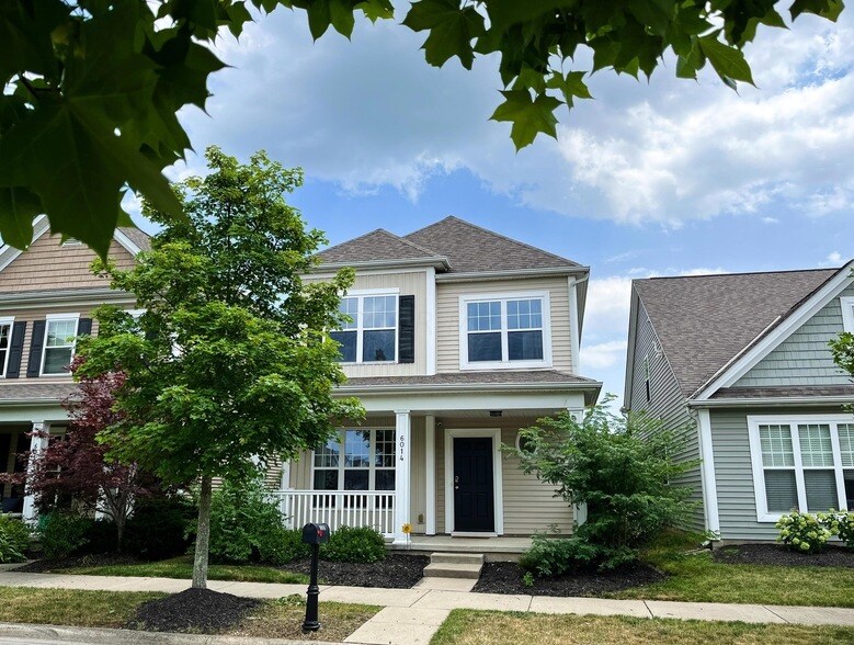
6014 Trumhall Ave
Westerville, OH 43081
-
Bedrooms
3
-
Bathrooms
3
-
Square Feet
1,892 sq ft
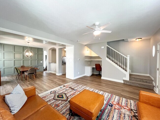
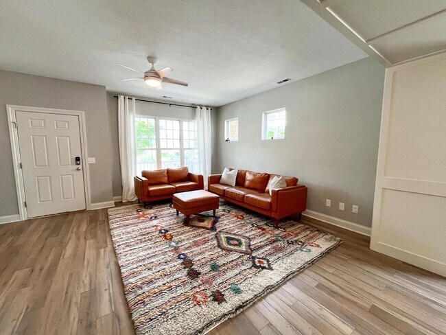
About This Home
Furnished and midterm lease option. 3 bed (with a first floor bonus room), 3 full bath home in the Upper Albany West neighborhood, nestled between Westerville & New Albany. This home has been completely gutted & redone in 2023. The HOA takes care of yard work and you have an awesome zero entry pool with a fountain (with staffed lifeguards), a clubhouse with a gym, rentable meeting space, a park, fishable ponds, and green spaces. Neighborhood events throughout the year.
6014 Trumhall Ave is a house located in Franklin County and the 43081 ZIP Code. This area is served by the Columbus City School District attendance zone.
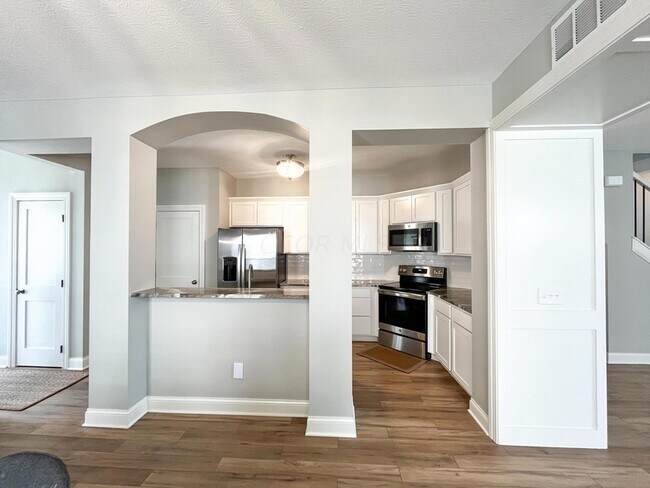
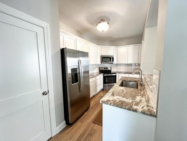
House Features
- Kitchen
- Refrigerator
Fees and Policies
The fees listed below are community-provided and may exclude utilities or add-ons. All payments are made directly to the property and are non-refundable unless otherwise specified.
Contact
West Albany sits 17 miles northeast of Columbus and is part of the larger suburb of New Albany. West Albany is a relatively upscale area, with new housing developments and amenity-laden apartment communities. The area is also popular with students thanks to its relative proximity to seven different Ohio colleges, including Ohio State University. The nearby Hoover Reservoir and the shoreline parks that surround it make for a relaxing afternoon, and the area is close to nearly six prestigious golf courses. The restaurants and shops of West Albany line Hamilton Road and New Albany Road. However, the buzz of Downtown Columbus is just a 20-minute drive via Interstate 670.
Learn more about living in West Albany- Kitchen
- Refrigerator
| Colleges & Universities | Distance | ||
|---|---|---|---|
| Colleges & Universities | Distance | ||
| Drive: | 12 min | 6.5 mi | |
| Drive: | 17 min | 10.6 mi | |
| Drive: | 24 min | 14.4 mi | |
| Drive: | 27 min | 16.9 mi |


View GreatSchools Rating Methodology
Data provided by GreatSchools.org © 2026. All rights reserved.
Scores provided by
Traffic
-Airport
-Businesses
-Scores provided by
HowLoud What is a Sound Score Rating? A Sound Score Rating aggregates noise caused by vehicle traffic, airplane traffic and local sources. How It Works6014 Trumhall Ave Photos
Nearby Apartments
Within 50 Miles of 6014 Trumhall Ave Westerville, OH 43081
-
4081 Peregrine Pass Dr
Columbus, OH 43230
$2,740
3 Br 2.8 mi
-
8245 Crete Ln
Blacklick, OH 43004
$2,300 Total Monthly Price
4 Br 8.0 mi
-
1136 Pauline Ave
Columbus, OH 43224
$2,295 Total Monthly Price
4 Br 12 Month Lease 8.4 mi
-
Cabot's Mill
39 Cotterrew Dr
Blacklick, OH 43004
$1,775 - $1,815
3 Br 8.6 mi
-
3762 Beulah Rd
Columbus, OH 43224
$2,100 Total Monthly Price
3 Br 12 Month Lease 8.8 mi
-
942 Mahle Dr
Reynoldsburg, OH 43068
$2,825 Total Monthly Price
3 Br 10.4 mi
-
3084 Highland Park Dr
Pickerington, OH 43147
$3,200 Total Monthly Price
3 Br 1 Month Lease 12.9 mi
-
3938 Winding Path Dr
Canal Winchester, OH 43110
$2,250 Total Monthly Price
3 Br 14.2 mi
-
1915 Berwick Ct
Delaware, OH 43015
$2,650 Total Monthly Price
4 Br 16.6 mi
-
452 Crestmoore Dr
Groveport, OH 43125
$2,470 Total Monthly Price
3 Br 17.8 mi
-
2356 Maribeth Pl
Grove City, OH 43123
$2,180 Total Monthly Price
3 Br 18.0 mi
-
Stillwell Jerome
8075 Brightside Dr
Plain City, OH 43064
$2,487 - $6,942
3 Br 19.2 mi
-
4284 Beechgrove Dr
Grove City, OH 43123
$2,000 Total Monthly Price
3 Br 12 Month Lease 19.8 mi
What Are Walk Score®, Transit Score®, and Bike Score® Ratings?
Walk Score® measures the walkability of any address. Transit Score® measures access to public transit. Bike Score® measures the bikeability of any address.
What is a Sound Score Rating?
A Sound Score Rating aggregates noise caused by vehicle traffic, airplane traffic and local sources.
6014 Trumhall Ave
Westerville, OH 43081