
Kinect at Southport
2301 Jefferson Blvd,
Sacramento, CA 95691
$1,550 - $3,049
Studio - 3 Beds
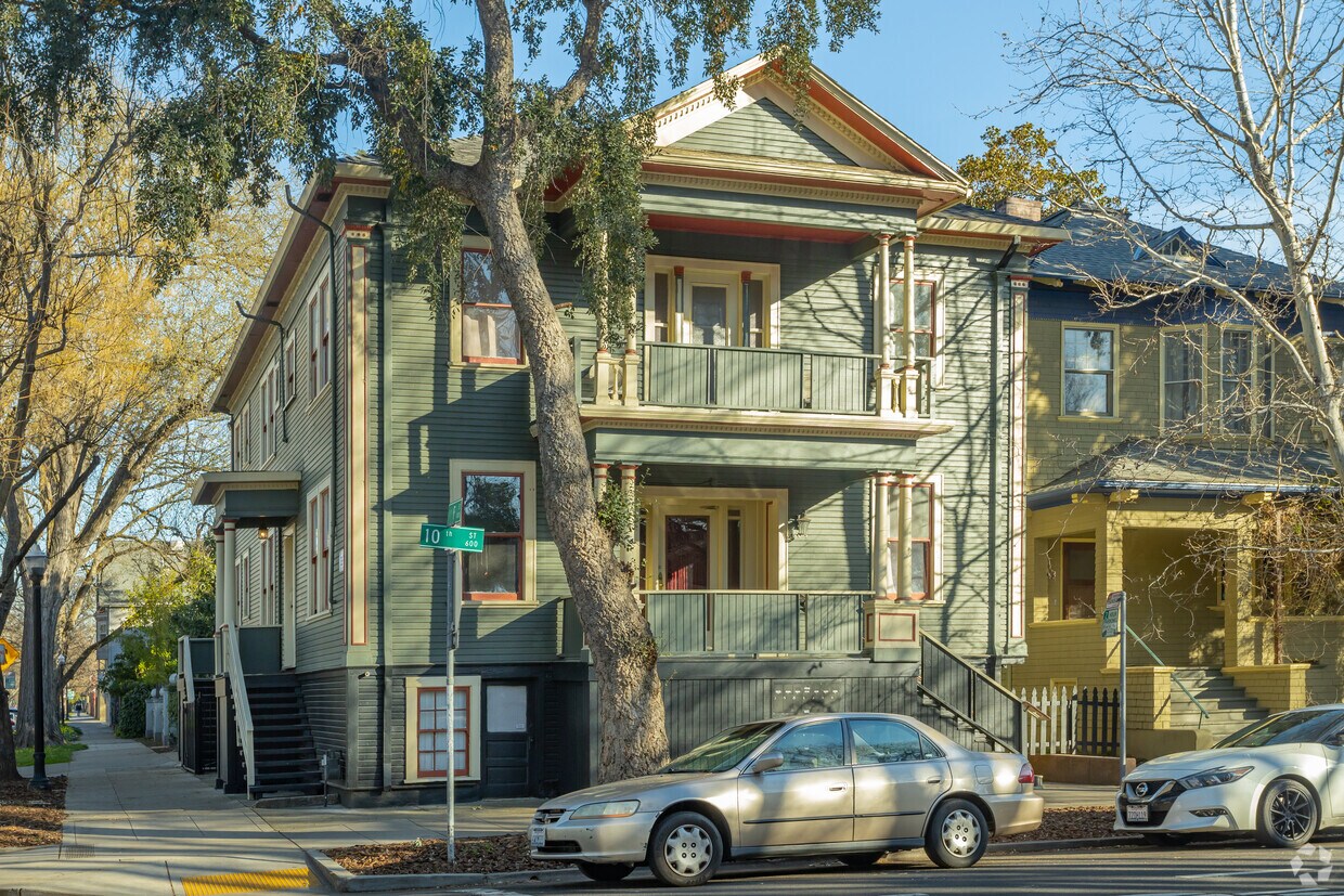

Find your new apartment at 01 10th St. You'll find this community at 601 10th St in the Alkali Flats area of Sacramento. From amenities to availability, the professional leasing team will assist you in finding your dream apartment. It's time to love where you live. Stop by for a visit today.
601 10th St is an apartment community located in Sacramento County and the 95814 ZIP Code. This area is served by the Sacramento City Unified School District attendance zone.
Laundry Facilities
Furnished Units Available
Community-Wide WiFi
Bicycle Storage
High Speed Internet Access
Hardwood Floors
Ceiling Fans
Smoke Free
Filled with gorgeous, classic architecture from Tudors to Victorians, Alkali Flat is one of Sacramento’s oldest neighborhoods and home to several government offices. This area is currently undergoing revitalization but the location provides access to excellent amenities. Alkali is a few blocks from the Sacramento River, adjacent to downtown, and next to the historic Mansion Flat neighborhood.
Close proximity to downtown means residents have an abundance of cafés, shopping centers, bars, restaurants, and entertainment venues. Residents also frequent the Old Sacramento Waterfront District nearby. This eight-block historic district features museums, history tours, wineries, breweries, pubs, specialty stores, and more. Satisfy your sweet tooth at the Sacramento Sweets Company, have a laugh at Laughs Unlimited Comedy Club and Lounge, or learn about trains at the California State Railroad Museum.
Learn more about living in Alkali FlatCompare neighborhood and city base rent averages by bedroom.
| Alkali Flat | Sacramento, CA | |
|---|---|---|
| Studio | $1,345 | $1,478 |
| 1 Bedroom | $1,622 | $1,570 |
| 2 Bedrooms | $2,038 | $1,873 |
| 3 Bedrooms | $2,099 | $2,423 |
| Colleges & Universities | Distance | ||
|---|---|---|---|
| Colleges & Universities | Distance | ||
| Drive: | 8 min | 3.8 mi | |
| Drive: | 11 min | 4.7 mi | |
| Drive: | 17 min | 10.5 mi | |
| Drive: | 19 min | 11.7 mi |


Transportation options available in Sacramento include 12Th & I, located 0.3 mile from 601 10th St. 601 10th St is near Sacramento International, located 11.4 miles or 17 minutes away.
| Transit / Subway | Distance | ||
|---|---|---|---|
| Transit / Subway | Distance | ||
|
|
Walk: | 5 min | 0.3 mi |
|
|
Walk: | 8 min | 0.4 mi |
|
|
Walk: | 8 min | 0.5 mi |
|
|
Walk: | 9 min | 0.5 mi |
|
|
Walk: | 9 min | 0.5 mi |
| Commuter Rail | Distance | ||
|---|---|---|---|
| Commuter Rail | Distance | ||
| Walk: | 12 min | 0.7 mi | |
| Drive: | 20 min | 14.6 mi | |
|
|
Drive: | 26 min | 19.2 mi |
|
|
Drive: | 27 min | 21.3 mi |
|
|
Drive: | 40 min | 33.6 mi |
| Airports | Distance | ||
|---|---|---|---|
| Airports | Distance | ||
|
Sacramento International
|
Drive: | 17 min | 11.4 mi |
Scores provided by
Traffic
ActiveAirport
CalmBusinesses
BusyScores provided by
HowLoud What is a Sound Score Rating? A Sound Score Rating aggregates noise caused by vehicle traffic, airplane traffic and local sources. How It WorksTime and distance from 601 10th St.
| Shopping Centers | Distance | ||
|---|---|---|---|
| Shopping Centers | Distance | ||
| Walk: | 10 min | 0.5 mi | |
| Walk: | 10 min | 0.6 mi | |
| Walk: | 13 min | 0.7 mi |
| Parks and Recreation | Distance | ||
|---|---|---|---|
| Parks and Recreation | Distance | ||
|
Governor's Mansion State Historic Park
|
Walk: | 11 min | 0.6 mi |
|
California State Capitol Museum
|
Walk: | 15 min | 0.8 mi |
|
Old Sacramento Historic District
|
Walk: | 17 min | 0.9 mi |
|
California State Railroad Museum
|
Walk: | 18 min | 0.9 mi |
|
Leland Stanford Mansion State Historic Park
|
Drive: | 3 min | 1.1 mi |
| Hospitals | Distance | ||
|---|---|---|---|
| Hospitals | Distance | ||
| Drive: | 5 min | 2.0 mi | |
| Drive: | 6 min | 2.6 mi | |
| Drive: | 7 min | 3.6 mi |
| Military Bases | Distance | ||
|---|---|---|---|
| Military Bases | Distance | ||
| Drive: | 23 min | 9.8 mi |
What Are Walk Score®, Transit Score®, and Bike Score® Ratings?
Walk Score® measures the walkability of any address. Transit Score® measures access to public transit. Bike Score® measures the bikeability of any address.
What is a Sound Score Rating?
A Sound Score Rating aggregates noise caused by vehicle traffic, airplane traffic and local sources.


