


$850
/ Month
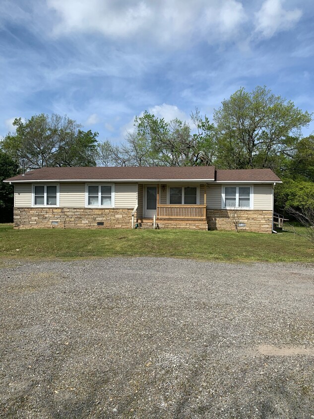
600 S Pocola Blvd
Pocola, OK 74902
Favorites
600 S Pocola Blvd

Favorites
Check Back Soon for Upcoming Availability
| Beds | Baths | Average SF |
|---|---|---|
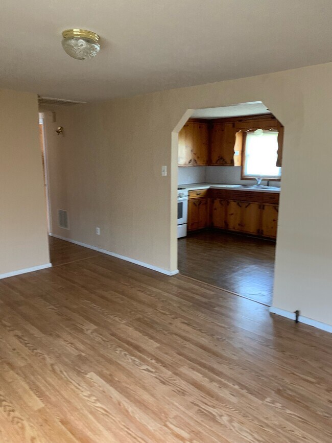
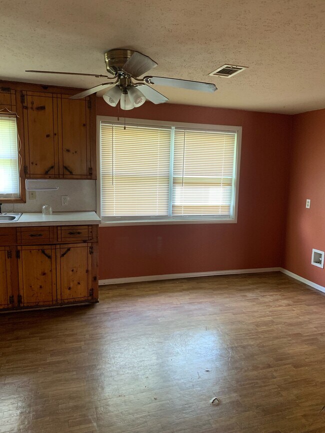
| 4 Bedrooms 4 Bedrooms 4 Br | 1 Bath 1 Bath 1 Ba | 1,200 SF |
600 S Pocola Blvd,
Pocola,
OK
74902
A historic town on the Oklahoma-Arkansas state line, Pocola boasts a unique character. The city’s name means “ten” in Choctaw, which stands for the approximate distance in miles that Pocola is from Fort Smith, Arkansas. Although Fort Smith is in a neighboring state, residents of Pocola commute to and from this historic metro area for work and entertainment. Pocola is home to the Choctaw Casino and Resort, a luxury hotel with restaurants, a nightclub, pools, and a full casino. This attraction brings in abundant tourism to the area. The remainder of the city is made up of residential neighborhoods and open land. As a renter in Pocola, you can easily get to the Ozark National Forest and the Ouachita National Forest for camping, hiking, and beautiful views of the rugged mountain landscape.
Learn more about living in Pocola
Education
| Colleges & Universities | Distance | ||
|---|---|---|---|
| Colleges & Universities | Distance | ||
| Drive: | 17 min | 13.5 mi |
600 S Pocola Blvd is within 17 minutes or 13.5 miles from Univ. of Ark., Fort Smith.
Schools


Public Elementary School
Grades PK-5
385 Students
Attendance Zone
Public Middle School
Grades 6-8
155 Students
Attendance Zone
Public High School
Grades 9-12
207 Students
Attendance Zone
Private Elementary School
Grades PK-5
Nearby
Private Elementary & Middle School
Grades PK-8
33 Students
Nearby
School data provided by
 The GreatSchools Rating helps parents compare schools within a state based on a variety of school quality indicators and provides a helpful picture of how effectively each school serves all of its students. Ratings are on a scale of 1 (below average) to 10 (above average) and can include test scores, college readiness, academic progress, advanced courses, equity, discipline and attendance data. We also advise parents to visit schools, consider other information on school performance and programs, and consider family needs as part of the school selection process.
View GreatSchools Rating Methodology
Data provided by GreatSchools.org © 2026. All rights reserved.
View GreatSchools Rating Methodology
Data provided by GreatSchools.org © 2026. All rights reserved.
Walkability Near 600 S Pocola Blvd Pocola, OK 74902
Getting Around
 What do Walkability, Transit, Drivability, and Bikeability mean?
Walkability measures the walking distance to day-to-day needs.
Transit measures access to public transportation.
Drivability measures congestion, parking availability, and access to major roads.
Bikeability measures the suitability for cycling.
How It Works
What do Walkability, Transit, Drivability, and Bikeability mean?
Walkability measures the walking distance to day-to-day needs.
Transit measures access to public transportation.
Drivability measures congestion, parking availability, and access to major roads.
Bikeability measures the suitability for cycling.
How It Works
Somewhat Walkable
Walkability
20
/ 100
Exceptionally Drivable
Drivability
100
/ 100
Somewhat Bikeable
Bikeability
20
/ 100
Scores provided by
-
Soundscore™
-
/ 100
Traffic
-Airport
-Businesses
-Scores provided by
HowLoud What is a Sound Score Rating? A Sound Score Rating aggregates noise caused by vehicle traffic, airplane traffic and local sources. How It WorksSimilar Rentals Nearby


What Are Walk Score®, Transit Score®, and Bike Score® Ratings?
Walk Score® measures the walkability of any address. Transit Score® measures access to public transit. Bike Score® measures the bikeability of any address.
What is a Sound Score Rating?
A Sound Score Rating aggregates noise caused by vehicle traffic, airplane traffic and local sources.

600 S Pocola Blvd
Pocola, OK 74902