

$3,000
Total Monthly Price
6 Sewall St Unit 2
Mission Hill, MA 02120
2 Weeks Ago
|
Edit
Favorites
6 Sewall St Unit 2

Favorites
Check Back Soon for Upcoming Availability
| Beds | Baths | Average SF |
|---|---|---|
| 3 Bedrooms 3 Bedrooms 3 Br | 2 Baths 2 Baths 2 Ba | — |
About This Property
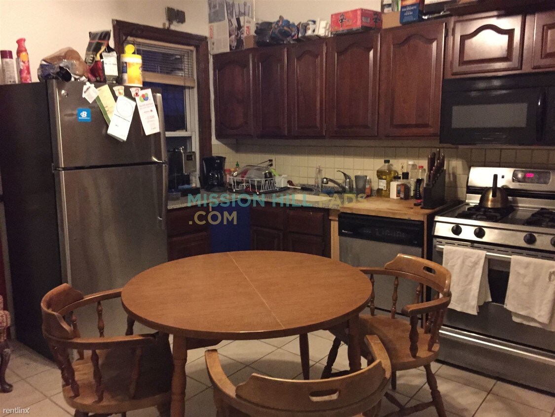
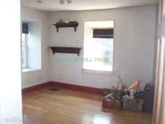
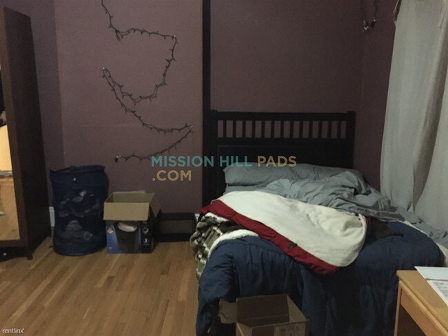
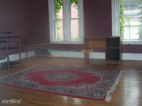
(617) 285-5884 - Location, Location, Location...in this 3 bed 2 bath in Mission Hill!! -Updated kitchen -Stainless steel appliances -Granite counters -Dishwasher -Skylights -Gleaming hardwood floors -Yard -Spacious Area Amenities: Northeastern, Wentworth, Simmons, Emanuel, Longwood Medical, Mass College of Pharmacy, Beth Israel Hospital, JP Licks, Commercial Banks, Stop and Shop, Walgreens, Numerous MBTA Bus Routes, Mission Hill, The orange line, and more! Call/Text Ben 617-285-5884 to schedule a showing! (RLNE2802536) Appliances - Dishwasher. Lease lengths - 12 Months.
6 Sewall St is a condo located in Suffolk County and the 02120 ZIP Code.
6 Sewall St,
Mission Hill,
MA
02120
Boston’s Mission Hill neighborhood is a historic residential community adjacent to one of the city’s busiest sections. The neighborhood is located next door to the Longwood Medical Area, making it perfect for those who work at Boston Children’s Hospital, VA Boston Healthcare System, Massachusetts College of Pharmacy and Health Science, or Harvard Medical School. Massachusetts College of Art and Design and Wentworth Institute of Technology are on the north side as well, making it a highly convenient location for students.
What’s it like living in Mission Hill? Well, you’ll be within walking distance of Fenway Park and its surrounding dining, retail, and entertainment district, as well as beautiful parks, including Boston’s famous Emerald Necklace. Rentals can be a bit pricey, but you can find some great deals on apartments, condos, and houses in this area.
Learn more about living in Mission Hill
Education
| Colleges & Universities | Distance | ||
|---|---|---|---|
| Colleges & Universities | Distance | ||
| Walk: | 9 min | 0.5 mi | |
| Walk: | 10 min | 0.5 mi | |
| Walk: | 10 min | 0.5 mi | |
| Drive: | 4 min | 1.7 mi |
6 Sewall St Unit 2 is within 9 minutes or 0.5 mile from Wentworth Inst. of Technology. It is also near MCPHS University, Boston and MassArt.
Transportation options available in Mission Hill include Roxbury Crossing Station, located 0.3 mile from 6 Sewall St Unit 2. 6 Sewall St Unit 2 is near General Edward Lawrence Logan International, located 6.6 miles or 13 minutes away.
| Transit / Subway | Distance | ||
|---|---|---|---|
| Transit / Subway | Distance | ||
|
|
Walk: | 5 min | 0.3 mi |
|
|
Walk: | 9 min | 0.5 mi |
|
|
Walk: | 9 min | 0.5 mi |
|
|
Walk: | 10 min | 0.5 mi |
|
|
Walk: | 11 min | 0.6 mi |
| Commuter Rail | Distance | ||
|---|---|---|---|
| Commuter Rail | Distance | ||
|
|
Walk: | 13 min | 0.7 mi |
| Drive: | 4 min | 1.9 mi | |
|
|
Drive: | 4 min | 2.0 mi |
|
|
Drive: | 7 min | 2.0 mi |
|
|
Drive: | 9 min | 4.8 mi |
| Airports | Distance | ||
|---|---|---|---|
| Airports | Distance | ||
|
General Edward Lawrence Logan International
|
Drive: | 13 min | 6.6 mi |
Walkability Near 6 Sewall St Mission Hill, MA 02120
Getting Around
 What do Walkability, Transit, Drivability, and Bikeability mean?
Walkability measures the walking distance to day-to-day needs.
Transit measures access to public transportation.
Drivability measures congestion, parking availability, and access to major roads.
Bikeability measures the suitability for cycling.
How It Works
What do Walkability, Transit, Drivability, and Bikeability mean?
Walkability measures the walking distance to day-to-day needs.
Transit measures access to public transportation.
Drivability measures congestion, parking availability, and access to major roads.
Bikeability measures the suitability for cycling.
How It Works
Exceptionally Walkable
Walkability
100
/ 100
Exceptional Public Transit
Transit
100
/ 100
Fairly Drivable
Drivability
40
/ 100
Moderately Bikeable
Bikeability
70
/ 100
Scores provided by
Active
Soundscore™
69
/ 100
Traffic
BusyAirport
CalmBusinesses
ActiveScores provided by
HowLoud What is a Sound Score Rating? A Sound Score Rating aggregates noise caused by vehicle traffic, airplane traffic and local sources. How It WorksTime and distance from 6 Sewall St Unit 2.
| Shopping Centers | Distance | ||
|---|---|---|---|
| Shopping Centers | Distance | ||
| Walk: | 16 min | 0.9 mi | |
| Drive: | 3 min | 1.5 mi | |
| Drive: | 10 min | 5.7 mi |
6 Sewall St Unit 2 has 3 shopping centers within 5.7 miles, which is about a 10-minute drive. The miles and minutes will be for the farthest away property.
| Parks and Recreation | Distance | ||
|---|---|---|---|
| Parks and Recreation | Distance | ||
|
Roxbury Heritage State Park
|
Walk: | 10 min | 0.5 mi |
|
Charles River Reservation
|
Drive: | 4 min | 2.0 mi |
|
Frederick Law Olmsted National Historic Site
|
Drive: | 4 min | 2.1 mi |
|
John Fitzgerald Kennedy National Historic Site
|
Drive: | 6 min | 2.1 mi |
|
Coit Observatory
|
Drive: | 5 min | 2.5 mi |
6 Sewall St Unit 2 has 5 parks within 2.5 miles, including Roxbury Heritage State Park, Coit Observatory, and Charles River Reservation.
| Hospitals | Distance | ||
|---|---|---|---|
| Hospitals | Distance | ||
| Walk: | 12 min | 0.6 mi | |
| Walk: | 13 min | 0.7 mi | |
| Walk: | 13 min | 0.7 mi |
6 Sewall St Unit 2 has 3 hospitals within 0.7 mile, the nearest is Brigham and Women's Hospital which is 0.6 mile away and a 12 minute walk.
| Military Bases | Distance | ||
|---|---|---|---|
| Military Bases | Distance | ||
| Drive: | 27 min | 15.0 mi | |
| Drive: | 31 min | 15.6 mi |
6 Sewall St Unit 2 is 15.0 miles from US Military Reservation, and is convenient to other military bases, including Hanscom Air Force Base.
You May Also Like
Similar Rentals Nearby


What Are Walk Score®, Transit Score®, and Bike Score® Ratings?
Walk Score® measures the walkability of any address. Transit Score® measures access to public transit. Bike Score® measures the bikeability of any address.
What is a Sound Score Rating?
A Sound Score Rating aggregates noise caused by vehicle traffic, airplane traffic and local sources.

6 Sewall St
Mission Hill, MA 02120