$1,500
/ Month
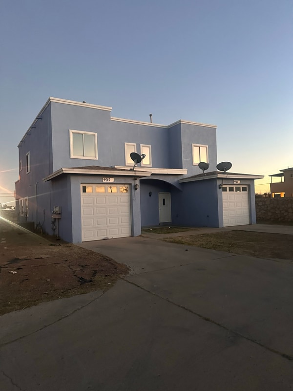
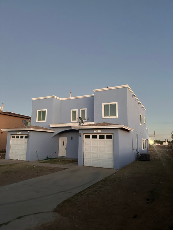
5912 Cielo Del Rey Pl
El Paso, TX 79924
2 Weeks Ago
|
Edit
Favorites
5912 Cielo Del Rey Pl

Favorites
Check Back Soon for Upcoming Availability
| Beds | Baths | Average SF |
|---|---|---|
| 3 Bedrooms 3 Bedrooms 3 Br | 2.5 Baths 2.5 Baths 2.5 Ba | 1,200 SF |
Fees and Policies
The fees listed below are community-provided and may exclude utilities or add-ons. All payments are made directly to the property and are non-refundable unless otherwise specified.
-
One-Time Basics
-
Due at Move-In
-
Security Deposit - RefundableCharged per unit.$1,000
-
-
Due at Move-In
-
Dogs
-
Allowed
-
-
Cats
-
Allowed
-
-
Garage Lot
Property Fee Disclaimer: Based on community-supplied data and independent market research. Subject to change without notice. May exclude fees for mandatory or optional services and usage-based utilities.
About This Property
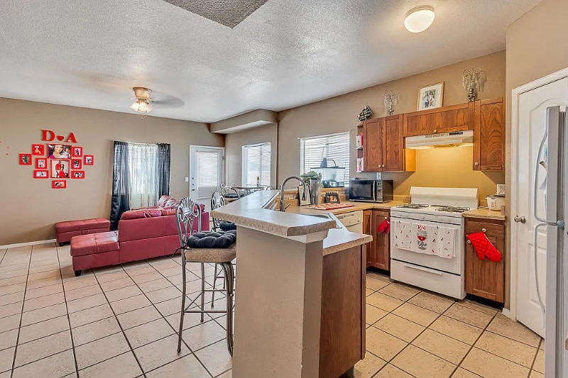
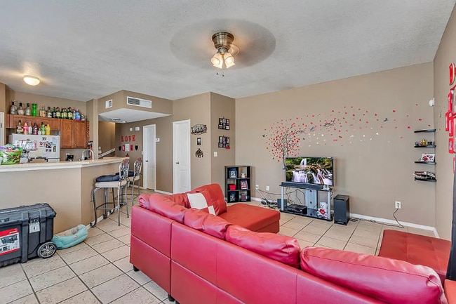
Property Id: 816851 This is the Perfect Home for You! This Gem is nestled in the Northeast of El Paso. Close to Fort Bliss, this Duplex has the a spacious Kitchen with pantry or a large Living room for entertaining friends. The duplex offers 3 Bedrooms and two full bathrooms. Perfect distance from shopping, schools, and restaurants.
5912 Cielo Del Rey Pl is a house located in El Paso County and the 79924 ZIP Code. This area is served by the Ysleta Independent School District attendance zone.
House Features
Dishwasher
Microwave
Refrigerator
Tile Floors
- Cable Ready
- Dishwasher
- Microwave
- Oven
- Refrigerator
- Tile Floors
5912 Cielo Del Rey Pl,
El Paso,
TX
79924
El Paso sits where West Texas, New Mexico, and the Mexican state of Chihuahua converge, giving the city a cross-border identity that shapes everything from its architecture to its daily rhythm. With the Franklin Mountains rising inside city limits and the Rio Grande forming its southern edge, the geography alone sets it apart from anywhere else in Texas. Fort Bliss, one of the largest U.S. Army installations in the country, and the University of Texas at El Paso are two of the city's most significant economic and institutional anchors. The Chamizal National Memorial marks the site of a peacefully resolved international border dispute, a piece of history few American cities can claim.
Neighborhoods range widely in character. Manhattan Heights offers historic homes close to downtown, while Northeast El Paso spreads out with newer residential development near Fort Bliss. Kern Place, adjacent to UTEP's campus, has an established, walkable feel.
Learn more about living in El Paso
Amenities
- Cable Ready
- Dishwasher
- Microwave
- Oven
- Refrigerator
- Tile Floors
Education
| Colleges & Universities | Distance | ||
|---|---|---|---|
| Colleges & Universities | Distance | ||
| Drive: | 8 min | 3.6 mi | |
| Drive: | 23 min | 13.7 mi | |
| Drive: | 22 min | 14.4 mi | |
| Drive: | 25 min | 15.0 mi |
5912 Cielo Del Rey Pl is within 8 minutes or 3.6 miles from El Paso C.C., Transmountain. It is also near UT El Paso and El Paso C.C., Valle Verde.
Schools


Public Elementary School
Grades K-5
510 Students
Attendance Zone
Public Middle School
Grades 6-8
1,166 Students
Attendance Zone
Public High School
Grades 9-12
1,674 Students
Attendance Zone
Private Elementary, Middle & High School
Grades PK-12
85 Students
Nearby
Private Elementary & Middle School
Grades PK-8
138 Students
Nearby
School data provided by
 The GreatSchools Rating helps parents compare schools within a state based on a variety of school quality indicators and provides a helpful picture of how effectively each school serves all of its students. Ratings are on a scale of 1 (below average) to 10 (above average) and can include test scores, college readiness, academic progress, advanced courses, equity, discipline and attendance data. We also advise parents to visit schools, consider other information on school performance and programs, and consider family needs as part of the school selection process.
View GreatSchools Rating Methodology
Data provided by GreatSchools.org © 2026. All rights reserved.
View GreatSchools Rating Methodology
Data provided by GreatSchools.org © 2026. All rights reserved.
Walkability Near 5912 Cielo Del Rey Pl El Paso, TX 79924
Getting Around
 What do Walkability, Transit, Drivability, and Bikeability mean?
Walkability measures the walking distance to day-to-day needs.
Transit measures access to public transportation.
Drivability measures congestion, parking availability, and access to major roads.
Bikeability measures the suitability for cycling.
How It Works
What do Walkability, Transit, Drivability, and Bikeability mean?
Walkability measures the walking distance to day-to-day needs.
Transit measures access to public transportation.
Drivability measures congestion, parking availability, and access to major roads.
Bikeability measures the suitability for cycling.
How It Works
Somewhat Walkable
Walkability
30
/ 100
Limited Public Transit
Transit
30
/ 100
Very Drivable
Drivability
80
/ 100
Somewhat Bikeable
Bikeability
30
/ 100
Scores provided by
-
Soundscore™
-
/ 100
Traffic
-Airport
-Businesses
-Scores provided by
HowLoud What is a Sound Score Rating? A Sound Score Rating aggregates noise caused by vehicle traffic, airplane traffic and local sources. How It WorksYou May Also Like
Similar Rentals Nearby
-
-

-
-

-

-

-

-

-

-
 4 Beds, 3 Baths, 3,316 sq ft$3,000Total Monthly Price12 Month LeaseTotal Monthly Price NewPrices include all required monthly fees.6371 Franklin View Dr


What Are Walk Score®, Transit Score®, and Bike Score® Ratings?
Walk Score® measures the walkability of any address. Transit Score® measures access to public transit. Bike Score® measures the bikeability of any address.
What is a Sound Score Rating?
A Sound Score Rating aggregates noise caused by vehicle traffic, airplane traffic and local sources.

5912 Cielo Del Rey Pl
El Paso, TX 79924