
$1,600 / Month
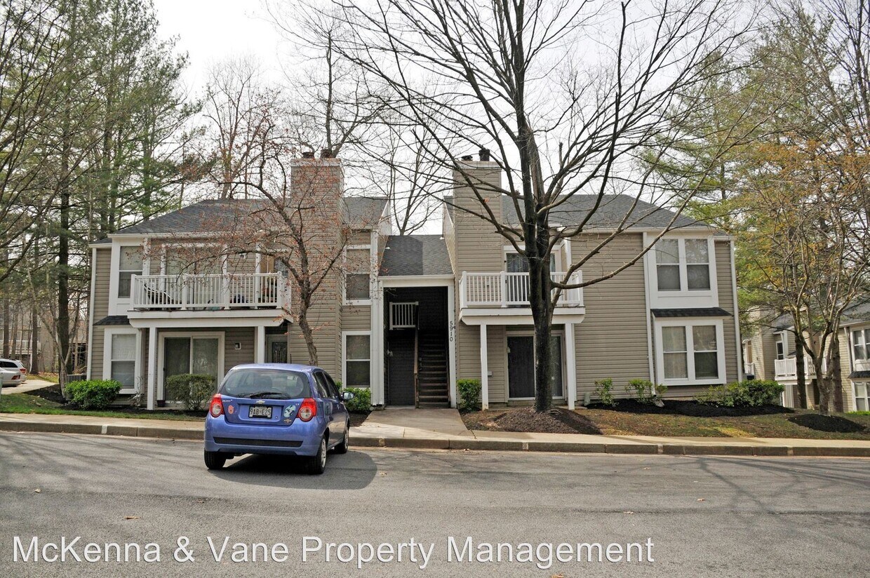
5910 Watch Chain Way
Columbia, MD 21044
2 Weeks Ago
Favorites
5910 Watch Chain Way

Favorites
Check Back Soon for Upcoming Availability
| Beds | Baths | Average SF |
|---|---|---|
| 2 Bedrooms 2 Bedrooms 2 Br | 1 Bath 1 Bath 1 Ba | 735 SF |
About This Property
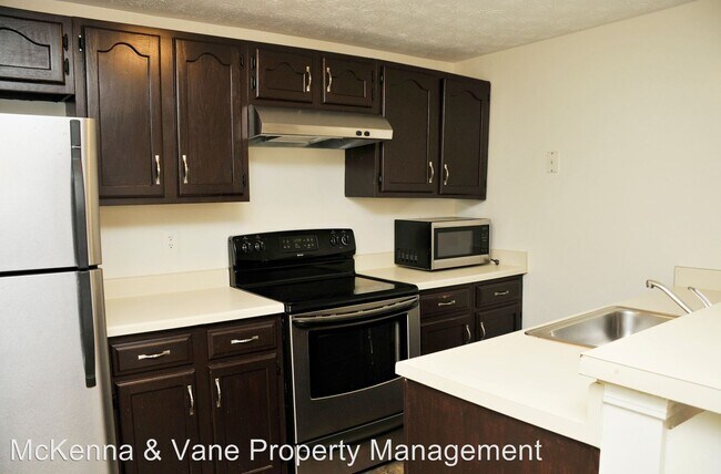
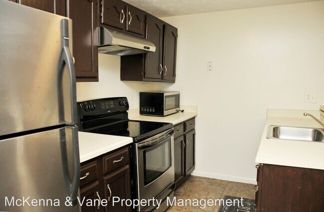
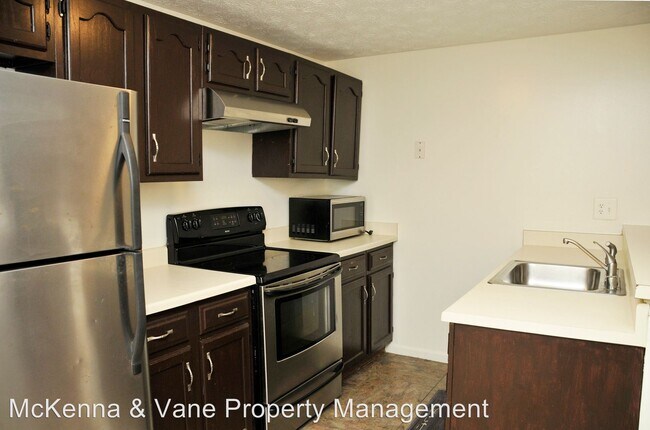
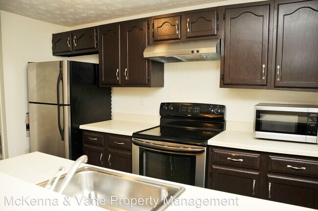
(301) 703-8608 x8608 - Columbia, MD - This 2 bedroom 1 full bath condo has a fireplace and walks out to a nice ground level patio. Located minutes from shopping, restaurants, commuter routes & more. Pets ok on a case-by-case basis with additional deposit. (RLNE5699088)
5910 Watch Chain Way is a house located in Howard County and the 21044 ZIP Code. This area is served by the Howard County Public Schools attendance zone.
Location
Get Directions
Hickory Ridge is a popular suburb of Washington, DC and Baltimore and is known for its verdant landscape and parks, top-notch public schools, and central location. Hickory Ridge is one of the 10 villages in Columbia and is located directly south of downtown, giving residents easy access to the city’s best shopping, dining, and entertainment options. The neighborhood is near Howard County General Hospital and Howard Community College as well. Hickory Ridge also has an active neighborhood association, which heightens the community’s close-knit feel. Flanked by the Middle Patuxent Environmental Area to the west, Hickory Ridge features tree-lined streets, lush green spaces, and a variety of rental options including apartments, townhomes, and houses.
Learn more about living in Hickory RidgeBelow are rent ranges for similar nearby apartments
| Beds | Average Size | Lowest | Typical | Premium |
|---|---|---|---|---|
| Studio Studio Studio | 551 Sq Ft | $1,803 | $1,852 | $1,873 |
| 1 Bed 1 Bed 1 Bed | 768 Sq Ft | $1,150 | $2,125 | $3,058 |
| 2 Beds 2 Beds 2 Beds | 1122 Sq Ft | $1,795 | $2,699 | $5,164 |
| 3 Beds 3 Beds 3 Beds | 1504 Sq Ft | $2,349 | $3,387 | $4,494 |
| 4 Beds 4 Beds 4 Beds | 1814 Sq Ft | $2,820 | $3,110 | $3,400 |
Education
| Colleges & Universities | Distance | ||
|---|---|---|---|
| Colleges & Universities | Distance | ||
| Walk: | 19 min | 1.0 mi | |
| Drive: | 27 min | 16.4 mi | |
| Drive: | 27 min | 16.9 mi | |
| Drive: | 35 min | 20.0 mi |
5910 Watch Chain Way is within 19 minutes or 1.0 miles from Howard Community College. It is also near CCBC Cantonsville and UMBC.
Schools


Public Elementary School
Grades PK-5
592 Students
Attendance Zone
Public Middle School
Grades 6-8
497 Students
Attendance Zone
Public High School
Grades 9-12
1,341 Students
Attendance Zone
Private Elementary, Middle & High School
Grades PK-12
748 Students
Nearby
Private Elementary, Middle & High School
Grades PK-10
181 Students
Nearby
Private Elementary School
Grades PK-1
65 Students
Nearby
Private Elementary School
Grades K-1
66 Students
Nearby
School data provided by
 The GreatSchools Rating helps parents compare schools within a state based on a variety of school quality indicators and provides a helpful picture of how effectively each school serves all of its students. Ratings are on a scale of 1 (below average) to 10 (above average) and can include test scores, college readiness, academic progress, advanced courses, equity, discipline and attendance data. We also advise parents to visit schools, consider other information on school performance and programs, and consider family needs as part of the school selection process.
View GreatSchools Rating Methodology
Data provided by GreatSchools.org © 2025. All rights reserved.
View GreatSchools Rating Methodology
Data provided by GreatSchools.org © 2025. All rights reserved.
Transportation options available in Columbia include Dorsey, located 11.5 miles from 5910 Watch Chain Way. 5910 Watch Chain Way is near Baltimore/Washington International Thurgood Marshall, located 19.0 miles or 29 minutes away, and Ronald Reagan Washington Ntl, located 31.0 miles or 51 minutes away.
| Transit / Subway | Distance | ||
|---|---|---|---|
| Transit / Subway | Distance | ||
|
|
Drive: | 21 min | 11.5 mi |
| Commuter Rail | Distance | ||
|---|---|---|---|
| Commuter Rail | Distance | ||
|
|
Drive: | 18 min | 10.3 mi |
|
|
Drive: | 19 min | 10.5 mi |
|
|
Drive: | 21 min | 11.2 mi |
|
|
Drive: | 20 min | 11.4 mi |
| Drive: | 21 min | 11.6 mi |
| Airports | Distance | ||
|---|---|---|---|
| Airports | Distance | ||
|
Baltimore/Washington International Thurgood Marshall
|
Drive: | 29 min | 19.0 mi |
|
Ronald Reagan Washington Ntl
|
Drive: | 51 min | 31.0 mi |
Time and distance from 5910 Watch Chain Way.
| Shopping Centers | Distance | ||
|---|---|---|---|
| Shopping Centers | Distance | ||
| Drive: | 4 min | 1.5 mi | |
| Drive: | 4 min | 1.7 mi | |
| Drive: | 4 min | 1.7 mi |
5910 Watch Chain Way has 3 shopping centers within 1.7 miles, which is about a 4-minute drive. The miles and minutes will be for the farthest away property.
| Parks and Recreation | Distance | ||
|---|---|---|---|
| Parks and Recreation | Distance | ||
|
Clark's Elioak Farm
|
Drive: | 7 min | 3.5 mi |
|
Browns Bridge Recreation Area
|
Drive: | 16 min | 8.5 mi |
|
Brighton Dam's Azalea Garden
|
Drive: | 17 min | 9.3 mi |
|
Pigtail Recreation Area
|
Drive: | 19 min | 9.3 mi |
|
Mt Pleasant - Howard County Conservancy
|
Drive: | 21 min | 10.1 mi |
5910 Watch Chain Way has 5 parks within 10.1 miles, including Clark's Elioak Farm, Browns Bridge Recreation Area, and Mt Pleasant - Howard County Conservancy.
| Hospitals | Distance | ||
|---|---|---|---|
| Hospitals | Distance | ||
| Walk: | 12 min | 0.7 mi | |
| Drive: | 23 min | 14.5 mi | |
| Drive: | 25 min | 14.8 mi |
5910 Watch Chain Way has 3 hospitals within 14.8 miles, the nearest is Howard County General Hospital which is 0.7 mile away and a 12 minute walk.
| Military Bases | Distance | ||
|---|---|---|---|
| Military Bases | Distance | ||
| Drive: | 24 min | 14.6 mi |
5910 Watch Chain Way is 14.6 miles and a 24 minute drive from Fort George Meade.
You May Also Like
Similar Rentals Nearby


What Are Walk Score®, Transit Score®, and Bike Score® Ratings?
Walk Score® measures the walkability of any address. Transit Score® measures access to public transit. Bike Score® measures the bikeability of any address.
What is a Sound Score Rating?
A Sound Score Rating aggregates noise caused by vehicle traffic, airplane traffic and local sources
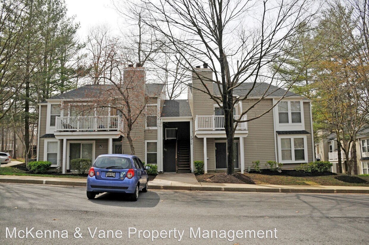
5910 Watch Chain Way
Columbia, MD 21044