$2,800
/ Month
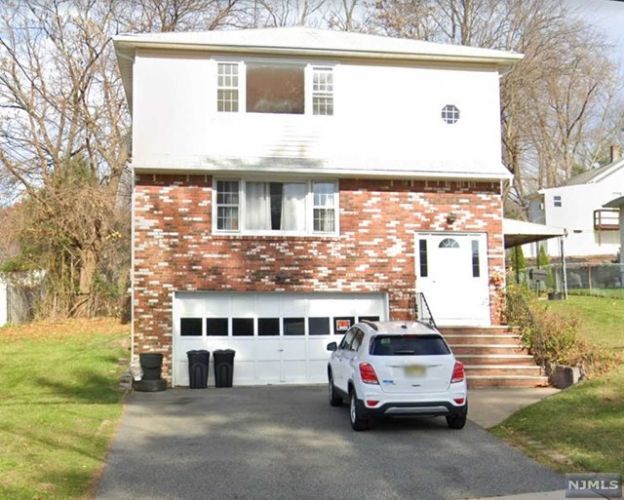
59 Rock Rd
Hawthorne, NJ 07506
Favorites
59 Rock Rd

Favorites
Check Back Soon for Upcoming Availability
| Beds | Baths | Average SF |
|---|---|---|
| 3 Bedrooms 3 Bedrooms 3 Br | 1 Bath 1 Bath 1 Ba | — |
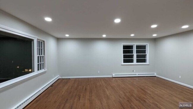
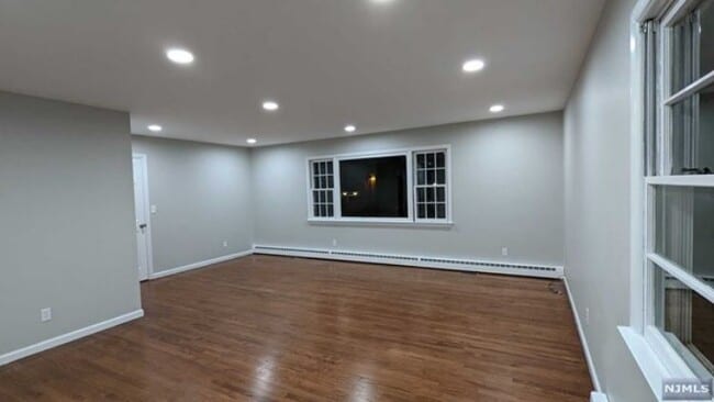
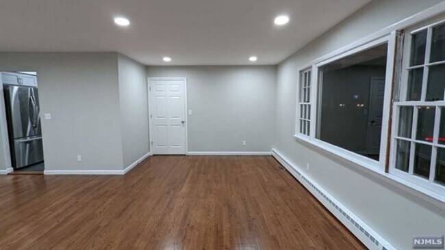
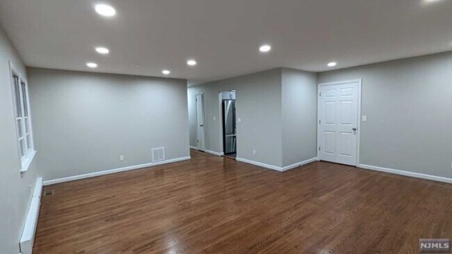
About This Property
If you're moving to Hawthorne, NJ, this great property could be your new place. Located at 59 Rock Rd in Hawthorne, this property has much to offer. Get a head start on your move to a new home. Contact us to discuss the next steps.
59 Rock Rd is an apartment community located in Passaic County and the 07506 ZIP Code.
59 Rock Rd,
Hawthorne,
NJ
07506
Hawthorne, New Jersey carries a distinction that most small boroughs can't claim: it was named after one of America's most celebrated novelists, Nathaniel Hawthorne, and has quietly built its own story ever since. Tucked into Passaic County about 20 miles from Midtown Manhattan, this four-square-mile borough offers a grounded, small-town atmosphere without asking residents to give up access to a major metropolitan area. NJ Transit rail service connects Hawthorne directly to New York City, making it a practical base for commuters.
The borough's character is shaped by its tree-lined streets, a walkable downtown corridor along Diamond Bridge Avenue, and the 103-acre Goffle Brook Park, which anchors the community with trails, open green space, and recreational amenities year-round. William Paterson University sits just minutes away, adding an educational and cultural presence that extends well beyond the campus itself.
Learn more about living in Hawthorne
Education
| Colleges & Universities | Distance | ||
|---|---|---|---|
| Colleges & Universities | Distance | ||
| Drive: | 8 min | 4.4 mi | |
| Drive: | 11 min | 5.5 mi | |
| Drive: | 13 min | 6.2 mi | |
| Drive: | 12 min | 6.5 mi |
59 Rock Rd is within 11 minutes or 5.5 miles from William Paterson University. It is also near Passaic County C.C., Paterson and Bergen C.C., Paramus.
Walkability Near 59 Rock Rd Hawthorne, NJ 07506
Getting Around
 What do Walkability, Transit, Drivability, and Bikeability mean?
Walkability measures the walking distance to day-to-day needs.
Transit measures access to public transportation.
Drivability measures congestion, parking availability, and access to major roads.
Bikeability measures the suitability for cycling.
How It Works
What do Walkability, Transit, Drivability, and Bikeability mean?
Walkability measures the walking distance to day-to-day needs.
Transit measures access to public transportation.
Drivability measures congestion, parking availability, and access to major roads.
Bikeability measures the suitability for cycling.
How It Works
Fairly Walkable
Walkability
50
/ 100
Limited Public Transit
Transit
30
/ 100
Exceptionally Drivable
Drivability
100
/ 100
Moderately Bikeable
Bikeability
60
/ 100
Scores provided by
-
Soundscore™
-
/ 100
Traffic
-Airport
-Businesses
-Scores provided by
HowLoud What is a Sound Score Rating? A Sound Score Rating aggregates noise caused by vehicle traffic, airplane traffic and local sources. How It WorksYou May Also Like
How do I access Social Services in New Jersey?
Statewide service is free, confidential, multilingual and always open. Three easy ways to reach Social Services in NJ: Dial 2-1-1; text your zip code to 898-211; or chat at https://www.nj211.org
Similar Rentals Nearby
-
-
-
-
1 / 15
 3 Beds$7,027+Total Monthly PriceTotal Monthly Price NewPrices include base rent and required monthly fees of $94. Variable costs based on usage may apply.Base Rent:3 Beds$6,932+2 Months Free
Pets Allowed
-
-
-
1 / 48

-
-
-


What Are Walk Score®, Transit Score®, and Bike Score® Ratings?
Walk Score® measures the walkability of any address. Transit Score® measures access to public transit. Bike Score® measures the bikeability of any address.
What is a Sound Score Rating?
A Sound Score Rating aggregates noise caused by vehicle traffic, airplane traffic and local sources.

59 Rock Rd
Hawthorne, NJ 07506