
$1,495
/ Month
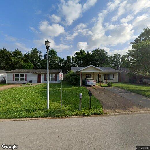
59 Cedar Ridge Dr
Pacific, MO 63069
Favorites
314-322-0375
-
Bedrooms
3
-
Bathrooms
1
-
Square Feet
960 sq ft
-
Available
Available May 22
59 Cedar Ridge Dr

Favorites
Contact
- Listed by Chris Rosenthal | The Hermann London Group LLC
- Phone Number
- Contact
-
Source
 MARIS MLS
Copyright 2026 MARIS MLS. All rights reserved. Information is deemed reliable but not guaranteed.
Location
Get Directions
Located about 30 miles southwest of Saint Louis, Pacific is a charming city with a small-town atmosphere. Pacific boasts a peaceful feel, with vast stretches of open space, a low crime rate, and plenty of tree-lined streets.
Residents enjoy the comfort of a close-knit community in Pacific, in addition to a host of recreational opportunities available at nearby Robertsville State Park, Shaw Nature Reserve, Young Conservation Area, and the Hidden Valley Ski Resort. Pacific apartments are particularly popular with commuters favoring the quiet life while still being within close proximity to the city. Getting around from Pacific is easy with direct access to Interstate 44.
Learn more about living in Pacific
Education
| Colleges & Universities | Distance | ||
|---|---|---|---|
| Colleges & Universities | Distance | ||
| Drive: | 23 min | 14.7 mi | |
| Drive: | 37 min | 24.8 mi | |
| Drive: | 36 min | 25.5 mi | |
| Drive: | 48 min | 31.7 mi |
59 Cedar Ridge Dr is within 23 minutes or 14.7 miles from Saint Louis C.C., Wildwood. It is also near Logan University and Maryville Univ. Saint Louis.
Getting Around
 What do Walkability, Transit, Drivability, and Bikeability mean?
Walkability measures the walking distance to day-to-day needs.
Transit measures access to public transportation.
Drivability measures congestion, parking availability, and access to major roads.
Bikeability measures the suitability for cycling.
How It Works
What do Walkability, Transit, Drivability, and Bikeability mean?
Walkability measures the walking distance to day-to-day needs.
Transit measures access to public transportation.
Drivability measures congestion, parking availability, and access to major roads.
Bikeability measures the suitability for cycling.
How It Works
Fairly Walkable
Walkability
40
/ 100
Exceptionally Drivable
Drivability
100
/ 100
Somewhat Bikeable
Bikeability
30
/ 100
Scores provided by
-
Soundscore™
-
/ 100
Traffic
-Airport
-Businesses
-Scores provided by
HowLoud What is a Sound Score Rating? A Sound Score Rating aggregates noise caused by vehicle traffic, airplane traffic and local sources. How It WorksYou May Also Like
Similar Rentals Nearby


What Are Walk Score®, Transit Score®, and Bike Score® Ratings?
Walk Score® measures the walkability of any address. Transit Score® measures access to public transit. Bike Score® measures the bikeability of any address.
What is a Sound Score Rating?
A Sound Score Rating aggregates noise caused by vehicle traffic, airplane traffic and local sources.

59 Cedar Ridge Dr
Pacific, MO 63069