$2,100
/ Month
586 Lucia Ave
Baltimore, MD 21229
Favorites
410-952-3885
-
Bedrooms
3
-
Bathrooms
1.5
-
Square Feet
--
-
Available
Available Jun 4
Highlight
- Basement
586 Lucia Ave

Favorites
About This Home
Available Jun 4
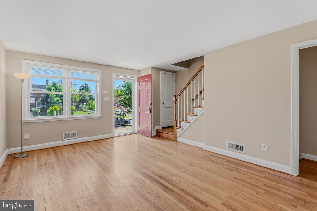
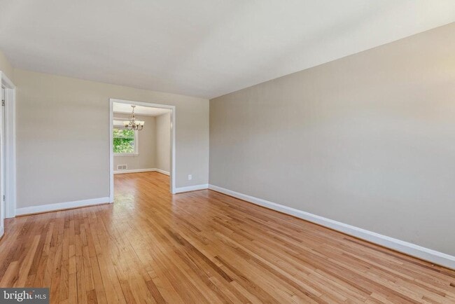
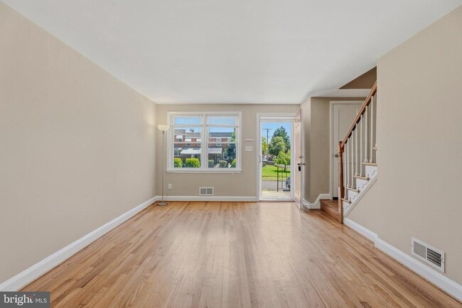
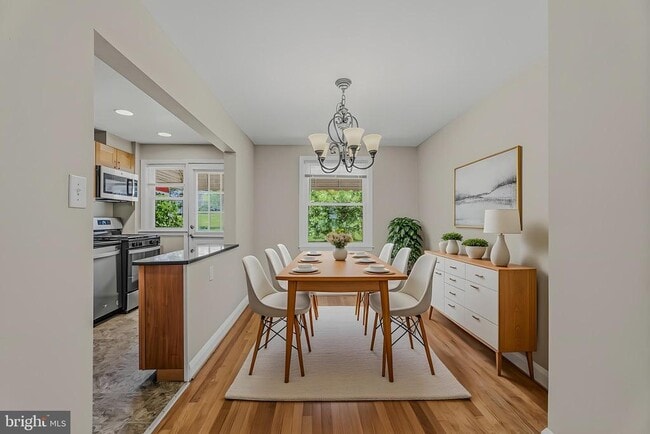
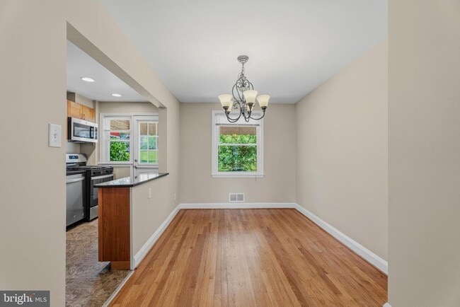
Welcome to 586 Lucia Ave! This charming 3-bedroom, 1.5-bath home in the desirable Yale Heights community offers the perfect blend of comfort and convenience. Step inside to find beautiful hardwood floors, spacious living and dining areas, and a large kitchen with plenty of room for cooking and entertaining. The generous layout provides comfortable living spaces throughout, making it easy to feel right at home. Conveniently located near shopping, restaurants, parks, and public transportation, this home also offers easy access to major commuter routes, making daily travel a breeze. Whether you're a first-time homebuyer or looking to add to your investment portfolio, this is an opportunity you won't want to miss. Schedule your showing today!
586 Lucia Ave is a townhome located in Baltimore City County and the 21229 ZIP Code. This area is served by the Baltimore City Public Schools attendance zone.
* Price shown is base rent. Excludes user-selected optional fees and variable or usage-based fees and required charges due at or prior to move-in or at move-out. Price, availability, fees, and any applicable rent special are subject to change without notice.
* Square footage definitions vary. Displayed square footage is approximate.
Townhome Features
- Basement
Contact
- Listed by Dylan S Miller | Cummings & Co. Realtors
- Phone Number
- Contact
-
Source
 Bright MLS, Inc.
Copyright © 2026 Bright MLS, Inc.
Location
Get Directions
Attractive Yale Heights features rows of brick townhouses and historic, single-family homes along tree-lined streets. Dating back to the 1950s, Yale Heights is located to the east of Beechfield and south of Tremont. It includes Yale Heights Park and part of Irvington Park, as well as several pocket parks and green spaces. Yale Heights is in western Baltimore, about two miles northeast of the University of Maryland-Baltimore County. There are several bus stops and stations in the neighborhood, especially along Cedar Garden Road and Beechfield Avenue. To reach downtown, just eight miles northeast, take the bus or I-95 to be there in minutes.
M&T Bank Stadium (home of the NFL's Baltimore Ravens) is just five miles from Yale Heights, making this neighborhood a great choice for football fans.
Learn more about living in Yale Heights
Amenities
- Basement
Education
| Colleges & Universities | Distance | ||
|---|---|---|---|
| Colleges & Universities | Distance | ||
| Drive: | 8 min | 2.6 mi | |
| Drive: | 10 min | 3.6 mi | |
| Drive: | 12 min | 4.3 mi | |
| Drive: | 13 min | 4.4 mi |
586 Lucia Ave is within 8 minutes or 2.6 miles from UMBC. It is also near CCBC Cantonsville and Univ. of Maryland-Baltimore.
Schools


Public Elementary & Middle School
Grades PK-8
583 Students
Attendance Zone
Public Middle & High School
Grades 6-12
854 Students
Attendance Zone
Public Middle & High School
Grades 6-12
370 Students
Attendance Zone
Public High School
Grades 9-12
859 Students
Attendance Zone
Public High School
Grades 9-12
1,020 Students
Attendance Zone
Private Elementary & Middle School
Grades PK-8
170 Students
Nearby
Private High School
Grades 9-12
852 Students
Nearby
School data provided by
 The GreatSchools Rating helps parents compare schools within a state based on a variety of school quality indicators and provides a helpful picture of how effectively each school serves all of its students. Ratings are on a scale of 1 (below average) to 10 (above average) and can include test scores, college readiness, academic progress, advanced courses, equity, discipline and attendance data. We also advise parents to visit schools, consider other information on school performance and programs, and consider family needs as part of the school selection process.
View GreatSchools Rating Methodology
Data provided by GreatSchools.org © 2026. All rights reserved.
View GreatSchools Rating Methodology
Data provided by GreatSchools.org © 2026. All rights reserved.
Transportation options available in Baltimore include Upton, located 4.9 miles from 586 Lucia Ave. 586 Lucia Ave is near Baltimore/Washington International Thurgood Marshall, located 8.0 miles or 15 minutes away, and Ronald Reagan Washington Ntl, located 40.2 miles or 63 minutes away.
| Transit / Subway | Distance | ||
|---|---|---|---|
| Transit / Subway | Distance | ||
| Drive: | 14 min | 4.9 mi | |
|
|
Drive: | 13 min | 4.9 mi |
| Drive: | 14 min | 5.0 mi | |
| Drive: | 15 min | 5.1 mi | |
|
|
Drive: | 14 min | 5.1 mi |
| Commuter Rail | Distance | ||
|---|---|---|---|
| Commuter Rail | Distance | ||
| Drive: | 7 min | 2.8 mi | |
| Drive: | 7 min | 2.8 mi | |
| Drive: | 10 min | 3.4 mi | |
| Drive: | 10 min | 4.7 mi | |
| Drive: | 13 min | 4.7 mi |
| Airports | Distance | ||
|---|---|---|---|
| Airports | Distance | ||
|
Baltimore/Washington International Thurgood Marshall
|
Drive: | 15 min | 8.0 mi |
|
Ronald Reagan Washington Ntl
|
Drive: | 63 min | 40.2 mi |
Getting Around
 What do Walkability, Transit, Drivability, and Bikeability mean?
Walkability measures the walking distance to day-to-day needs.
Transit measures access to public transportation.
Drivability measures congestion, parking availability, and access to major roads.
Bikeability measures the suitability for cycling.
How It Works
What do Walkability, Transit, Drivability, and Bikeability mean?
Walkability measures the walking distance to day-to-day needs.
Transit measures access to public transportation.
Drivability measures congestion, parking availability, and access to major roads.
Bikeability measures the suitability for cycling.
How It Works
Moderately Walkable
Walkability
60
/ 100
Limited Public Transit
Transit
30
/ 100
Moderately Drivable
Drivability
70
/ 100
Fairly Bikeable
Bikeability
40
/ 100
Scores provided by
-
Soundscore™
-
/ 100
Traffic
-Airport
-Businesses
-Scores provided by
HowLoud What is a Sound Score Rating? A Sound Score Rating aggregates noise caused by vehicle traffic, airplane traffic and local sources. How It WorksTime and distance from 586 Lucia Ave.
| Shopping Centers | Distance | ||
|---|---|---|---|
| Shopping Centers | Distance | ||
| Walk: | 18 min | 1.0 mi | |
| Drive: | 4 min | 1.2 mi | |
| Drive: | 6 min | 2.0 mi |
586 Lucia Ave has 3 shopping centers within 2.0 miles, which is about a 6-minute drive. The miles and minutes will be for the farthest away property.
| Parks and Recreation | Distance | ||
|---|---|---|---|
| Parks and Recreation | Distance | ||
|
Gwynns Falls Trail
|
Drive: | 10 min | 2.9 mi |
|
Banneker Planetarium
|
Drive: | 10 min | 3.6 mi |
|
Carroll Park
|
Drive: | 12 min | 3.9 mi |
|
Carrie Murray Nature Center
|
Drive: | 12 min | 4.0 mi |
|
Gwynns Falls - Leakin Park
|
Drive: | 12 min | 4.1 mi |
586 Lucia Ave has 5 parks within 4.1 miles, including Gwynns Falls Trail, Gwynns Falls - Leakin Park, and Carrie Murray Nature Center.
| Hospitals | Distance | ||
|---|---|---|---|
| Hospitals | Distance | ||
| Drive: | 5 min | 1.8 mi | |
| Drive: | 9 min | 3.1 mi | |
| Drive: | 8 min | 3.2 mi |
586 Lucia Ave has 3 hospitals within 3.2 miles, the nearest is Saint Agnes Hospital which is 1.8 miles away and a 5 minute drive.
| Military Bases | Distance | ||
|---|---|---|---|
| Military Bases | Distance | ||
| Drive: | 29 min | 16.0 mi | |
| Drive: | 49 min | 32.4 mi | |
| Drive: | 57 min | 38.2 mi |
586 Lucia Ave has 3 military bases within 38.2 miles, the nearest is Fort George Meade which is 16.0 miles away and a 29 minute drive.
You May Also Like
Similar Rentals Nearby


What Are Walk Score®, Transit Score®, and Bike Score® Ratings?
Walk Score® measures the walkability of any address. Transit Score® measures access to public transit. Bike Score® measures the bikeability of any address.
What is a Sound Score Rating?
A Sound Score Rating aggregates noise caused by vehicle traffic, airplane traffic and local sources.

586 Lucia Ave
Baltimore, MD 21229