

$6,450 / Month
58 St Andrews Ln
Alamo, CA 94507
1 Day Ago
Favorites
925-255-9663
-
Bedrooms
5
-
Bathrooms
4
-
Square Feet
3,512 sq ft
-
Available
Available Now
Highlights
- Fireplace in Primary Bedroom
- Family Room with Fireplace
- 3 Fireplaces
- Traditional Architecture
- Wood Flooring
- 3 Car Detached Garage
58 St Andrews Ln

Favorites
About This Home
Available Now
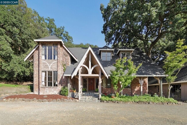
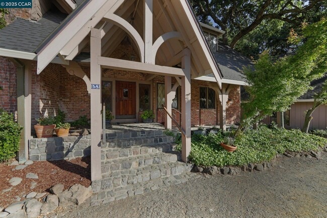
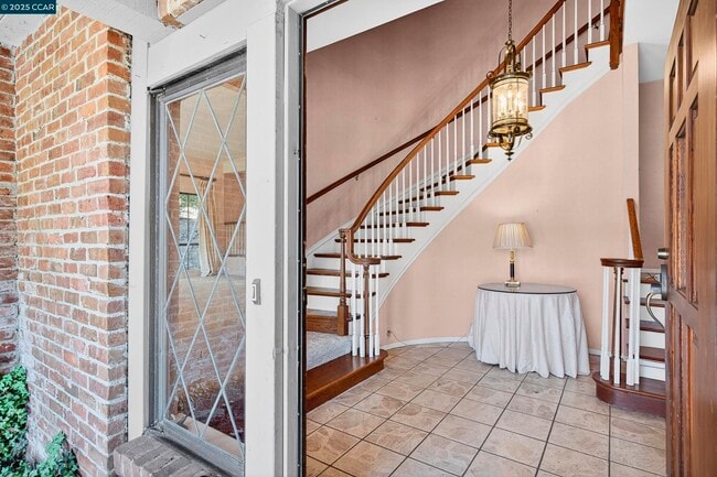
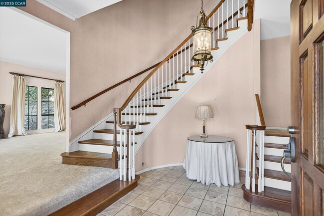
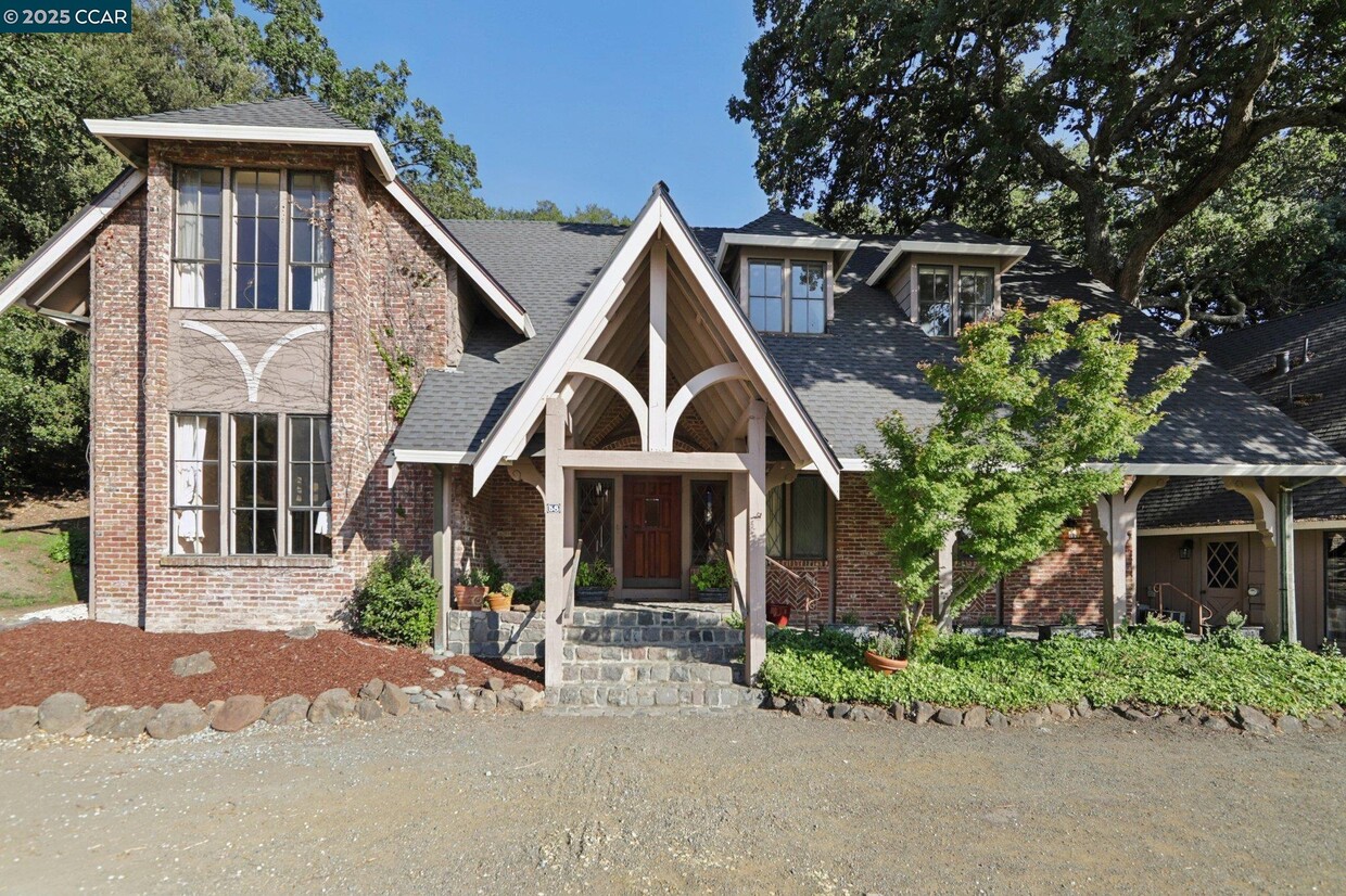
Available now: Gorgeous 5BR,4BA home overlooking the 6th fairway of Round Hill Country Club. Set on a serene half-acre lot with oak trees,this home offers privacy,charm and modern amenities. The large kitchen features double ovens,new gas cooktop,stainless steel fridge,and a Maple butcher block island. Abundant natural light fills the home. The primary suite offers golf course views,a cedar walk-in closet,and a marble bathroom with dual vanities. All bedrooms have ensuite baths and cedar closets. A guest bedroom on the first floor is perfect for guests or as an office. Additional features include: upstairs laundry room with storage,formal dining and living rooms,French antique doors,central AC,2-car garage and ample storage. Enjoy outdoor living with a cobblestone front porch overlooking the golf course,spacious back deck,and proximity to the Round Hill Country Club pool and tennis courts (membership not included). Top-rated schools: Rancho Romero Elementary,Stone Valley Middle,and Monte Vista High. Located just 2 miles from downtown Alamo and I-680,with easy access to shopping,dining,and outdoor activities. Pets allowed with deposit. Tenant pays utilities (except garbage and Wi-Fi). No smoking. Optional furniture: Piano,dining room table,kitchen table
58 St Andrews Ln is a house located in Contra Costa County and the 94507 ZIP Code. This area is served by the San Ramon Valley Unified attendance zone.
* Price shown is base rent and may not include non-optional fees and utilities.
Price, availability, fees, and any applicable rent special are subject to change without notice.
* Square footage definitions vary. Displayed square footage is approximate.
Home Details
Home Type
Single Family Detached Home
Year Built
Built in 1977
Bedrooms and Bathrooms
Fireplace in Primary Bedroom
4 Full Bathrooms
5 Bedrooms
Flooring
Wood
Carpet
Home Design
Traditional Architecture
Wood Shingle Exterior
Brick Exterior Construction
Composition Roof
Interior Spaces
Family Room with Fireplace
3 Fireplaces
Living Room with Fireplace
2-Story Property
Kitchen
Built-In Oven
Gas Range
Trash Compactor
Laundry
Washer and Dryer Hookup
Listing and Financial Details
Assessor Parcel Number 1935000024
Lot Details
0.46 Acre Lot
Lot Sloped Up
Parking
3 Car Detached Garage
Garage Door Opener
Utilities
Zoned Heating and Cooling System
Community Details
Overview
Property has a Home Owners Association
Roundhill Country Club Association, Phone Number (877) 904-3080
Roundhill C.C. Subdivision
Association fees include common area maintenance
Pet Policy
Pet Deposit Required
Contact
- Listed by Erin Kelly | Brightwork Realty Advocates
- Phone Number
- Contact
-
Source
 Contra Costa Association of REALTORS®
Copyright © 2025 Bay East, CCAR, bridgeMLS. Based on information from Bay East and Contra Costa Association of REALTORS® and bridgeMLS. All data, including all measurements and calculations of area, is obtained from various sources and has not been, and will not be, verified by broker or MLS. All information should be independently reviewed and verified for accuracy. If a floor plan is included, the floor plan is for illustrative purposes only, and the actual dimensions and layout of the home may differ from the floor plan. Buyer is urged to make a detailed inspection of the property, and if any aspect of a floor plan is critical to the buyer's decision to purchase, buyer must conduct their own measurements and inspection. Properties may or may not be listed by the office/agent presenting the information.
Location
Get Directions
Situated about 25 miles east of San Francisco, Alamo is an upscale suburb in Contra Costa County. Alamo offers residents the best of suburban living—peaceful luxury within close proximity to the bustling and vibrant San Francisco Bay Area. Outdoor recreation abounds near Alamo, with convenience to Mount Diablo State Park, Las Trampas Regional Wilderness, and Redwood Regional Park. Shopping opportunities are plentiful in Alamo’s charming downtown area as well as in neighboring Walnut Creek. Getting around from Alamo is simple with access to I-680 and the Lafayette BART Station.
Learn more about living in Alamo
Education
| Colleges & Universities | Distance | ||
|---|---|---|---|
| Colleges & Universities | Distance | ||
| Drive: | 25 min | 11.3 mi | |
| Drive: | 21 min | 11.6 mi | |
| Drive: | 25 min | 14.6 mi | |
| Drive: | 36 min | 22.8 mi |
58 St Andrews Ln is within 25 minutes or 11.3 miles from Saint Marys Coll. of Calif.. It is also near Diablo Valley, Pleasant Hill and Diablo Valley Coll, San Ramon.
Schools


Public Elementary School
Grades K-5
442 Students
Attendance Zone
Public Elementary School
Grades K-5
497 Students
Nearby
Public Middle School
Grades 6-8
580 Students
Attendance Zone
Public High School
Grades 9-12
2,243 Students
Attendance Zone
Private Elementary & Middle School
Grades K-8
355 Students
Nearby
Private Elementary School
Grades PK-6
96 Students
Nearby
School data provided by
 The GreatSchools Rating helps parents compare schools within a state based on a variety of school quality indicators and provides a helpful picture of how effectively each school serves all of its students. Ratings are on a scale of 1 (below average) to 10 (above average) and can include test scores, college readiness, academic progress, advanced courses, equity, discipline and attendance data. We also advise parents to visit schools, consider other information on school performance and programs, and consider family needs as part of the school selection process.
View GreatSchools Rating Methodology
Data provided by GreatSchools.org © 2025. All rights reserved.
View GreatSchools Rating Methodology
Data provided by GreatSchools.org © 2025. All rights reserved.
Transportation options available in Alamo include Walnut Creek Station, located 6.7 miles from 58 St Andrews Ln. 58 St Andrews Ln is near Metro Oakland International, located 28.9 miles or 43 minutes away, and San Francisco International, located 40.8 miles or 61 minutes away.
| Transit / Subway | Distance | ||
|---|---|---|---|
| Transit / Subway | Distance | ||
|
|
Drive: | 13 min | 6.7 mi |
|
|
Drive: | 14 min | 8.4 mi |
|
|
Drive: | 15 min | 8.9 mi |
|
|
Drive: | 20 min | 12.5 mi |
|
|
Drive: | 20 min | 12.9 mi |
| Commuter Rail | Distance | ||
|---|---|---|---|
| Commuter Rail | Distance | ||
|
|
Drive: | 26 min | 18.0 mi |
|
|
Drive: | 36 min | 19.9 mi |
| Drive: | 36 min | 19.9 mi | |
|
|
Drive: | 32 min | 22.0 mi |
|
|
Drive: | 37 min | 26.8 mi |
| Airports | Distance | ||
|---|---|---|---|
| Airports | Distance | ||
|
Metro Oakland International
|
Drive: | 43 min | 28.9 mi |
|
San Francisco International
|
Drive: | 61 min | 40.8 mi |
Time and distance from 58 St Andrews Ln.
| Shopping Centers | Distance | ||
|---|---|---|---|
| Shopping Centers | Distance | ||
| Drive: | 7 min | 2.3 mi | |
| Drive: | 7 min | 2.4 mi | |
| Drive: | 7 min | 2.4 mi |
58 St Andrews Ln has 3 shopping centers within 2.4 miles, which is about a 7-minute drive. The miles and minutes will be for the farthest away property.
| Parks and Recreation | Distance | ||
|---|---|---|---|
| Parks and Recreation | Distance | ||
|
Rudgear Park
|
Drive: | 9 min | 2.9 mi |
|
Lar Rieu Park
|
Drive: | 13 min | 5.9 mi |
|
Eugene O'Neill National Historic Site
|
Drive: | 16 min | 6.1 mi |
|
Castle Rock Regional Recreation Area
|
Drive: | 25 min | 12.0 mi |
|
Diablo Foothills Regional Park
|
Drive: | 27 min | 12.3 mi |
58 St Andrews Ln has 5 parks within 12.3 miles, including Rudgear Park, Diablo Foothills Regional Park, and Lar Rieu Park.
| Hospitals | Distance | ||
|---|---|---|---|
| Hospitals | Distance | ||
| Drive: | 10 min | 5.2 mi | |
| Drive: | 14 min | 8.1 mi | |
| Drive: | 17 min | 9.6 mi |
58 St Andrews Ln has 3 hospitals within 9.6 miles, the nearest is Kaiser Foundation Hospital - Walnut Creek which is 5.2 miles away and a 10 minute drive.
You May Also Like
Similar Rentals Nearby


What Are Walk Score®, Transit Score®, and Bike Score® Ratings?
Walk Score® measures the walkability of any address. Transit Score® measures access to public transit. Bike Score® measures the bikeability of any address.
What is a Sound Score Rating?
A Sound Score Rating aggregates noise caused by vehicle traffic, airplane traffic and local sources
58 St Andrews Ln
Alamo, CA 94507