

$5,000
Total Monthly Price
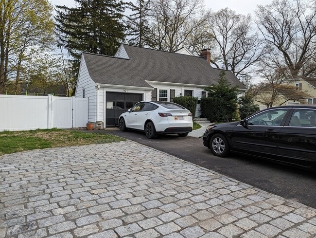
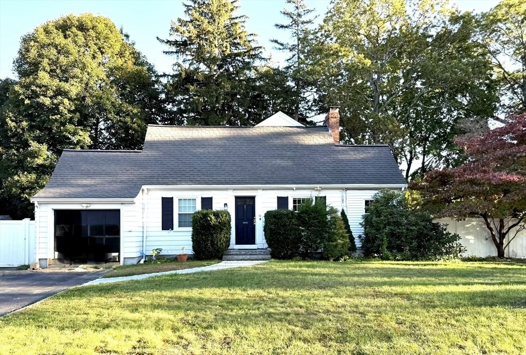
58 Hartford St
Natick, MA 01760
Today
|
Edit
Favorites
508-353-4610
-
Bedrooms
4
-
Bathrooms
3
-
Square Feet
1,790 sq ft
-
Available
Available Now
Highlights
- Golf Course Community
- Deck
- Property is near public transit
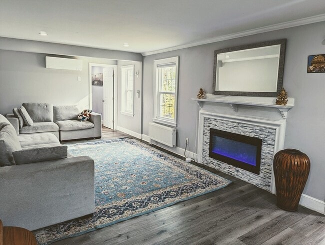
- 1 Fireplace
- Jogging Path
- Enclosed Patio or Porch
58 Hartford St

Favorites
About This Home
$5,000 deposit,
Available Now
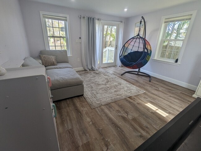
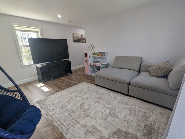
Spacious 4-bedroom expanded Cape for rent in the desirable town of Natick. The main level offers a fully equipped kitchen with granite countertops,dining room,living room with access to three-season porch and deck,a large bedroom/guest suite and a full bathroom. Upstairs there are 3 bedrooms and a full bathroom. The basement offers flexible finished space perfect for home office/playroom/gym,the laundry area,and a full bath. Additional features include hardwood floor throughout,gas fireplace,1-car garage and fully fenced in-yard with patio. Conveniently located with close access to Rt. 9,Mass Pike,commuter rail,and walking distance to Brown Elementary and Kennedy Middle School. Applicants 18+ must provide a rental application,credit report,and income verification. MLS# 73451770
58 Hartford St is a house located in Middlesex County and the 01760 ZIP Code. This area is served by the Natick attendance zone.
* Price shown is total price based on community-supplied monthly required fees. Excludes user-selected optional fees and variable or usage-based fees and required charges due at or prior to move-in or at move-out. Price, availability, fees, and any applicable rent special are subject to change without notice.
* Square footage definitions vary. Displayed square footage is approximate.
Home Details
Home Type
Single Family Detached Home
Year Built
Built in 1938
Bedrooms and Bathrooms
3 Full Bathrooms
4 Bedrooms
Home Design
Entry on the 1st floor
Interior Spaces
1 Fireplace
1,790 Sq Ft Home
Kitchen
Range
Freezer
Dishwasher
Laundry
Dryer
Laundry in unit
Washer
Listing and Financial Details
Security Deposit $5,000
Property Available on 12/1/25
Assessor Parcel Number 666646
Rent includes water, sewer, trash collection
Location
Property is near public transit
Property is near schools
Lot Details
0.25 Acre Lot
Outdoor Features
Deck
Enclosed Patio or Porch
Parking
1 Car Garage
Schools
Brown Elementary School
Kennedy Middle School
Natick High School
Utilities
Cooling Available
Heating System Uses Natural Gas
Community Details
Amenities
Shops
Overview
No Home Owners Association
Pet Policy
Call for details about the types of pets allowed
Recreation
Golf Course Community
Jogging Path
Fees and Policies
The fees below are based on community-supplied data and may exclude additional fees and utilities.
- One-Time Basics
- Due at Move-In
- Security Deposit - Refundable$5,000
- Due at Move-In
Property Fee Disclaimer: Based on community-supplied data and independent market research. Subject to change without notice. May exclude fees for mandatory or optional services and usage-based utilities.
Contact
- Listed by Raya Daoud | Berkshire Hathaway HomeServices Commonwealth Real Estate
- Phone Number
-
Source
 MLS Property Information Network
The property listing data and information set forth herein were provided to MLS Property Information Network, Inc. from third party sources, including sellers, lessors and public records, and were compiled by MLS Property Information Network, Inc. The property listing data and information are for the personal, non-commercial use of consumers having a good faith interest in purchasing or leasing listed properties of the type displayed to them and may not be used for any purpose other than to identify prospective properties which such consumers may have a good faith interest in purchasing or leasing. MLS Property Information Network, Inc. and its subscribers disclaim any and all representations and warranties as to the accuracy of the property listing data and information set forth herein. All properties are subject to prior sale, change or withdrawal. Copyright © 2025 MLS Property Information Network, Inc. All rights reserved.
Location
Get Directions
Amenities
- Dishwasher
- Range
- Refrigerator
- Freezer
- Patio
- Porch
- Deck
Just west of Boston and East of Worcester sits Metro West, a region that houses a group of towns and cities with significant historical backgrounds. A total of 19 municipalities make up the core of this community, but other municipalities are considered to be a part of the Interstate 495/Metro West Corridor.
Learn more about living in Metro West
Education
| Colleges & Universities | Distance | ||
|---|---|---|---|
| Colleges & Universities | Distance | ||
| Drive: | 8 min | 4.1 mi | |
| Drive: | 12 min | 5.9 mi | |
| Drive: | 12 min | 6.8 mi | |
| Drive: | 19 min | 11.1 mi |
58 Hartford St is within 8 minutes or 4.1 miles from Framingham State College. It is also near Wellesley College and Babson College.
Schools


Public Elementary School
Grades K-4
503 Students
Attendance Zone
Public Elementary & Middle School
Grades 5-8
884 Students
Attendance Zone
Public High School
Grades PK & 9-12
1,727 Students
Attendance Zone
Public Elementary School
Grades PK-5
401 Students
Nearby
Private Elementary School
Grades PK-K
54 Students
Nearby
Private Elementary & Middle School
Grades PK-8
174 Students
Nearby
Private High School
Grades 9-12
277 Students
Nearby
School data provided by
 The GreatSchools Rating helps parents compare schools within a state based on a variety of school quality indicators and provides a helpful picture of how effectively each school serves all of its students. Ratings are on a scale of 1 (below average) to 10 (above average) and can include test scores, college readiness, academic progress, advanced courses, equity, discipline and attendance data. We also advise parents to visit schools, consider other information on school performance and programs, and consider family needs as part of the school selection process.
View GreatSchools Rating Methodology
Data provided by GreatSchools.org © 2025. All rights reserved.
View GreatSchools Rating Methodology
Data provided by GreatSchools.org © 2025. All rights reserved.
Transportation options available in Natick include Woodland Station, located 8.2 miles from 58 Hartford St. 58 Hartford St is near General Edward Lawrence Logan International, located 23.2 miles or 34 minutes away, and Worcester Regional, located 32.9 miles or 48 minutes away.
| Transit / Subway | Distance | ||
|---|---|---|---|
| Transit / Subway | Distance | ||
|
|
Drive: | 14 min | 8.2 mi |
|
|
Drive: | 15 min | 8.3 mi |
|
|
Drive: | 15 min | 8.8 mi |
|
|
Drive: | 16 min | 9.4 mi |
|
|
Drive: | 17 min | 9.6 mi |
| Commuter Rail | Distance | ||
|---|---|---|---|
| Commuter Rail | Distance | ||
|
|
Drive: | 4 min | 1.8 mi |
|
|
Drive: | 6 min | 2.5 mi |
|
|
Drive: | 5 min | 2.6 mi |
|
|
Drive: | 6 min | 2.7 mi |
|
|
Drive: | 9 min | 5.1 mi |
| Airports | Distance | ||
|---|---|---|---|
| Airports | Distance | ||
|
General Edward Lawrence Logan International
|
Drive: | 34 min | 23.2 mi |
|
Worcester Regional
|
Drive: | 48 min | 32.9 mi |
Time and distance from 58 Hartford St.
| Shopping Centers | Distance | ||
|---|---|---|---|
| Shopping Centers | Distance | ||
| Walk: | 14 min | 0.8 mi | |
| Drive: | 4 min | 1.7 mi | |
| Drive: | 4 min | 1.7 mi |
58 Hartford St has 3 shopping centers within 1.7 miles, which is about a 4-minute walk. The miles and minutes will be for the farthest away property.
| Parks and Recreation | Distance | ||
|---|---|---|---|
| Parks and Recreation | Distance | ||
|
Wellesley College Botanic Gardens
|
Drive: | 8 min | 4.5 mi |
|
Mass Audubon's Broadmoor Wildlife Sanctuary
|
Drive: | 10 min | 5.0 mi |
|
Hamlen Woods
|
Drive: | 9 min | 5.1 mi |
|
Natick Community Organic Farm
|
Drive: | 10 min | 5.2 mi |
|
Cochituate State Park
|
Drive: | 15 min | 9.6 mi |
58 Hartford St has 5 parks within 9.6 miles, including Cochituate State Park, Hamlen Woods, and Wellesley College Botanic Gardens.
| Hospitals | Distance | ||
|---|---|---|---|
| Hospitals | Distance | ||
| Drive: | 5 min | 2.4 mi | |
| Drive: | 13 min | 7.9 mi | |
| Drive: | 15 min | 8.7 mi |
58 Hartford St has 3 hospitals within 8.7 miles, the nearest is MetroWest Medical Center which is 2.4 miles away and a 5 minute drive.
| Military Bases | Distance | ||
|---|---|---|---|
| Military Bases | Distance | ||
| Drive: | 4 min | 2.2 mi | |
| Drive: | 29 min | 16.2 mi |
58 Hartford St is 2.2 miles from US Military Reservation, and is convenient to other military bases, including Hanscom Air Force Base.
You May Also Like
Similar Rentals Nearby
-
-

-

-

-

-

-

-

-
 $4,15012 Month LeaseHouse for Rent4 Beds | 2 Baths | 1,862 sq ft
 -

What Are Walk Score®, Transit Score®, and Bike Score® Ratings?
Walk Score® measures the walkability of any address. Transit Score® measures access to public transit. Bike Score® measures the bikeability of any address.
What is a Sound Score Rating?
A Sound Score Rating aggregates noise caused by vehicle traffic, airplane traffic and local sources
58 Hartford St
Natick, MA 01760