
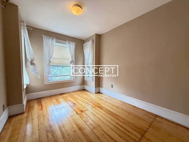
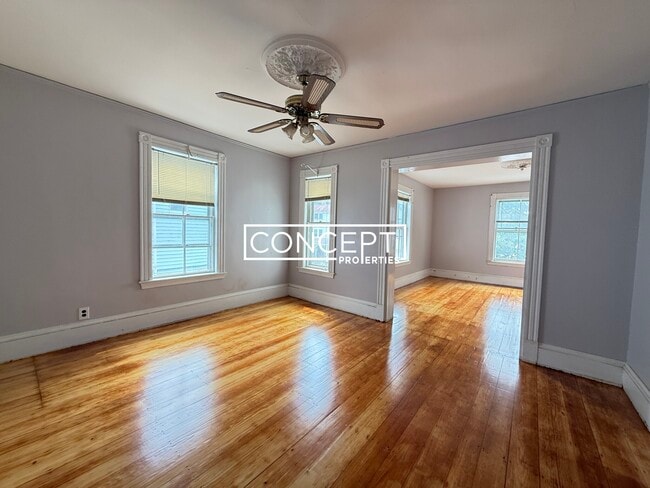
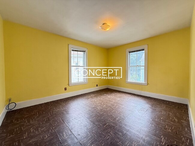
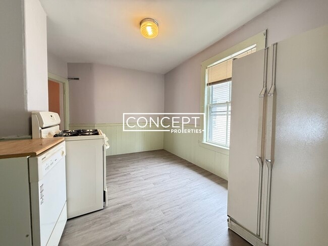
57 Rindge Ave Unit 1B
Cambridge, MA 02140
-
Bedrooms
4
-
Bathrooms
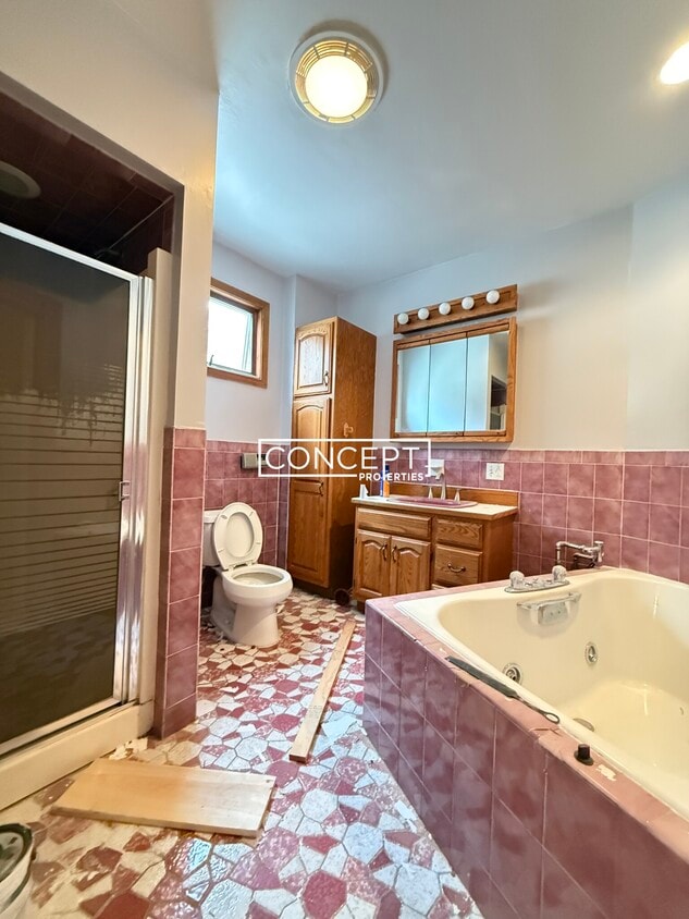
1
-
Square Feet
1,800 sq ft
-
Available
Available Now

About This Home
Transportation Bus: 83 Rindge Ave @ Haskell St (0.03 mi) Bus: 77 Massachusetts Ave @ Rindge Ave (0.10 mi) Bus: 87 Holland St @ Dover St (0.36 mi) Bus: 96 Elm St @ Chester St (0.32 mi) Bus: 94 Davis (0.38 mi) Subway: Red Line Davis (0.39 mi) Bus: 90 Highland Ave @ Cutter Ave (0.43 mi) Rail: Fitchburg Line Porter (0.51 mi) Fee Disclosure: Application Fee: $35 First Month Rent: $3,800 Security Deposit: $3,800 Disclaimer: Convenient to the Back Bay, South End, Bay Village, Beacon Hill, North End, Fenway, Kenmore, Audubon Circle, West End, Sowa, Mission Hill, Chinatown, Leather District, Downtown, Financial, Waterfront, Seaport, Charlestown, Prudential, Copley, Commons, Garden, Park, MBTA Line, Orange, Red, Green, Silver, Tufts, Boston Medical Center/BU Dental (BMC), Dana Farber, Children's, New England Medical Center (NEMC), Medicine, Brigham Women's, General, MGH, Beth Israel Hospital, BIDMC, Harvard, Longwood Area, Northeastern, NEU, Wentworth Institute Technology, MIT, Mass Co
57 Rindge Ave is a condo located in Middlesex County and the 02140 ZIP Code.
Condo Features
- Washer/Dryer
Fees and Policies
The fees below are based on community-supplied data and may exclude additional fees and utilities.
Pet policies are negotiable.
Details
Utilities Included
-
Water
Lease Options
-
12 Months
Contact
- Phone Number
- Website View Property Website
- Contact
-
Source

- Washer/Dryer
This walkable, friendly community offers a serene location and favorable amenities. North Cambridge is just two miles northeast of Harvard University and five miles from downtown Boston. The nearby Ivy League University is a staple to the Cambridge Community and is a true educational treasure. North Cambridge belongs to Cambridge Public Schools, a highly rated district in Massachusetts. Cambridge, as well as downtown Boston, offer North Cambridge residents a plethora of amenities including museums, local eateries, historic landmarks, international airport, and water views.
North Cambridge offers public parks to its residents as well as trails throughout the community such as Alewife Linear Path, perfect for walking, running, or biking through town. Buy your fresh produce and garden supplies at Pemberton Farms Marketplace and support local business in North Cambridge. Grab lunch, dinner, or even late night drinks at Christopher’s on Massachusetts Avenue.
Learn more about living in North Cambridge| Colleges & Universities | Distance | ||
|---|---|---|---|
| Colleges & Universities | Distance | ||
| Walk: | 13 min | 0.7 mi | |
| Drive: | 2 min | 1.1 mi | |
| Drive: | 4 min | 1.5 mi | |
| Drive: | 3 min | 1.8 mi |
Transportation options available in Cambridge include Davis Station, located 0.4 mile from 57 Rindge Ave Unit 1B. 57 Rindge Ave Unit 1B is near General Edward Lawrence Logan International, located 7.3 miles or 17 minutes away.
| Transit / Subway | Distance | ||
|---|---|---|---|
| Transit / Subway | Distance | ||
|
|
Walk: | 8 min | 0.4 mi |
|
|
Walk: | 10 min | 0.6 mi |
| Walk: | 15 min | 0.8 mi | |
|
|
Walk: | 17 min | 0.9 mi |
| Drive: | 4 min | 1.7 mi |
| Commuter Rail | Distance | ||
|---|---|---|---|
| Commuter Rail | Distance | ||
|
|
Walk: | 11 min | 0.6 mi |
|
|
Drive: | 6 min | 2.6 mi |
|
|
Drive: | 6 min | 2.9 mi |
|
|
Drive: | 8 min | 4.1 mi |
| Drive: | 15 min | 7.7 mi |
| Airports | Distance | ||
|---|---|---|---|
| Airports | Distance | ||
|
General Edward Lawrence Logan International
|
Drive: | 17 min | 7.3 mi |
Time and distance from 57 Rindge Ave Unit 1B.
| Shopping Centers | Distance | ||
|---|---|---|---|
| Shopping Centers | Distance | ||
| Walk: | 10 min | 0.6 mi | |
| Walk: | 11 min | 0.6 mi | |
| Walk: | 12 min | 0.6 mi |
| Parks and Recreation | Distance | ||
|---|---|---|---|
| Parks and Recreation | Distance | ||
|
Harvard-Smithsonian Center for Astrophysics
|
Drive: | 4 min | 1.4 mi |
|
Mineralogical and Geological Museum
|
Drive: | 3 min | 1.4 mi |
|
Harvard Museum of Natural History
|
Drive: | 3 min | 1.4 mi |
|
Longfellow National Historic Site
|
Drive: | 3 min | 1.8 mi |
|
Mystic River Reservation
|
Drive: | 5 min | 2.7 mi |
| Hospitals | Distance | ||
|---|---|---|---|
| Hospitals | Distance | ||
| Drive: | 5 min | 1.9 mi | |
| Drive: | 5 min | 2.3 mi | |
| Drive: | 9 min | 4.1 mi |
| Military Bases | Distance | ||
|---|---|---|---|
| Military Bases | Distance | ||
| Drive: | 19 min | 10.3 mi | |
| Drive: | 31 min | 17.0 mi |
You May Also Like
What Are Walk Score®, Transit Score®, and Bike Score® Ratings?
Walk Score® measures the walkability of any address. Transit Score® measures access to public transit. Bike Score® measures the bikeability of any address.
What is a Sound Score Rating?
A Sound Score Rating aggregates noise caused by vehicle traffic, airplane traffic and local sources
57 Rindge Ave
Cambridge, MA 02140