
$1,961
/ Month
566 Vista Ave
Palo Alto, CA 94306
Today
|
Edit
Favorites
650-231-7670
-
Bedrooms
1
-
Bathrooms
1
-
Square Feet
529 sq ft
-
Available
Available Now
566 Vista Ave

Favorites
About This Home
Available Now
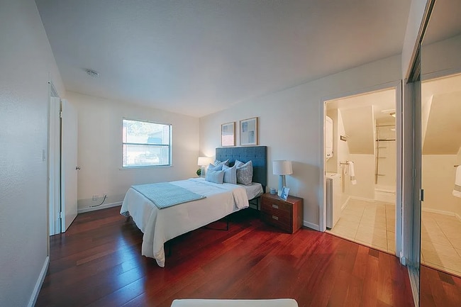
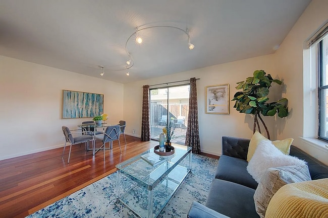
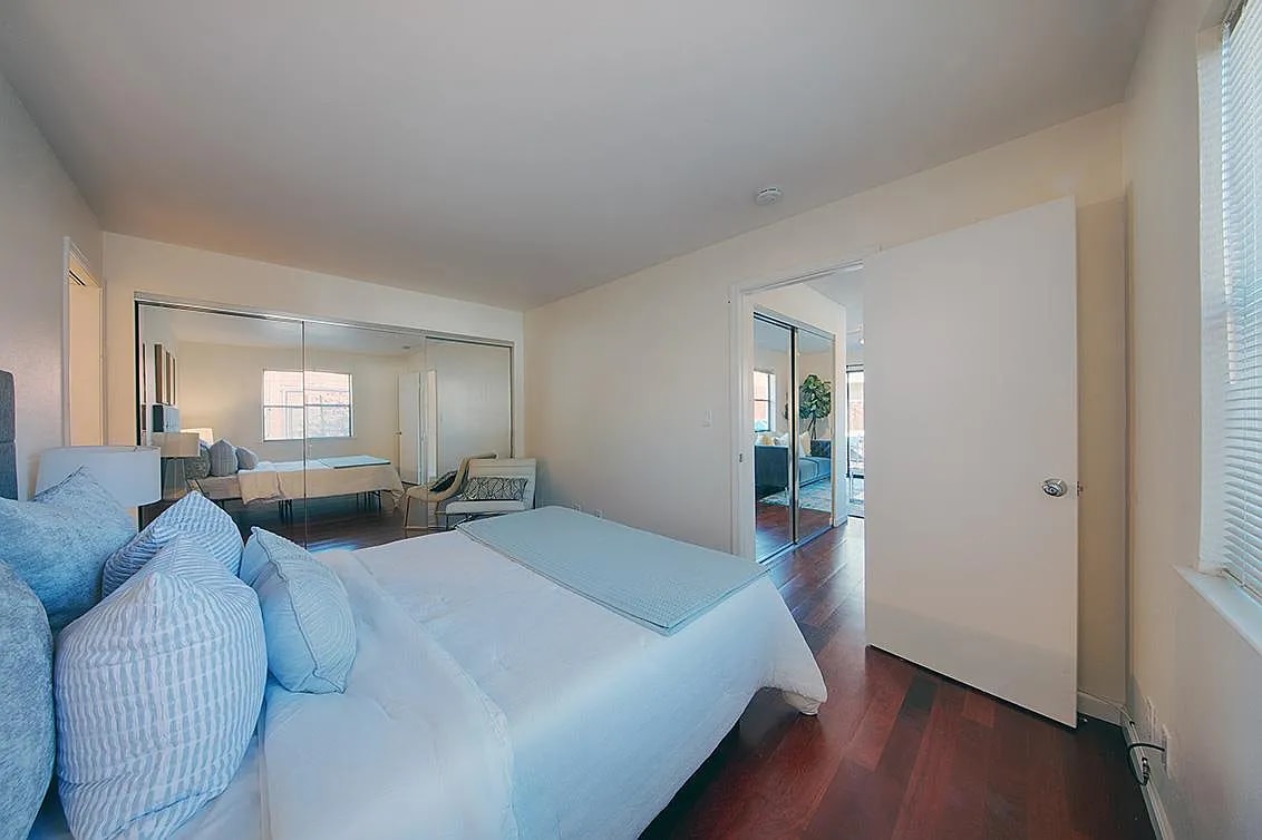
Half of this home is a single story extending out from a building, having multiple homes, while the second half is on the ground level beneath a different home. The Barron Park neighborhood has long been considered to be the most rural neighborhood in Palo Alto, yet this wonderful home is just a couple short blocks from El Camino Real cafes and shops.
566 Vista Ave is an apartment community located in Santa Clara County and the 94306 ZIP Code.
* Price shown is base rent. Excludes user-selected optional fees and variable or usage-based fees and required charges due at or prior to move-in or at move-out. Price, availability, fees, and any applicable rent special are subject to change without notice.
* Square footage definitions vary. Displayed square footage is approximate.
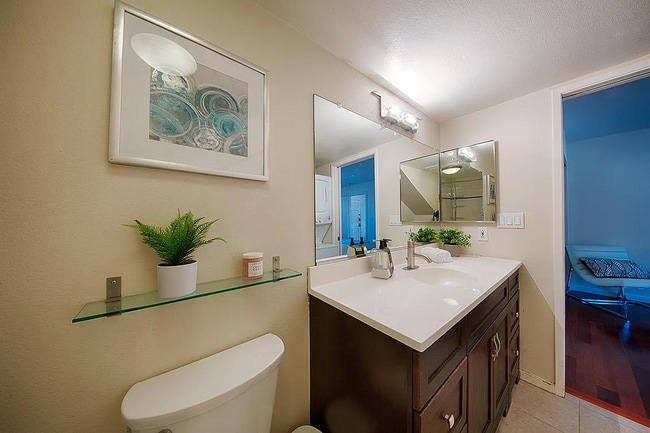
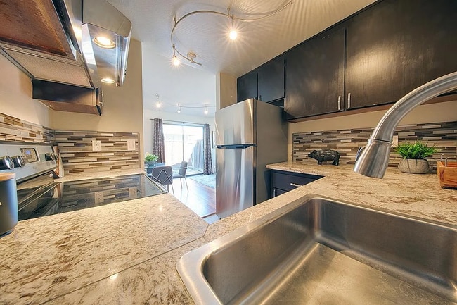
Features
Air Conditioning
Dishwasher
Microwave
Refrigerator
- Air Conditioning
- Dishwasher
- Disposal
- Microwave
- Refrigerator
- Carpet
- Furnished
- Patio
Fees and Policies
The fees below are based on community-supplied data and may exclude additional fees and utilities.
- Dogs Allowed
-
Fees not specified
-
Weight limit--
-
Pet Limit--
Details
Utilities Included
-
Gas
-
Electricity
-
Trash Removal
-
Sewer
Property Information
-
Furnished Units Available
Contact
- Listed by TRINAR INC
- Phone Number
- Contact
Location
Get Directions
Amenities
- Air Conditioning
- Dishwasher
- Disposal
- Microwave
- Refrigerator
- Carpet
- Furnished
- Patio
Expenses
Utilities Included
Gas, Electricity, Trash Removal, Sewer
Included
Living in Palo Alto places you in Silicon Valley, where historic neighborhoods complement the city's technological presence. Tree-lined streets wind through the community, which is anchored by Stanford University. University Avenue features local boutiques and restaurants housed in preserved historic buildings, while the Stanford Shopping Center offers high-end retail destinations. The city maintains 36 parks and preserves, including the Baylands Nature Preserve and Foothills Park, where residents enjoy hiking trails and outdoor activities. Palo Alto's infrastructure supports alternative transportation, with dedicated bike lanes throughout the city.
The rental market in Palo Alto reflects the area's popularity, with current average rents ranging from $2,634 for studios to $6,139 for four-bedroom homes. Recent trends show steady growth, with rent increases varying from 1.8% to 17% across different unit sizes over the past year.
Learn more about living in Palo Alto
Education
| Colleges & Universities | Distance | ||
|---|---|---|---|
| Colleges & Universities | Distance | ||
| Drive: | 6 min | 1.8 mi | |
| Drive: | 8 min | 2.9 mi | |
| Drive: | 11 min | 4.8 mi | |
| Drive: | 12 min | 5.1 mi |
566 Vista Ave is within 6 minutes or 1.8 miles from Foothill College, Middlefield. It is also near Stanford University and Foothill Coll., Los Altos.
Transportation options available in Palo Alto include Mountain View Station, located 3.4 miles from 566 Vista Ave. 566 Vista Ave is near Norman Y Mineta San Jose International, located 12.7 miles or 21 minutes away, and San Francisco International, located 23.7 miles or 34 minutes away.
| Transit / Subway | Distance | ||
|---|---|---|---|
| Transit / Subway | Distance | ||
| Drive: | 7 min | 3.4 mi | |
|
|
Drive: | 7 min | 3.4 mi |
|
|
Drive: | 10 min | 4.7 mi |
| Drive: | 11 min | 5.2 mi | |
|
|
Drive: | 11 min | 5.4 mi |
| Commuter Rail | Distance | ||
|---|---|---|---|
| Commuter Rail | Distance | ||
| Drive: | 4 min | 1.7 mi | |
| Drive: | 4 min | 1.9 mi | |
| Drive: | 5 min | 2.1 mi | |
| Drive: | 8 min | 3.3 mi | |
| Drive: | 9 min | 3.9 mi |
| Airports | Distance | ||
|---|---|---|---|
| Airports | Distance | ||
|
Norman Y Mineta San Jose International
|
Drive: | 21 min | 12.7 mi |
|
San Francisco International
|
Drive: | 34 min | 23.7 mi |
Time and distance from 566 Vista Ave.
| Shopping Centers | Distance | ||
|---|---|---|---|
| Shopping Centers | Distance | ||
| Walk: | 11 min | 0.6 mi | |
| Walk: | 16 min | 0.8 mi | |
| Drive: | 4 min | 1.5 mi |
566 Vista Ave has 3 shopping centers within 1.5 miles, which is about a 4-minute walk. The miles and minutes will be for the farthest away property.
| Parks and Recreation | Distance | ||
|---|---|---|---|
| Parks and Recreation | Distance | ||
|
Terman Park
|
Drive: | 3 min | 1.1 mi |
|
J. Pearce Mitchell Park
|
Drive: | 4 min | 1.2 mi |
|
Bol Park
|
Drive: | 4 min | 1.3 mi |
|
Esther Clark Nature Preserve
|
Drive: | 6 min | 2.2 mi |
|
Gamble Garden
|
Drive: | 7 min | 2.7 mi |
566 Vista Ave has 5 parks within 2.7 miles, including Bol Park, Terman Park, and J. Pearce Mitchell Park.
| Hospitals | Distance | ||
|---|---|---|---|
| Hospitals | Distance | ||
| Drive: | 9 min | 3.6 mi | |
| Drive: | 10 min | 4.1 mi | |
| Drive: | 11 min | 4.6 mi |
566 Vista Ave has 3 hospitals within 4.6 miles, the nearest is Lucile Salter Packard Children's Hospital at Stanford which is 3.6 miles away and a 9 minute drive.
| Military Bases | Distance | ||
|---|---|---|---|
| Military Bases | Distance | ||
| Drive: | 14 min | 5.6 mi |
566 Vista Ave is 5.6 miles and a 14 minute drive from Ames Research Center.
You May Also Like
Similar Rentals Nearby


What Are Walk Score®, Transit Score®, and Bike Score® Ratings?
Walk Score® measures the walkability of any address. Transit Score® measures access to public transit. Bike Score® measures the bikeability of any address.
What is a Sound Score Rating?
A Sound Score Rating aggregates noise caused by vehicle traffic, airplane traffic and local sources
566 Vista Ave
Palo Alto, CA 94306