$1,395 / Month
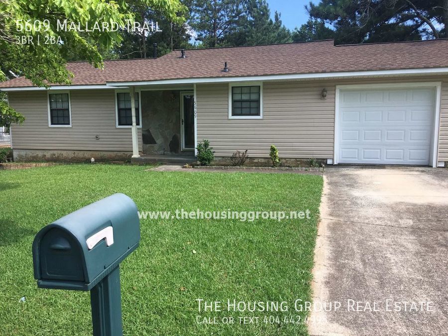
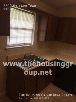
5609 Mallard Trail
Lithonia, GA 30058
2 Weeks Ago
Favorites
5609 Mallard Trail

Favorites
Check Back Soon for Upcoming Availability
| Beds | Baths | Average SF |
|---|---|---|
| 3 Bedrooms 3 Bedrooms 3 Br | 2 Baths 2 Baths 2 Ba | 1,114 SF |
About This Property
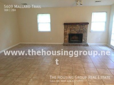
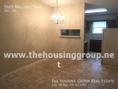
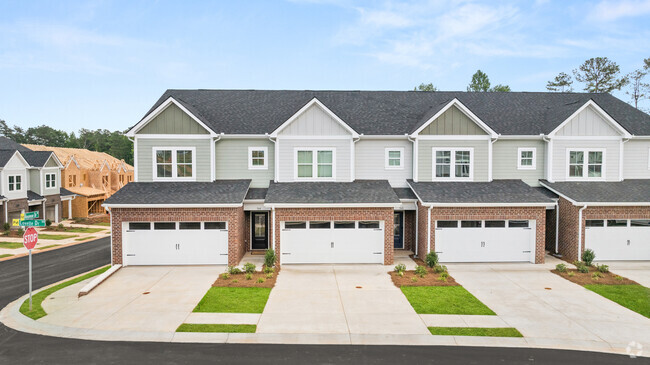
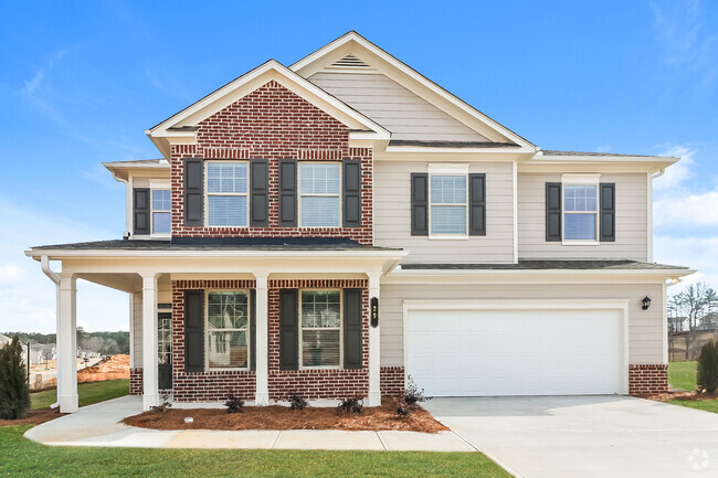
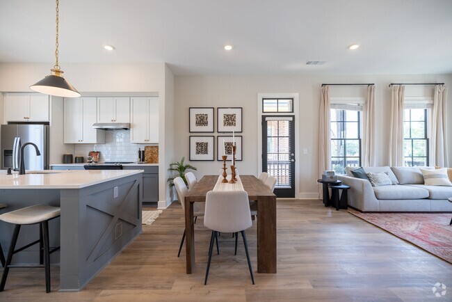
---- SCHEDULE A SHOWING ONLINE AT: ---- One level living in this convenient neighborhood close to Panola Road and Covington Hwy. Living areas are tiled for easy clean up!! Nice open fireside family room. Nice level lot on quiet street.
5609 Mallard Trail is a house located in DeKalb County and the 30058 ZIP Code. This area is served by the DeKalb County attendance zone.
Location
Get Directions
Southeast DeKalb refers to a sprawling region in the southeastern portion of DeKalb County. Among the many communities in this area are the communities of Clarkston, Stone Mountain, Lithonia, Panthersville, Gresham Park, and Sheffield Woods.
Each community in this region has its own distinct character. Southeast DeKalb offers ample opportunities for outdoor recreation at destinations such as Stone Mountain Park, Panola Mountain State Park, and Arabia Mountain National Heritage Area. Southeast DeKalb sits within easy driving distance of all that Greater Atlanta has to offer, with close proximity to major thoroughfares like I-285, I-20, and U.S. 278.
Learn more about living in Southeast DeKalb
Education
| Colleges & Universities | Distance | ||
|---|---|---|---|
| Colleges & Universities | Distance | ||
| Drive: | 17 min | 8.8 mi | |
| Drive: | 18 min | 10.0 mi | |
| Drive: | 17 min | 10.2 mi | |
| Drive: | 22 min | 12.0 mi |
5609 Mallard Trail is within 17 minutes or 8.8 miles from Georgia Perim., Clarkston. It is also near Agnes Scott College and Georgia Perim. Coll., Decatur.
Schools


Public Elementary School
Grades PK-5
653 Students
Attendance Zone
Public Middle School
Grades 6-8
722 Students
Attendance Zone
Public High School
Grades 9-12
1,188 Students
Attendance Zone
Private Elementary, Middle & High School
Grades 2-12
132 Students
Nearby
Private Elementary & Middle School
Grades K-8
82 Students
Nearby
Private Elementary School
Grades PK-3
67 Students
Nearby
Private Elementary School
Grades PK-1
Nearby
School data provided by
 The GreatSchools Rating helps parents compare schools within a state based on a variety of school quality indicators and provides a helpful picture of how effectively each school serves all of its students. Ratings are on a scale of 1 (below average) to 10 (above average) and can include test scores, college readiness, academic progress, advanced courses, equity, discipline and attendance data. We also advise parents to visit schools, consider other information on school performance and programs, and consider family needs as part of the school selection process.
View GreatSchools Rating Methodology
View GreatSchools Rating Methodology
Transportation options available in Lithonia include Indian Creek, located 6.5 miles from 5609 Mallard Trail. 5609 Mallard Trail is near Hartsfield - Jackson Atlanta International, located 20.1 miles or 31 minutes away.
| Transit / Subway | Distance | ||
|---|---|---|---|
| Transit / Subway | Distance | ||
|
Indian Creek
|
Drive: | 12 min | 6.5 mi |
|
|
Drive: | 14 min | 7.4 mi |
|
|
Drive: | 16 min | 9.0 mi |
|
|
Drive: | 17 min | 9.8 mi |
|
|
Drive: | 19 min | 10.8 mi |
| Commuter Rail | Distance | ||
|---|---|---|---|
| Commuter Rail | Distance | ||
|
|
Drive: | 29 min | 20.5 mi |
| Airports | Distance | ||
|---|---|---|---|
| Airports | Distance | ||
|
Hartsfield - Jackson Atlanta International
|
Drive: | 31 min | 20.1 mi |
Time and distance from 5609 Mallard Trail.
| Shopping Centers | Distance | ||
|---|---|---|---|
| Shopping Centers | Distance | ||
| Walk: | 14 min | 0.7 mi | |
| Walk: | 14 min | 0.8 mi | |
| Drive: | 4 min | 1.5 mi |
5609 Mallard Trail has 3 shopping centers within 1.5 miles, which is about a 4-minute walk. The miles and minutes will be for the farthest away property.
| Parks and Recreation | Distance | ||
|---|---|---|---|
| Parks and Recreation | Distance | ||
|
Arabia Mountain Heritage Area and Nature Center
|
Drive: | 14 min | 6.6 mi |
|
Panola Mountain State Park
|
Drive: | 16 min | 7.4 mi |
|
Stone Mountain State Memorial Park
|
Drive: | 21 min | 9.0 mi |
|
DeShong Park
|
Drive: | 19 min | 9.8 mi |
|
Yellow River Park
|
Drive: | 24 min | 11.2 mi |
5609 Mallard Trail has 5 parks within 11.2 miles, including Arabia Mountain Heritage Area and Nature Center, Panola Mountain State Park, and Stone Mountain State Memorial Park.
| Hospitals | Distance | ||
|---|---|---|---|
| Hospitals | Distance | ||
| Drive: | 6 min | 2.8 mi | |
| Drive: | 15 min | 9.6 mi | |
| Drive: | 18 min | 10.5 mi |
5609 Mallard Trail has 3 hospitals within 10.5 miles, the nearest is Emory Hillandale Hospital which is 2.8 miles away and a 6 minute drive.
| Military Bases | Distance | ||
|---|---|---|---|
| Military Bases | Distance | ||
| Drive: | 28 min | 17.9 mi | |
| Drive: | 30 min | 20.9 mi |
5609 Mallard Trail is 17.9 miles from Fort Gillem, and is convenient to other military bases, including Fort McPherson.
You May Also Like
Similar Rentals Nearby
-
-
-
-
-
-
-
1 / 28
-
-
-
What Are Walk Score®, Transit Score®, and Bike Score® Ratings?
Walk Score® measures the walkability of any address. Transit Score® measures access to public transit. Bike Score® measures the bikeability of any address.
What is a Sound Score Rating?
A Sound Score Rating aggregates noise caused by vehicle traffic, airplane traffic and local sources

5609 Mallard Trail
Lithonia, GA 30058