$3,300
/ Month
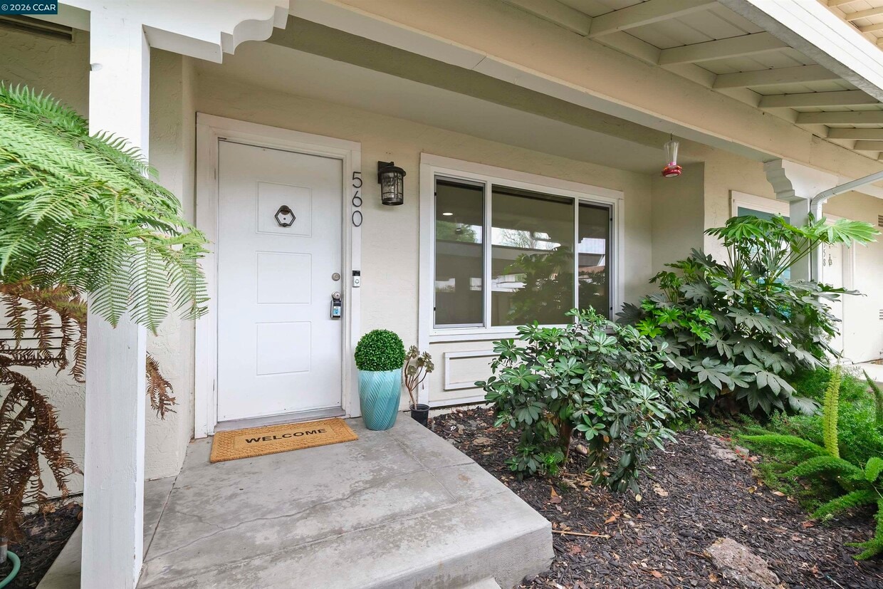
560 La Copita Ct
San Ramon, CA 94583
Favorites
925-351-6212
-
Bedrooms
3
-
Bathrooms
1.5
-
Square Feet
1,200 sq ft
-
Available
Available Now
560 La Copita Ct

Favorites
About This Home
Available Now
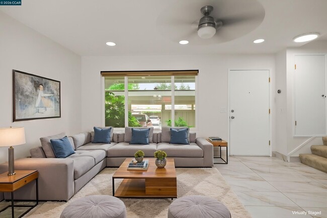
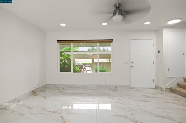
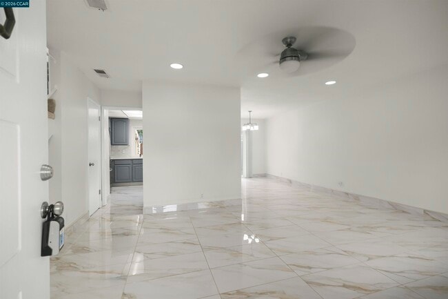
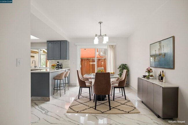
Charming North-East facing townhome ideally situated at the end of a quiet cul-de-sac in one of San Ramon’s most sought-after communities! This move-in ready home showcases bright,open living space,enhanced with oversized elegant tile flooring,upgraded baseboards,and large picture window. The modernized kitchen features quartz countertops,a full designer tile backsplash,stainless steel appliances,ample cabinetry,and a cozy dining area—perfect for everyday living and entertaining. A convenient downstairs guest bathroom and in-unit laundry add to the home’s functional appeal. Upstairs,the spacious primary suite offers mirrored closets,ceiling fan,and tranquil views of the private backyard. Two additional well-sized bedrooms provide versatility for a home office,guest rooms,or growing family needs. Step outside to a private backyard with a beautifully tiled patio—ideal for relaxing,entertaining,or enjoying peaceful outdoor moments. Additional highlights include dual pane windows,Nest smart thermostat,one assigned carport space,ample guest parking,and access to the community HOA pool. Ideally located near top-rated San Ramon schools,parks,shopping,dining,City Center Bishop Ranch,and HWY 680—this home combines comfort,convenience,and value in today's market!
560 La Copita Ct is a townhome located in Contra Costa County and the 94583 ZIP Code.
* Price shown is base rent. Excludes user-selected optional fees and variable or usage-based fees and required charges due at or prior to move-in or at move-out. Price, availability, fees, and any applicable rent special are subject to change without notice.
* Square footage definitions vary. Displayed square footage is approximate.
Contact
- Listed by Anita Ramchandani | RE/MAX Accord
- Phone Number
- Contact
-
Source
 Contra Costa Association of REALTORS®
Copyright © 2026 Bay East, CCAR, bridgeMLS. Based on information from Bay East and Contra Costa Association of REALTORS® and bridgeMLS. All data, including all measurements and calculations of area, is obtained from various sources and has not been, and will not be, verified by broker or MLS. All information should be independently reviewed and verified for accuracy. If a floor plan is included, the floor plan is for illustrative purposes only, and the actual dimensions and layout of the home may differ from the floor plan. Buyer is urged to make a detailed inspection of the property, and if any aspect of a floor plan is critical to the buyer's decision to purchase, buyer must conduct their own measurements and inspection. Properties may or may not be listed by the office/agent presenting the information.
Location
Get Directions
Sitting in the shadow of Mount Diablo along the I-680 corridor, San Ramon is an East Bay city where open space and polished urban planning coexist in a way that's hard to find anywhere else in the Bay Area. The City Center Bishop Ranch development, designed by renowned architect Renzo Piano, anchors the city's social scene with a walkable mix of restaurants, shops, and THE LOT cinema. Neighborhoods like Dougherty Valley, Twin Creeks, and the Crow Canyon area each offer their own character, from trail-adjacent living to fairway views and quiet, tree-lined streets. With more than 50 parks within city limits and the Iron Horse Regional Trail connecting key corridors, getting outside is always within reach.
The rental landscape spans well-appointed apartment communities, spacious townhomes, and multi-bedroom layouts, giving renters plenty of options across different price points.
Learn more about living in San Ramon
Education
| Colleges & Universities | Distance | ||
|---|---|---|---|
| Colleges & Universities | Distance | ||
| Drive: | 12 min | 6.2 mi | |
| Drive: | 25 min | 12.9 mi | |
| Drive: | 22 min | 14.6 mi | |
| Drive: | 28 min | 16.4 mi |
560 La Copita Ct is within 12 minutes or 6.2 miles from Diablo Valley Coll, San Ramon. It is also near Saint Marys Coll. of Calif. and Cal State East Bay.
Transportation options available in San Ramon include West Dublin/Pleasanton Station, located 6.7 miles from 560 La Copita Ct. 560 La Copita Ct is near Metro Oakland International, located 20.0 miles or 31 minutes away, and San Francisco International, located 33.9 miles or 51 minutes away.
| Transit / Subway | Distance | ||
|---|---|---|---|
| Transit / Subway | Distance | ||
|
|
Drive: | 9 min | 6.7 mi |
|
|
Drive: | 11 min | 7.8 mi |
|
|
Drive: | 18 min | 10.0 mi |
|
|
Drive: | 21 min | 11.1 mi |
|
|
Drive: | 24 min | 13.8 mi |
| Commuter Rail | Distance | ||
|---|---|---|---|
| Commuter Rail | Distance | ||
| Drive: | 15 min | 11.1 mi | |
|
|
Drive: | 23 min | 11.8 mi |
| Drive: | 23 min | 11.8 mi | |
| Drive: | 23 min | 16.1 mi | |
| Drive: | 34 min | 25.1 mi |
| Airports | Distance | ||
|---|---|---|---|
| Airports | Distance | ||
|
Metro Oakland International
|
Drive: | 31 min | 20.0 mi |
|
San Francisco International
|
Drive: | 51 min | 33.9 mi |
Getting Around
 What do Walkability, Transit, Drivability, and Bikeability mean?
Walkability measures the walking distance to day-to-day needs.
Transit measures access to public transportation.
Drivability measures congestion, parking availability, and access to major roads.
Bikeability measures the suitability for cycling.
How It Works
What do Walkability, Transit, Drivability, and Bikeability mean?
Walkability measures the walking distance to day-to-day needs.
Transit measures access to public transportation.
Drivability measures congestion, parking availability, and access to major roads.
Bikeability measures the suitability for cycling.
How It Works
Fairly Walkable
Walkability
50
/ 100
Minimal Public Transit
Transit
10
/ 100
Exceptionally Drivable
Drivability
90
/ 100
Fairly Bikeable
Bikeability
40
/ 100
Scores provided by
Active
Soundscore™
73
/ 100
Traffic
ActiveAirport
CalmBusinesses
CalmScores provided by
HowLoud What is a Sound Score Rating? A Sound Score Rating aggregates noise caused by vehicle traffic, airplane traffic and local sources. How It WorksTime and distance from 560 La Copita Ct.
| Shopping Centers | Distance | ||
|---|---|---|---|
| Shopping Centers | Distance | ||
| Walk: | 7 min | 0.4 mi | |
| Walk: | 7 min | 0.4 mi | |
| Walk: | 8 min | 0.4 mi |
560 La Copita Ct has 3 shopping centers within 0.4 mile, which is about a 8-minute walk. The miles and minutes will be for the farthest away property.
| Parks and Recreation | Distance | ||
|---|---|---|---|
| Parks and Recreation | Distance | ||
|
Bishop Ranch Regional Preserve
|
Drive: | 4 min | 1.8 mi |
|
Little Hills Picnic Ranch (By Reservation)
|
Drive: | 17 min | 5.1 mi |
|
Las Trampas Regional Wilderness
|
Drive: | 19 min | 5.6 mi |
|
Dublin Hills Regional Parks
|
Drive: | 15 min | 6.1 mi |
|
Eugene O'Neill National Historic Site
|
Drive: | 13 min | 6.7 mi |
560 La Copita Ct has 5 parks within 6.7 miles, including Bishop Ranch Regional Preserve, Little Hills Picnic Ranch (By Reservation), and Las Trampas Regional Wilderness.
| Hospitals | Distance | ||
|---|---|---|---|
| Hospitals | Distance | ||
| Drive: | 3 min | 1.4 mi | |
| Drive: | 14 min | 10.0 mi | |
| Drive: | 13 min | 10.3 mi |
560 La Copita Ct has 3 hospitals within 10.3 miles, the nearest is San Ramon Regional Medical Center which is 1.4 miles away and a 3 minute drive.
| Military Bases | Distance | ||
|---|---|---|---|
| Military Bases | Distance | ||
| Drive: | 27 min | 14.2 mi | |
| Drive: | 24 min | 17.8 mi | |
| Drive: | 30 min | 19.1 mi |
560 La Copita Ct has 3 military bases within 19.1 miles, the nearest is Air National Guard Base which is 14.2 miles away and a 27 minute drive.
You May Also Like
Similar Rentals Nearby


What Are Walk Score®, Transit Score®, and Bike Score® Ratings?
Walk Score® measures the walkability of any address. Transit Score® measures access to public transit. Bike Score® measures the bikeability of any address.
What is a Sound Score Rating?
A Sound Score Rating aggregates noise caused by vehicle traffic, airplane traffic and local sources.

560 La Copita Ct
San Ramon, CA 94583