
Forest Hill Apartments
123 Davey St,
Bloomfield, NJ 07003
$1,659 - $2,519
Studio - 2 Beds


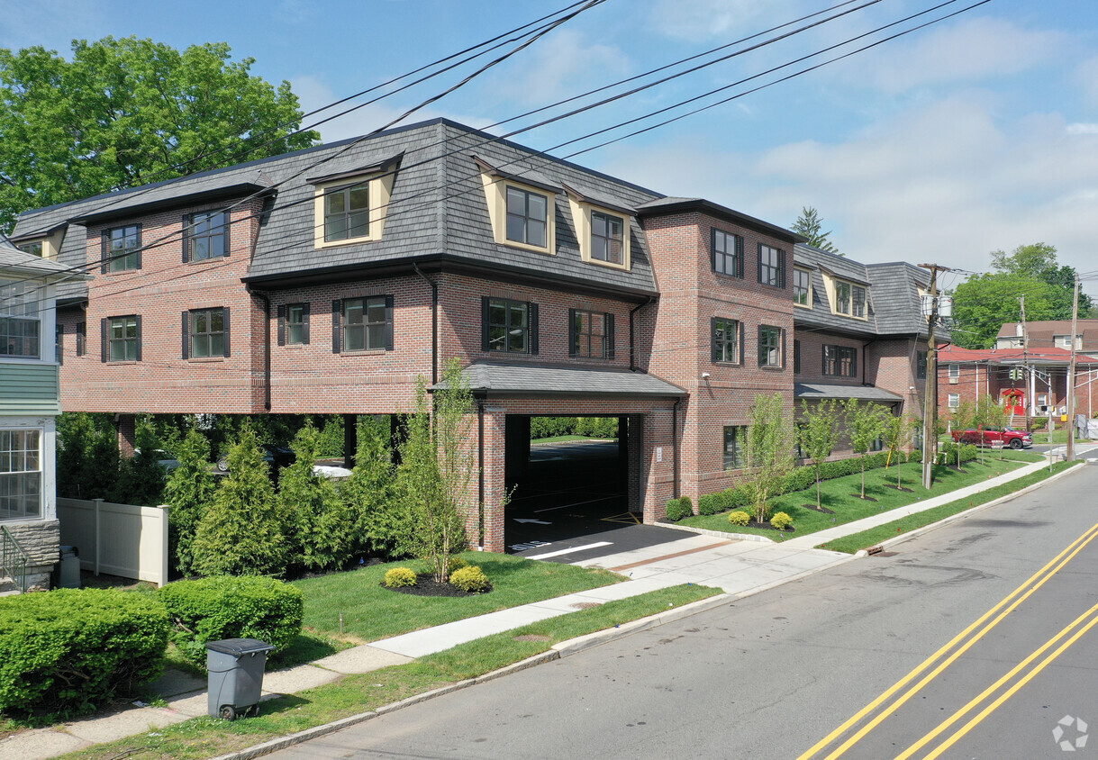
551 Centre St is a luxurious, apartment building complex in an unsurpassed location, minutes from Manhattan via Routes 3, 21, 80, rail stops and Newark Liberty Airport. This building complex offers a beautiful lobby entrance, elevators, disability access accommodations, and parking included. All units include top of the line kitchens, granite counter tops, open floor plan, large bedrooms, full size in-unit washer and dryer and walk in closets. They also feature hardwood floors throughout, its own programmable AC and heat thermostat, ample and covered parking.
551 Centre St is an apartment community located in Essex County and the 07110 ZIP Code. This area is served by the Nutley Public School District attendance zone.
Washer/Dryer
Air Conditioning
High Speed Internet Access
Hardwood Floors
Nutley, NJ sits just 15 miles from Midtown Manhattan, giving it that rare quality of feeling genuinely removed from city life while staying closely connected to one of the world's busiest economic centers. Tucked into Essex County along the Passaic River, this compact township covers only four square miles yet holds a population of nearly 30,000 residents, making it one of the more densely settled communities in the Garden State.
The township carries a strong sense of place rooted in its early-20th-century roots. Originally incorporated as Franklin Township in 1874, Nutley grew into a close-knit community with tree-lined streets and well-kept residential blocks that still define its character today. The Downtown district along Franklin Avenue anchors the social and commercial life of the area, while surrounding neighborhoods offer a quieter, more settled pace.
Learn more about living in Nutley| Colleges & Universities | Distance | ||
|---|---|---|---|
| Colleges & Universities | Distance | ||
| Drive: | 5 min | 2.5 mi | |
| Drive: | 8 min | 4.1 mi | |
| Drive: | 10 min | 4.4 mi | |
| Drive: | 10 min | 5.5 mi |


Transportation options available in Nutley include Branch Brook Park, located 3.1 miles from 551 Centre St. 551 Centre St is near Newark Liberty International, located 12.8 miles or 20 minutes away, and LaGuardia, located 22.2 miles or 41 minutes away.
| Transit / Subway | Distance | ||
|---|---|---|---|
| Transit / Subway | Distance | ||
|
|
Drive: | 6 min | 3.1 mi |
|
|
Drive: | 7 min | 3.6 mi |
|
|
Drive: | 8 min | 3.6 mi |
|
|
Drive: | 7 min | 3.6 mi |
|
|
Drive: | 8 min | 4.1 mi |
| Commuter Rail | Distance | ||
|---|---|---|---|
| Commuter Rail | Distance | ||
|
|
Drive: | 5 min | 2.8 mi |
|
|
Drive: | 6 min | 3.0 mi |
|
|
Drive: | 8 min | 3.0 mi |
|
|
Drive: | 6 min | 3.0 mi |
|
|
Drive: | 7 min | 3.5 mi |
| Airports | Distance | ||
|---|---|---|---|
| Airports | Distance | ||
|
Newark Liberty International
|
Drive: | 20 min | 12.8 mi |
|
LaGuardia
|
Drive: | 41 min | 22.2 mi |
Scores provided by
Traffic
-Airport
-Businesses
-Scores provided by
HowLoud What is a Sound Score Rating? A Sound Score Rating aggregates noise caused by vehicle traffic, airplane traffic and local sources. How It WorksTime and distance from 551 Centre St.
| Shopping Centers | Distance | ||
|---|---|---|---|
| Shopping Centers | Distance | ||
| Drive: | 5 min | 2.0 mi | |
| Drive: | 5 min | 2.4 mi | |
| Drive: | 5 min | 2.6 mi |
| Parks and Recreation | Distance | ||
|---|---|---|---|
| Parks and Recreation | Distance | ||
|
Van Vleck House & Gardens
|
Drive: | 8 min | 3.9 mi |
|
Presby Memorial Iris Gardens
|
Drive: | 9 min | 4.3 mi |
|
Branch Brook Park
|
Drive: | 10 min | 4.8 mi |
|
Richard W. DeKorte Park
|
Drive: | 13 min | 5.8 mi |
|
Meadowlands Environment Center
|
Drive: | 17 min | 7.0 mi |
| Hospitals | Distance | ||
|---|---|---|---|
| Hospitals | Distance | ||
| Drive: | 8 min | 4.3 mi | |
| Drive: | 9 min | 5.5 mi | |
| Drive: | 12 min | 5.6 mi |
| Military Bases | Distance | ||
|---|---|---|---|
| Military Bases | Distance | ||
| Drive: | 25 min | 16.6 mi | |
| Drive: | 29 min | 17.9 mi | |
| Drive: | 41 min | 24.7 mi |
What Are Walk Score®, Transit Score®, and Bike Score® Ratings?
Walk Score® measures the walkability of any address. Transit Score® measures access to public transit. Bike Score® measures the bikeability of any address.
What is a Sound Score Rating?
A Sound Score Rating aggregates noise caused by vehicle traffic, airplane traffic and local sources.
551 Centre St
Nutley, NJ 07110


