
$2,295
/ Month
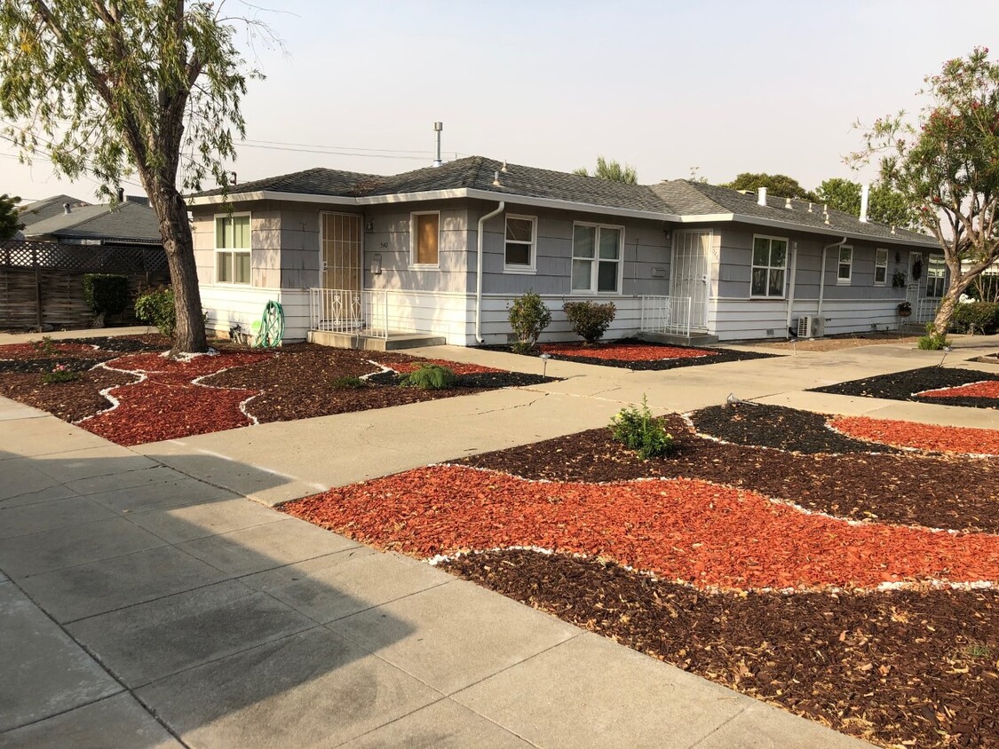
546 S P St Unit A
Livermore, CA 94550
Favorites
546 S P St Unit A

Favorites
Check Back Soon for Upcoming Availability
| Beds | Baths | Average SF |
|---|---|---|
| 1 Bedroom 1 Bedroom 1 Br | 1 Bath 1 Bath 1 Ba | 625 SF |
Fees and Policies
The fees listed below are community-provided and may exclude utilities or add-ons. All payments are made directly to the property and are non-refundable unless otherwise specified.
- Dogs Allowed
-
Fees not specified
- Cats Allowed
-
Fees not specified
About This Property
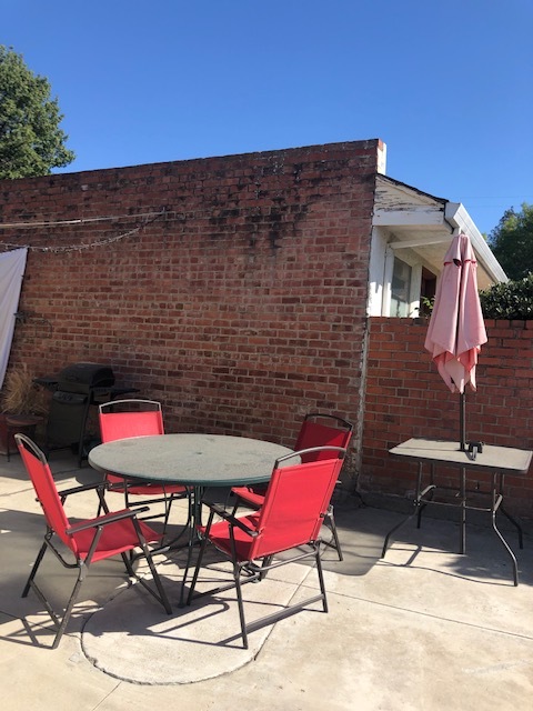
1940 Bungalow recently renovated. On the quite south side of Livermore. Take a quick walk to Starbucks, Safeway, the Vine theater or just stroll downtown. Just three blocks away from downtown Livermore. Built in the 40's this unit has the original hardwood floors (refinished), split system Heater/AC, tankless water heater, ceiling fans in the bedroom and family room. Like to cook you have a five burner gas stove and microwave. The property has new two tone paint, crown molding, and has plenty of natural light from double pane windows. Call for an appointment to view unit, do not auto reply, call for information.
546 S P St is a condo located in Alameda County and the 94550 ZIP Code.
546 S P St,
Livermore,
CA
94550
Located in California's wine country, Livermore combines scientific innovation with small-town charm. The city houses the Lawrence Livermore National Laboratory and Sandia National Laboratories, reflecting its evolution from agricultural roots. Current rental rates average $2,278 for one-bedroom apartments. The walkable downtown district along First Street features local shops and restaurants, while South Livermore Valley showcases over 40 wineries, including Wente Vineyards and Concannon Vineyard - both pioneering establishments from the 1880s that helped establish California's wine industry.
The Livermore Area Recreation and Park District maintains 1,842 acres of parks and open spaces, including Sycamore Grove Park and Robertson Park, offering trails and recreational facilities. The Mediterranean climate creates ideal conditions for outdoor activities and wine growing.
Learn more about living in LivermoreBelow are rent ranges for similar nearby apartments
Education
| Colleges & Universities | Distance | ||
|---|---|---|---|
| Colleges & Universities | Distance | ||
| Drive: | 10 min | 4.8 mi | |
| Drive: | 21 min | 13.4 mi | |
| Drive: | 22 min | 14.6 mi | |
| Drive: | 25 min | 15.1 mi |
546 S P St Unit A is within 10 minutes or 4.8 miles from Las Positas College. It is also near Diablo Valley Coll, San Ramon and San Joaquin Delta, Mtn. House.
Transportation options available in Livermore include Dublin Pleasanton Station, located 10.2 miles from 546 S P St Unit A. 546 S P St Unit A is near Metro Oakland International, located 29.0 miles or 37 minutes away, and Norman Y Mineta San Jose International, located 30.0 miles or 42 minutes away.
| Transit / Subway | Distance | ||
|---|---|---|---|
| Transit / Subway | Distance | ||
|
|
Drive: | 14 min | 10.2 mi |
|
|
Drive: | 14 min | 10.6 mi |
| Commuter Rail | Distance | ||
|---|---|---|---|
| Commuter Rail | Distance | ||
| Walk: | 18 min | 1.0 mi | |
| Drive: | 11 min | 4.9 mi | |
| Drive: | 13 min | 6.8 mi | |
| Drive: | 31 min | 19.2 mi | |
| Drive: | 32 min | 19.2 mi |
| Airports | Distance | ||
|---|---|---|---|
| Airports | Distance | ||
|
Metro Oakland International
|
Drive: | 37 min | 29.0 mi |
|
Norman Y Mineta San Jose International
|
Drive: | 42 min | 30.0 mi |
Walkability Near 546 S P St Livermore, CA 94550
Getting Around
 What do Walkability, Transit, Drivability, and Bikeability mean?
Walkability measures the walking distance to day-to-day needs.
Transit measures access to public transportation.
Drivability measures congestion, parking availability, and access to major roads.
Bikeability measures the suitability for cycling.
How It Works
What do Walkability, Transit, Drivability, and Bikeability mean?
Walkability measures the walking distance to day-to-day needs.
Transit measures access to public transportation.
Drivability measures congestion, parking availability, and access to major roads.
Bikeability measures the suitability for cycling.
How It Works
Moderately Walkable
Walkability
60
/ 100
Limited Public Transit
Transit
30
/ 100
Moderately Drivable
Drivability
70
/ 100
Moderately Bikeable
Bikeability
60
/ 100
Scores provided by
-
Soundscore™
-
/ 100
Traffic
-Airport
-Businesses
-Scores provided by
HowLoud What is a Sound Score Rating? A Sound Score Rating aggregates noise caused by vehicle traffic, airplane traffic and local sources. How It WorksTime and distance from 546 S P St Unit A.
| Shopping Centers | Distance | ||
|---|---|---|---|
| Shopping Centers | Distance | ||
| Walk: | 6 min | 0.4 mi | |
| Walk: | 7 min | 0.4 mi | |
| Walk: | 7 min | 0.4 mi |
546 S P St Unit A has 3 shopping centers within 0.4 mile, which is about a 7-minute walk. The miles and minutes will be for the farthest away property.
| Parks and Recreation | Distance | ||
|---|---|---|---|
| Parks and Recreation | Distance | ||
|
Shadow Cliffs Regional Recreation Area
|
Drive: | 9 min | 4.4 mi |
|
Brushy Peak Regional Preserve
|
Drive: | 15 min | 7.4 mi |
|
Del Valle Regional Park
|
Drive: | 25 min | 8.6 mi |
|
Los Vaqueros Watershed
|
Drive: | 16 min | 8.8 mi |
|
Carnegie State Vehicle Recreation Area
|
Drive: | 21 min | 11.8 mi |
546 S P St Unit A has 5 parks within 11.8 miles, including Shadow Cliffs Regional Recreation Area, Brushy Peak Regional Preserve, and Del Valle Regional Park.
| Hospitals | Distance | ||
|---|---|---|---|
| Hospitals | Distance | ||
| Drive: | 12 min | 7.0 mi |
546 S P St Unit A is 7.0 miles and a 12 minute drive from Stanford Health Care - ValleyCare.
| Military Bases | Distance | ||
|---|---|---|---|
| Military Bases | Distance | ||
| Drive: | 47 min | 32.8 mi | |
| Drive: | 60 min | 38.3 mi | |
| Drive: | 59 min | 44.7 mi |
546 S P St Unit A has 3 military bases within 44.7 miles, the nearest is Ames Research Center which is 32.8 miles away and a 47 minute drive.
You May Also Like
Similar Rentals Nearby


What Are Walk Score®, Transit Score®, and Bike Score® Ratings?
Walk Score® measures the walkability of any address. Transit Score® measures access to public transit. Bike Score® measures the bikeability of any address.
What is a Sound Score Rating?
A Sound Score Rating aggregates noise caused by vehicle traffic, airplane traffic and local sources.

546 S P St
Livermore, CA 94550