
$1,595
/ Month
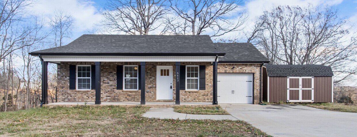
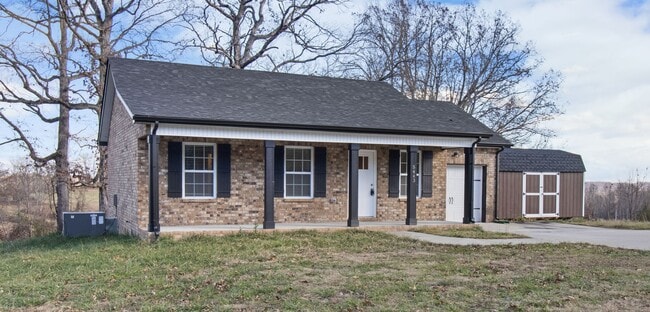
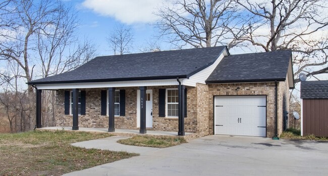
5443 State Hwy 48
Cumberland Furnace, TN 37051
2 Weeks Ago
|
Edit
Favorites
5443 State Hwy 48

Favorites
Check Back Soon for Upcoming Availability
| Beds | Baths | Average SF |
|---|---|---|
| 3 Bedrooms 3 Bedrooms 3 Br | 2 Baths 2 Baths 2 Ba | 1,176 SF |
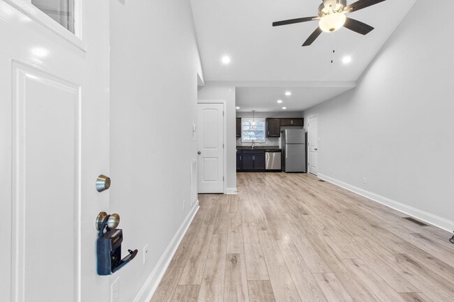
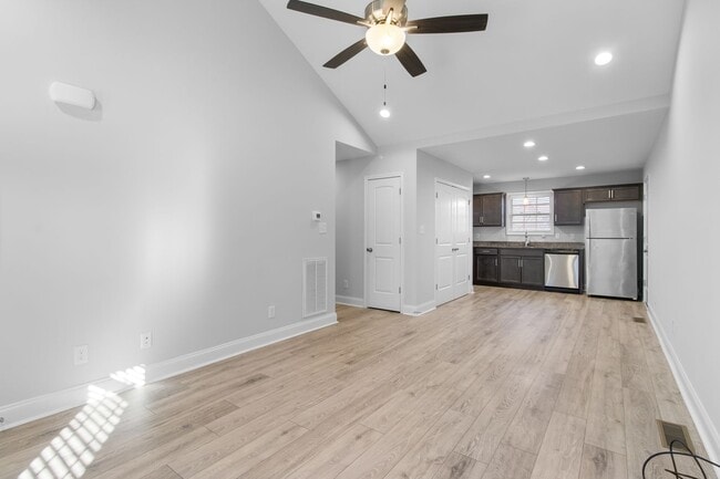
About This Property
This beautiful home is located directly off the highway and is situated only a short drive from Clarksville, Charlotte, and Dickson areas. It has a very functional 3 bedroom/2 bath layout as well as a large garage and outdoor storage shed. Give us a call to get your application in today!
5443 State Hwy 48 is a house located in Montgomery County and the 37051 ZIP Code. This area is served by the Dickson County School District attendance zone.
House Features
- Dishwasher
5443 State Hwy 48,
Cumberland Furnace,
TN
37051
Amenities
- Dishwasher
Education
| Colleges & Universities | Distance | ||
|---|---|---|---|
| Colleges & Universities | Distance | ||
| Drive: | 22 min | 13.9 mi | |
| Drive: | 71 min | 49.8 mi | |
| Drive: | 73 min | 52.2 mi | |
| Drive: | 73 min | 52.3 mi |
5443 State Hwy 48 is within 22 minutes or 13.9 miles from Austin Peay State University. It is also near Tennessee State University and Meharry Medical College.
Schools


Public Elementary School
Grades PK-5
267 Students
Attendance Zone
Public Middle School
Grades 6-8
436 Students
Attendance Zone
Public High School
Grades 9-12
933 Students
Attendance Zone
Private Elementary, Middle & High School
Grades PK-12
86 Students
Nearby
Private Elementary, Middle & High School
Grades K-12
Nearby
Private Elementary & Middle School
Grades K-8
3 Students
Nearby
School data provided by
 The GreatSchools Rating helps parents compare schools within a state based on a variety of school quality indicators and provides a helpful picture of how effectively each school serves all of its students. Ratings are on a scale of 1 (below average) to 10 (above average) and can include test scores, college readiness, academic progress, advanced courses, equity, discipline and attendance data. We also advise parents to visit schools, consider other information on school performance and programs, and consider family needs as part of the school selection process.
View GreatSchools Rating Methodology
Data provided by GreatSchools.org © 2026. All rights reserved.
View GreatSchools Rating Methodology
Data provided by GreatSchools.org © 2026. All rights reserved.
Walkability Near 5443 State Hwy 48 Cumberland Furnace, TN 37051
Getting Around
 What do Walkability, Transit, Drivability, and Bikeability mean?
Walkability measures the walking distance to day-to-day needs.
Transit measures access to public transportation.
Drivability measures congestion, parking availability, and access to major roads.
Bikeability measures the suitability for cycling.
How It Works
What do Walkability, Transit, Drivability, and Bikeability mean?
Walkability measures the walking distance to day-to-day needs.
Transit measures access to public transportation.
Drivability measures congestion, parking availability, and access to major roads.
Bikeability measures the suitability for cycling.
How It Works
Not Walkable
Walkability
10
/ 100
Exceptionally Drivable
Drivability
100
/ 100
Not Bikeable
Bikeability
10
/ 100
Scores provided by
-
Soundscore™
-
/ 100
Traffic
-Airport
-Businesses
-Scores provided by
HowLoud What is a Sound Score Rating? A Sound Score Rating aggregates noise caused by vehicle traffic, airplane traffic and local sources. How It WorksYou May Also Like
Similar Rentals Nearby
-
-
-

-

-
-

-

-

-

-
 3 Beds$1,850Total Monthly PriceTotal Monthly Price NewPrices include all required monthly fees.House for Rent


What Are Walk Score®, Transit Score®, and Bike Score® Ratings?
Walk Score® measures the walkability of any address. Transit Score® measures access to public transit. Bike Score® measures the bikeability of any address.
What is a Sound Score Rating?
A Sound Score Rating aggregates noise caused by vehicle traffic, airplane traffic and local sources.

5443 State Hwy 48
Cumberland Furnace, TN 37051