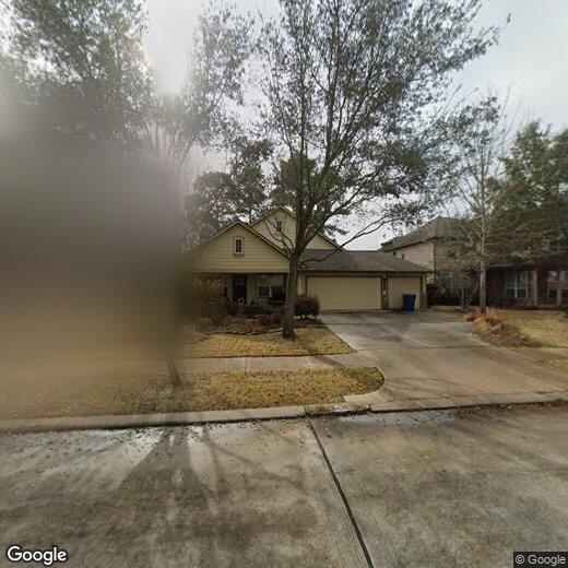
5435 Chelsea Fair Ln
5435 Chelsea Fair Ln
Spring, TX 77379
Favorites
5435 Chelsea Fair Ln

Favorites
Check Back Soon for Upcoming Availability
5435 Chelsea Fair Ln,
Spring,
TX
77379
Located in the northern Houston metropolitan area, Spring, Texas combines small-town atmosphere with suburban convenience. The community of 62,000 residents features Old Town Spring, where locally-owned shops, restaurants, and art galleries occupy historic buildings dating to the late 1800s. Since the 1970s, Spring has grown to include both established neighborhoods and newer planned communities. Current rental rates range from $1,291 for one-bedroom units to $2,789 for four-bedroom homes.
Spring offers abundant outdoor recreation and entertainment options. Southwell Park and Pundt Park provide green spaces for residents, with Pundt Park featuring water access to Spring Creek Greenway. The area is home to Hurricane Harbor SplashTown water park and the 300-acre Mercer Arboretum and Botanic Gardens. The ExxonMobil campus, which opened in 2014, employs approximately 9,000 people.
Learn more about living in Spring
Education
| Colleges & Universities | Distance | ||
|---|---|---|---|
| Colleges & Universities | Distance | ||
| Drive: | 23 min | 14.6 mi | |
| Drive: | 37 min | 22.9 mi | |
| Drive: | 43 min | 25.7 mi | |
| Drive: | 40 min | 26.0 mi |
5435 Chelsea Fair Ln is within 23 minutes or 14.6 miles from Lone Star College. It is also near Univ. of Houston, Downtown and University of St Thomas.
Walkability Near 5435 Chelsea Fair Ln Spring, TX 77379
Getting Around
 What do Walkability, Transit, Drivability, and Bikeability mean?
Walkability measures the walking distance to day-to-day needs.
Transit measures access to public transportation.
Drivability measures congestion, parking availability, and access to major roads.
Bikeability measures the suitability for cycling.
How It Works
What do Walkability, Transit, Drivability, and Bikeability mean?
Walkability measures the walking distance to day-to-day needs.
Transit measures access to public transportation.
Drivability measures congestion, parking availability, and access to major roads.
Bikeability measures the suitability for cycling.
How It Works
Fairly Walkable
Walkability
50
/ 100
Very Drivable
Drivability
80
/ 100
Fairly Bikeable
Bikeability
50
/ 100
Scores provided by
-
Soundscore™
-
/ 100
Traffic
-Airport
-Businesses
-Scores provided by
HowLoud What is a Sound Score Rating? A Sound Score Rating aggregates noise caused by vehicle traffic, airplane traffic and local sources. How It WorksYou May Also Like
Similar Rentals Nearby
-
-
3 Beds$2,097+4 Beds$2,296+Total Monthly PriceTotal Monthly Price NewPrices include base rent and required monthly fees. Variable costs based on usage may apply.2 Months Free
Pets Allowed Fitness Center Pool
-
-
1 Bed$1,647+2 Beds$2,219+3 Beds$2,300+Total Monthly PriceTotal Monthly Price NewPrices include base rent and required monthly fees. Variable costs based on usage may apply.
Pets Allowed Pool Dishwasher Refrigerator Kitchen In Unit Washer & Dryer
-
-
-
1 Bed$1,743+2 Beds$1,743+3 Beds$2,455+Total Monthly Price14 Month LeaseTotal Monthly Price NewPrices include required monthly fees of $165.Base Rent:1 Bed$1,578+2 Beds$1,578+3 Beds$2,290+1 Month Free
Pets Allowed Fitness Center Pool In Unit Washer & Dryer Maintenance on site High-Speed Internet Stainless Steel Appliances
-
-
-


What Are Walk Score®, Transit Score®, and Bike Score® Ratings?
Walk Score® measures the walkability of any address. Transit Score® measures access to public transit. Bike Score® measures the bikeability of any address.
What is a Sound Score Rating?
A Sound Score Rating aggregates noise caused by vehicle traffic, airplane traffic and local sources.