
10 Halletts Point
10, 20, 30 Halletts Pt,
Astoria, NY 11102
$3,300 - $6,971
Studio - 2 Beds

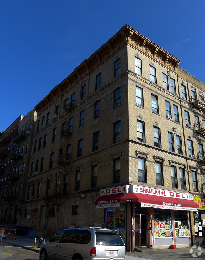
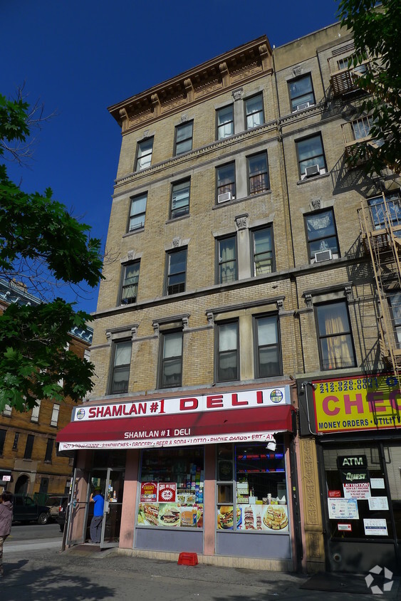
Find your new home at 537 Malcolm X Blvd in New York, NY. This property is situated in the Strivers Row area of New York. The leasing team is eager to show you our community. Select from 1 to 3 bedroom apartments. Give us a call now to schedule your tour.
537 Malcolm X Blvd is an apartment community located in New York County and the 10037 ZIP Code. This area is served by the New York City Geographic District # 5 attendance zone.
There's a reason New York City has been the backdrop of countless films, novels, and lifelong ambitions; it simply does things at a scale and intensity that no other place in the country matches. Spread across five distinct boroughs — Manhattan, Brooklyn, Queens, the Bronx, and Staten Island — NYC offers wildly different ways to experience daily life depending on where you plant your roots. Whether you're drawn to the electric pace of Midtown, the tree-lined streets of Park Slope, or the arts-forward energy of Astoria, each corner of the city carries its own character and cadence.
The rental landscape here is as varied as the city itself. Sleek high-rise apartment communities with floor-to-ceiling skyline views define much of Midtown and the Financial District, while pre-war lofts and historic brownstones dominate neighborhoods like SoHo, the West Village, and Park Slope.
Learn more about living in New YorkCompare neighborhood and city base rent averages by bedroom.
| Striver's Row | New York, NY | |
|---|---|---|
| Studio | $1,624 | $3,373 |
| 1 Bedroom | $1,679 | $4,148 |
| 2 Bedrooms | $2,321 | $5,707 |
| 3 Bedrooms | $1,441 | $7,179 |
| Colleges & Universities | Distance | ||
|---|---|---|---|
| Colleges & Universities | Distance | ||
| Drive: | 3 min | 1.1 mi | |
| Drive: | 4 min | 1.3 mi | |
| Drive: | 5 min | 1.8 mi | |
| Drive: | 6 min | 1.9 mi |


Transportation options available in New York include 135 Street (2,3 Line), located 0.1 mile from 537 Malcolm X Blvd. 537 Malcolm X Blvd is near LaGuardia, located 7.2 miles or 17 minutes away, and Newark Liberty International, located 23.4 miles or 29 minutes away.
| Transit / Subway | Distance | ||
|---|---|---|---|
| Transit / Subway | Distance | ||
|
|
Walk: | 2 min | 0.1 mi |
|
|
Walk: | 7 min | 0.4 mi |
|
|
Walk: | 9 min | 0.5 mi |
|
|
Walk: | 14 min | 0.7 mi |
|
|
Drive: | 4 min | 1.2 mi |
| Commuter Rail | Distance | ||
|---|---|---|---|
| Commuter Rail | Distance | ||
|
|
Drive: | 4 min | 1.4 mi |
|
|
Drive: | 5 min | 1.9 mi |
|
|
Drive: | 8 min | 2.8 mi |
| Drive: | 9 min | 3.1 mi | |
|
|
Drive: | 11 min | 3.8 mi |
| Airports | Distance | ||
|---|---|---|---|
| Airports | Distance | ||
|
LaGuardia
|
Drive: | 17 min | 7.2 mi |
|
Newark Liberty International
|
Drive: | 29 min | 23.4 mi |
Scores provided by
Traffic
-Airport
-Businesses
-Scores provided by
HowLoud What is a Sound Score Rating? A Sound Score Rating aggregates noise caused by vehicle traffic, airplane traffic and local sources. How It WorksTime and distance from 537 Malcolm X Blvd.
| Shopping Centers | Distance | ||
|---|---|---|---|
| Shopping Centers | Distance | ||
| Walk: | 18 min | 0.9 mi | |
| Drive: | 5 min | 1.5 mi | |
| Drive: | 6 min | 1.9 mi |
| Parks and Recreation | Distance | ||
|---|---|---|---|
| Parks and Recreation | Distance | ||
|
St. Nicholas Park
|
Walk: | 11 min | 0.6 mi |
|
Jackie Robinson Park
|
Walk: | 20 min | 1.0 mi |
|
Marcus Garvey Park
|
Drive: | 3 min | 1.2 mi |
|
Northern Manhattan Parks
|
Drive: | 4 min | 1.4 mi |
|
Mill Pond Park
|
Drive: | 6 min | 1.6 mi |
| Hospitals | Distance | ||
|---|---|---|---|
| Hospitals | Distance | ||
| Walk: | 1 min | 0.1 mi | |
| Drive: | 4 min | 1.4 mi | |
| Drive: | 6 min | 2.4 mi |
| Military Bases | Distance | ||
|---|---|---|---|
| Military Bases | Distance | ||
| Drive: | 24 min | 12.4 mi | |
| Drive: | 26 min | 12.8 mi | |
| Drive: | 36 min | 18.4 mi |
What Are Walk Score®, Transit Score®, and Bike Score® Ratings?
Walk Score® measures the walkability of any address. Transit Score® measures access to public transit. Bike Score® measures the bikeability of any address.
What is a Sound Score Rating?
A Sound Score Rating aggregates noise caused by vehicle traffic, airplane traffic and local sources.
537 Malcolm X Blvd
New York, NY 10037


