
$2,400
/ Month
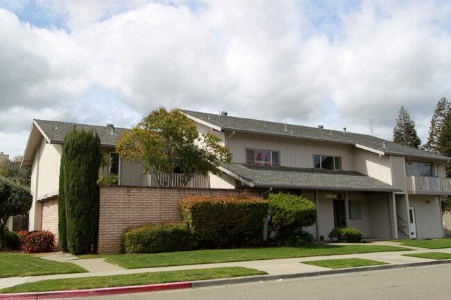
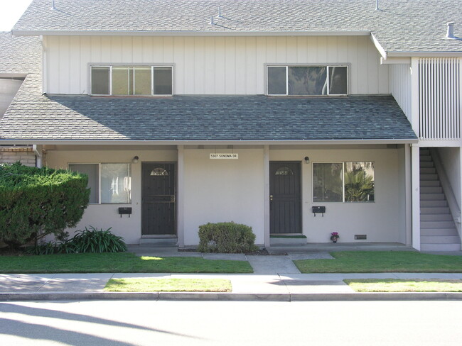
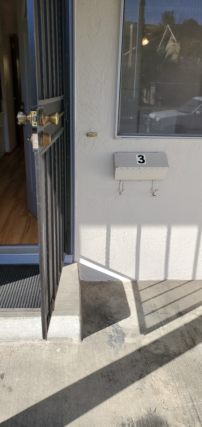
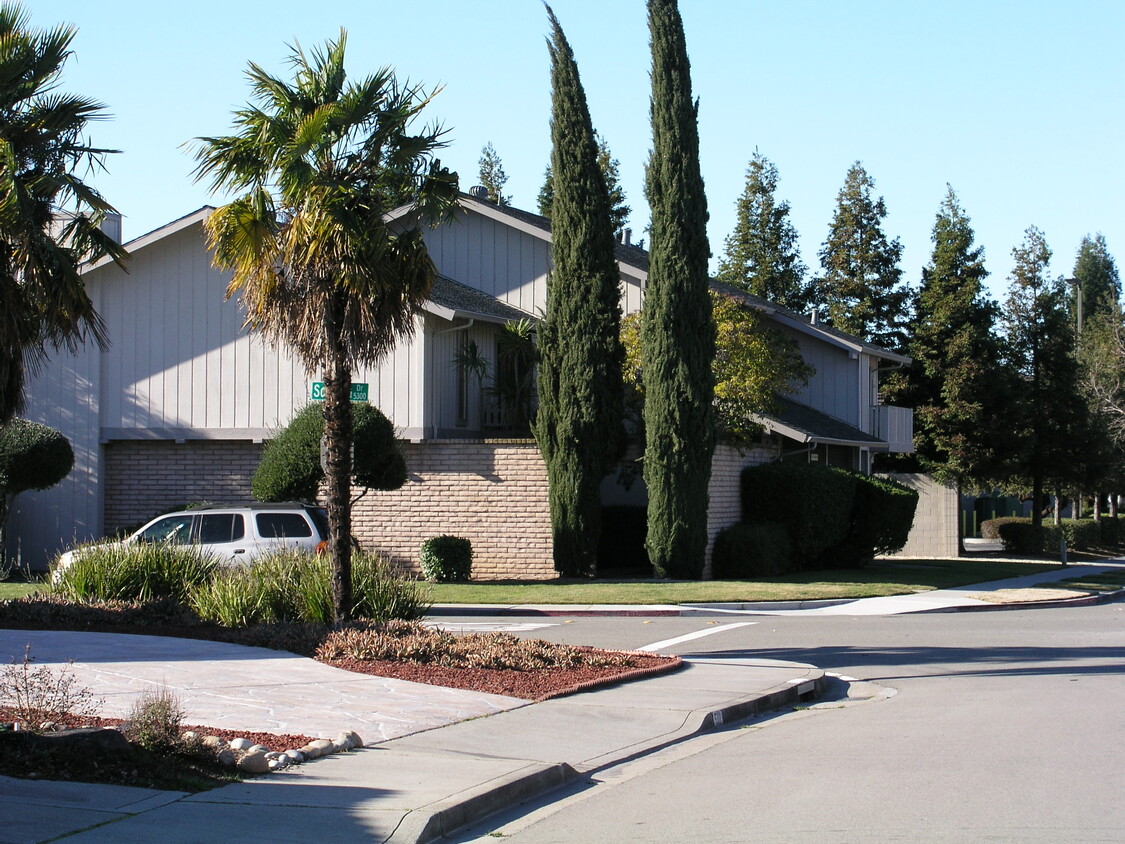
5307 Sonoma Dr Unit 3
Pleasanton, CA 94566
2 Weeks Ago
|
Edit
Favorites
5307 Sonoma Dr Unit 3

Favorites
Check Back Soon for Upcoming Availability
| Beds | Baths | Average SF |
|---|---|---|
| 2 Bedrooms 2 Bedrooms 2 Br | 1.5 Baths 1.5 Baths 1.5 Ba | 1,000 SF |
Fees and Policies
The fees below are based on community-supplied data and may exclude additional fees and utilities.
- Parking
-
Covered--
Details
Utilities Included
-
Trash Removal
Property Information
-
4 units
About This Property
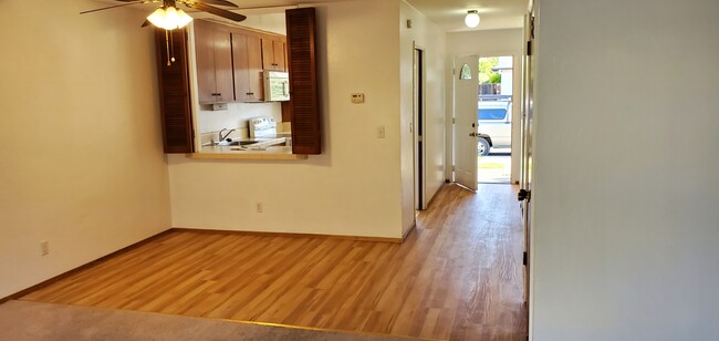
2 Bedroom 1 1/2 Bath unit in a desirable Neighborhood, near Parks, Pleasanton Fair Grounds, Downtown Main Street Shopping like Restaurants & Coffee Shops, Safeway Stores, Unit is located behind Raley's Shopping Center. Plenty of Street parking . Award winning schools . Quarter mile from the Hwy 680 corridor towards San Jose/ Fremont. Please do not Disturb Tenants. Owner pays Garbage. Refrigerator stays. {No Smoking / No Pets.} Must have Good Credit. Applications run through a Tenant Screening Service.
5307 Sonoma Dr is an apartment community located in Alameda County and the 94566 ZIP Code.
Apartment Features
Air Conditioning
Dishwasher
Microwave
Refrigerator
- Air Conditioning
- Heating
- Ceiling Fans
- Smoke Free
- Cable Ready
- Security System
- Tub/Shower
- Sprinkler System
- Dishwasher
- Disposal
- Ice Maker
- Microwave
- Oven
- Range
- Refrigerator
- Laundry Facilities
- Balcony
- Patio
- Porch
- Yard
- Lawn
Location
Get Directions
Pleasanton, California sits in the heart of the Tri-Valley region, where the average rent for a one-bedroom apartment is $2,534. The city's downtown district preserves its historic character with independent shops and a weekly farmers' market that draws visitors from across the region. Pleasanton Ridge Regional Park stretches along the western edge of the city, while the Alameda County Fairgrounds anchors the community's event calendar. Studio apartments have seen a 10.1% increase in rent, while two-bedroom units average $3,022 monthly.
The city houses both Amador Valley High School and Foothill High School, which consistently rank among California's academic leaders. Major employers in the area include the corporate headquarters of Workday, Safeway, and Veeva Systems. Shadow Cliffs Regional Park provides opportunities for swimming, fishing, and boating. The area's history stretches to the 1850s, when it was known as Alisal and earned notoriety as a Gold Rush-era haven for outlaws.
Learn more about living in Pleasanton
Amenities
- Air Conditioning
- Heating
- Ceiling Fans
- Smoke Free
- Cable Ready
- Security System
- Tub/Shower
- Sprinkler System
- Dishwasher
- Disposal
- Ice Maker
- Microwave
- Oven
- Range
- Refrigerator
- Laundry Facilities
- Balcony
- Patio
- Porch
- Yard
- Lawn
Expenses
Utilities Included
Trash Removal
Included
Education
| Colleges & Universities | Distance | ||
|---|---|---|---|
| Colleges & Universities | Distance | ||
| Drive: | 17 min | 8.4 mi | |
| Drive: | 18 min | 8.9 mi | |
| Drive: | 17 min | 11.0 mi | |
| Drive: | 28 min | 17.7 mi |
5307 Sonoma Dr Unit 3 is within 18 minutes or 8.9 miles from Diablo Valley Coll, San Ramon. It is also near Las Positas College and Ohlone College, Fremont Campus.
Transportation options available in Pleasanton include West Dublin/Pleasanton Station, located 5.6 miles from 5307 Sonoma Dr Unit 3. 5307 Sonoma Dr Unit 3 is near Metro Oakland International, located 24.1 miles or 32 minutes away, and Norman Y Mineta San Jose International, located 25.9 miles or 34 minutes away.
| Transit / Subway | Distance | ||
|---|---|---|---|
| Transit / Subway | Distance | ||
|
|
Drive: | 9 min | 5.6 mi |
|
|
Drive: | 10 min | 6.3 mi |
|
|
Drive: | 21 min | 13.3 mi |
|
|
Drive: | 21 min | 13.4 mi |
|
|
Drive: | 27 min | 15.2 mi |
| Commuter Rail | Distance | ||
|---|---|---|---|
| Commuter Rail | Distance | ||
| Walk: | 20 min | 1.0 mi | |
| Drive: | 3 min | 1.1 mi | |
| Drive: | 13 min | 7.1 mi | |
| Drive: | 14 min | 7.3 mi | |
| Drive: | 20 min | 10.5 mi |
| Airports | Distance | ||
|---|---|---|---|
| Airports | Distance | ||
|
Metro Oakland International
|
Drive: | 32 min | 24.1 mi |
|
Norman Y Mineta San Jose International
|
Drive: | 34 min | 25.9 mi |
Time and distance from 5307 Sonoma Dr Unit 3.
| Shopping Centers | Distance | ||
|---|---|---|---|
| Shopping Centers | Distance | ||
| Walk: | 3 min | 0.2 mi | |
| Walk: | 20 min | 1.1 mi | |
| Drive: | 3 min | 1.2 mi |
5307 Sonoma Dr Unit 3 has 3 shopping centers within 1.2 miles, which is about a 3-minute walk. The miles and minutes will be for the farthest away property.
| Parks and Recreation | Distance | ||
|---|---|---|---|
| Parks and Recreation | Distance | ||
|
Shadow Cliffs Regional Recreation Area
|
Drive: | 8 min | 3.0 mi |
|
Dublin Hills Regional Parks
|
Drive: | 19 min | 8.5 mi |
|
Niles Canyon Railway
|
Drive: | 21 min | 12.3 mi |
|
Pleasanton Ridge Regional Park
|
Drive: | 23 min | 14.7 mi |
|
Garin/Dry Creek Pioneer Parks
|
Drive: | 27 min | 15.7 mi |
5307 Sonoma Dr Unit 3 has 5 parks within 15.7 miles, including Shadow Cliffs Regional Recreation Area, Dublin Hills Regional Parks, and Pleasanton Ridge Regional Park.
| Hospitals | Distance | ||
|---|---|---|---|
| Hospitals | Distance | ||
| Drive: | 8 min | 3.2 mi | |
| Drive: | 18 min | 12.2 mi | |
| Drive: | 21 min | 13.7 mi |
5307 Sonoma Dr Unit 3 has 3 hospitals within 13.7 miles, the nearest is Stanford Health Care - ValleyCare which is 3.2 miles away and a 8 minute drive.
| Military Bases | Distance | ||
|---|---|---|---|
| Military Bases | Distance | ||
| Drive: | 39 min | 28.6 mi |
5307 Sonoma Dr Unit 3 is 28.6 miles and a 39 minute drive from Ames Research Center.
You May Also Like
Similar Rentals Nearby


What Are Walk Score®, Transit Score®, and Bike Score® Ratings?
Walk Score® measures the walkability of any address. Transit Score® measures access to public transit. Bike Score® measures the bikeability of any address.
What is a Sound Score Rating?
A Sound Score Rating aggregates noise caused by vehicle traffic, airplane traffic and local sources
5307 Sonoma Dr
Pleasanton, CA 94566