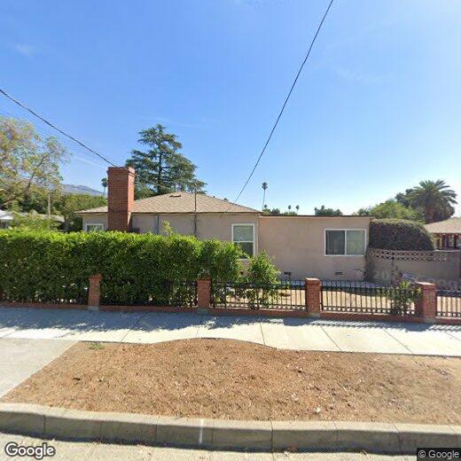

530 W Montana St
530 W Montana St
Pasadena, CA 91103
2 Weeks Ago
Favorites
530 W Montana St

Favorites
Check Back Soon for Upcoming Availability
Location
Get Directions
Nestled in the foothills of the San Gabriel Mountains, the city of Pasadena sits about ten miles northeast of Downtown Los Angeles. Known as the City of Roses, Pasadena hosts the annual Rose Parade, where a variety of floats covered in flowers file through the streets. And to add to the rose theme, Pasadena is also home to Rose Bowl Stadium, which hosts a yearly championship college football game in addition to a monthly flea market.
As a resident of Pasadena, you’ll live near the California Institute of Technology and where Albert Einstein lived while he taught at the university. You can tour NASA’s Jet Propulsion Laboratory, view the vast collection of art at the Norton Simon Museum, and enjoy the festivities at the whimsical Doo Dah Parade. Historic sites are a major attraction in Pasadena.
Learn more about living in Pasadena
Education
| Colleges & Universities | Distance | ||
|---|---|---|---|
| Colleges & Universities | Distance | ||
| Drive: | 9 min | 3.1 mi | |
| Drive: | 8 min | 3.8 mi | |
| Drive: | 9 min | 5.2 mi | |
| Drive: | 11 min | 5.4 mi |
530 W Montana St is within 9 minutes or 3.1 miles from Art Center College of Design. It is also near Fuller Theological Seminary and Pasadena City College.
Transportation options available in Pasadena include Memorial Park Station, located 3.3 miles from 530 W Montana St. 530 W Montana St is near Bob Hope, located 16.2 miles or 25 minutes away, and Los Angeles International, located 27.1 miles or 43 minutes away.
| Transit / Subway | Distance | ||
|---|---|---|---|
| Transit / Subway | Distance | ||
|
|
Drive: | 7 min | 3.3 mi |
|
|
Drive: | 7 min | 3.6 mi |
|
|
Drive: | 6 min | 3.9 mi |
|
|
Drive: | 8 min | 4.2 mi |
|
|
Drive: | 7 min | 4.9 mi |
| Commuter Rail | Distance | ||
|---|---|---|---|
| Commuter Rail | Distance | ||
|
|
Drive: | 16 min | 10.9 mi |
|
|
Drive: | 20 min | 12.1 mi |
|
|
Drive: | 22 min | 12.1 mi |
|
|
Drive: | 18 min | 13.0 mi |
| Drive: | 24 min | 16.2 mi |
| Airports | Distance | ||
|---|---|---|---|
| Airports | Distance | ||
|
Bob Hope
|
Drive: | 25 min | 16.2 mi |
|
Los Angeles International
|
Drive: | 43 min | 27.1 mi |
Time and distance from 530 W Montana St.
| Shopping Centers | Distance | ||
|---|---|---|---|
| Shopping Centers | Distance | ||
| Walk: | 6 min | 0.3 mi | |
| Walk: | 9 min | 0.5 mi | |
| Drive: | 3 min | 1.3 mi |
530 W Montana St has 3 shopping centers within 1.3 miles, which is about a 3-minute walk. The miles and minutes will be for the farthest away property.
| Parks and Recreation | Distance | ||
|---|---|---|---|
| Parks and Recreation | Distance | ||
|
Jet Propulsion Laboratory
|
Walk: | 20 min | 1.0 mi |
|
Kidspace Children's Museum
|
Drive: | 6 min | 2.3 mi |
|
Descanso Gardens
|
Drive: | 9 min | 4.5 mi |
|
Eaton Canyon Nature Center
|
Drive: | 11 min | 5.2 mi |
|
Huntington Botanical Gardens
|
Drive: | 13 min | 6.5 mi |
530 W Montana St has 5 parks within 6.5 miles, including Jet Propulsion Laboratory, Kidspace Children's Museum, and Descanso Gardens.
| Hospitals | Distance | ||
|---|---|---|---|
| Hospitals | Distance | ||
| Drive: | 6 min | 3.8 mi | |
| Drive: | 8 min | 4.5 mi | |
| Drive: | 12 min | 7.5 mi |
530 W Montana St has 3 hospitals within 7.5 miles, the nearest is Huntington Memorial Hospital which is 3.8 miles away and a 6 minute drive.
| Military Bases | Distance | ||
|---|---|---|---|
| Military Bases | Distance | ||
| Drive: | 40 min | 28.7 mi | |
| Drive: | 50 min | 32.3 mi |
530 W Montana St is 28.7 miles from Los Angeles Air Force Base, and is convenient to other military bases, including Los Alamitos Army Airfield.
You May Also Like
Similar Rentals Nearby


What Are Walk Score®, Transit Score®, and Bike Score® Ratings?
Walk Score® measures the walkability of any address. Transit Score® measures access to public transit. Bike Score® measures the bikeability of any address.
What is a Sound Score Rating?
A Sound Score Rating aggregates noise caused by vehicle traffic, airplane traffic and local sources