
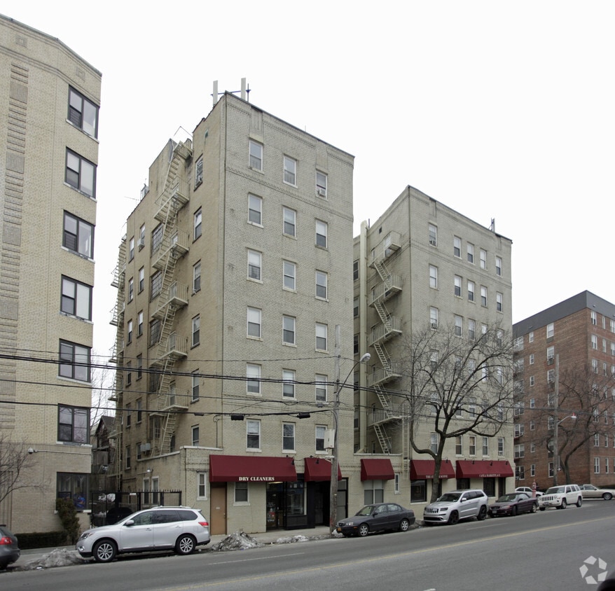
The Station Apartments
5959 Broadway,
Bronx, NY 10463
$1,750 - $2,300
Studio - 1 Bed
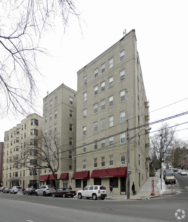
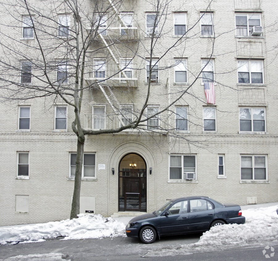
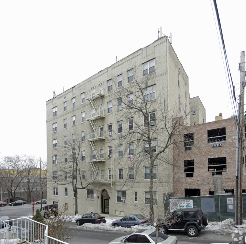

At 530 E 236th in Bronx, NY, you've discovered your new place. In a location on E. 236th in Bronx's 10470 Zip code, local residents can easily connect with a number of nearby points of interest. Come for a visit to check out the current floorplan options. The leasing staff will assist you in finding the perfect apartment. Contact us or drop by to find out the availability today and find your new home at 530 E 236th.
530 E 236th is an apartment community located in Bronx County and the 10470 ZIP Code. This area is served by the New York City Geographic District #11 attendance zone.
Nestled at the northern tip of the Bronx, Woodlawn Heights disrupts a square of green space occupied by Van Cortlandt Park and the historic Woodlawn Cemetery. As one of New York’s most famous residential areas, Woodlawn Heights provides easy access to the city and surrounding areas by bus and subway. The neighborhood features a boot-like shape, with 233rd Street forming the southern edge. Katonah Avenue runs north-south through the center of the neighborhood, serving as Woodlawn Heights’ major thoroughfare, and is lined with local restaurants, bars, and shops. Woodlawn Heights is very walkable with excellent public transit options. The rent average is lower in the neighborhood than it is in the Bronx as a whole, making it a great place for renters to find their next home.
Learn more about living in Woodlawn HeightsCompare neighborhood and city base rent averages by bedroom.
| Woodlawn Heights | Bronx, NY | |
|---|---|---|
| Studio | $1,156 | $1,612 |
| 1 Bedroom | $1,528 | $1,633 |
| 2 Bedrooms | $1,890 | $2,094 |
| 3 Bedrooms | - | $2,352 |
| Colleges & Universities | Distance | ||
|---|---|---|---|
| Colleges & Universities | Distance | ||
| Drive: | 7 min | 2.9 mi | |
| Drive: | 6 min | 3.2 mi | |
| Drive: | 6 min | 3.3 mi | |
| Drive: | 7 min | 3.5 mi |


Transportation options available in Bronx include 233 Street, located 0.6 mile from 530 E 236th. 530 E 236th is near LaGuardia, located 13.4 miles or 24 minutes away, and Westchester County, located 19.0 miles or 29 minutes away.
| Transit / Subway | Distance | ||
|---|---|---|---|
| Transit / Subway | Distance | ||
|
|
Walk: | 11 min | 0.6 mi |
|
|
Walk: | 11 min | 0.6 mi |
|
|
Walk: | 19 min | 1.0 mi |
|
|
Walk: | 19 min | 1.0 mi |
|
|
Drive: | 4 min | 1.3 mi |
| Commuter Rail | Distance | ||
|---|---|---|---|
| Commuter Rail | Distance | ||
|
|
Walk: | 11 min | 0.6 mi |
|
|
Drive: | 2 min | 1.5 mi |
|
|
Drive: | 3 min | 1.5 mi |
|
|
Drive: | 4 min | 2.0 mi |
|
|
Drive: | 4 min | 2.4 mi |
| Airports | Distance | ||
|---|---|---|---|
| Airports | Distance | ||
|
LaGuardia
|
Drive: | 24 min | 13.4 mi |
|
Westchester County
|
Drive: | 29 min | 19.0 mi |
Scores provided by
Traffic
-Airport
-Businesses
-Scores provided by
HowLoud What is a Sound Score Rating? A Sound Score Rating aggregates noise caused by vehicle traffic, airplane traffic and local sources. How It WorksTime and distance from 530 E 236th.
| Shopping Centers | Distance | ||
|---|---|---|---|
| Shopping Centers | Distance | ||
| Drive: | 3 min | 1.3 mi | |
| Drive: | 4 min | 2.3 mi | |
| Drive: | 4 min | 2.4 mi |
| Parks and Recreation | Distance | ||
|---|---|---|---|
| Parks and Recreation | Distance | ||
|
Seton Falls Park
|
Drive: | 3 min | 1.6 mi |
|
Williamsbridge Oval
|
Drive: | 4 min | 2.0 mi |
|
Van Cortlandt Park
|
Drive: | 5 min | 3.3 mi |
|
New York Botanical Garden
|
Drive: | 10 min | 4.2 mi |
|
Wave Hill
|
Drive: | 9 min | 4.3 mi |
| Hospitals | Distance | ||
|---|---|---|---|
| Hospitals | Distance | ||
| Drive: | 4 min | 2.0 mi | |
| Drive: | 4 min | 2.0 mi | |
| Drive: | 8 min | 3.7 mi |
| Military Bases | Distance | ||
|---|---|---|---|
| Military Bases | Distance | ||
| Drive: | 21 min | 11.8 mi | |
| Drive: | 36 min | 20.0 mi | |
| Drive: | 42 min | 27.5 mi |
What Are Walk Score®, Transit Score®, and Bike Score® Ratings?
Walk Score® measures the walkability of any address. Transit Score® measures access to public transit. Bike Score® measures the bikeability of any address.
What is a Sound Score Rating?
A Sound Score Rating aggregates noise caused by vehicle traffic, airplane traffic and local sources.


