
$1,700
/ Month
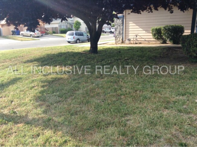
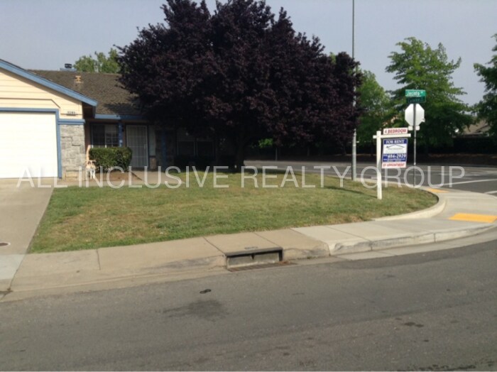
5285 Jacinto Ave
Sacramento, CA 95823
Favorites
5285 Jacinto Ave

Favorites
Check Back Soon for Upcoming Availability
| Beds | Baths | Average SF |
|---|---|---|
| 4 Bedrooms 4 Bedrooms 4 Br | 2 Baths 2 Baths 2 Ba | 1,568 SF |
About This Property
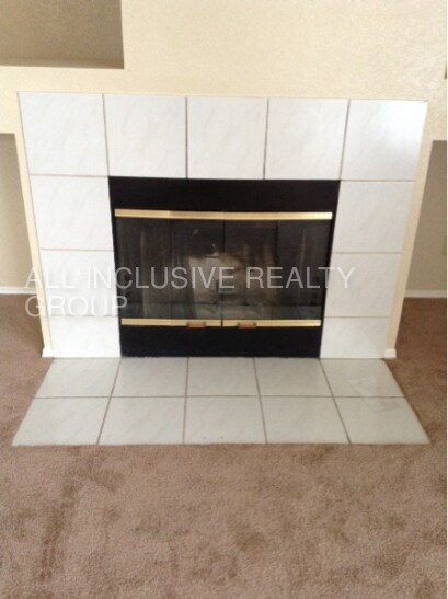
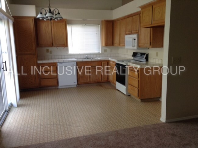
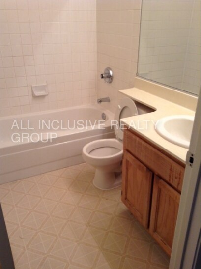
Clean and Bright Family home on corner lot. Spacious, well maintained 4-bedroom, 2 baths Home in Laguna Franklin. Close to Schools, and Shopping. Easy access to Calvine Rd. This lovely home has Carpet throughout, large kitchen, with tile counter-tops, dishwasher, and Gas Range. Two car garage, and laundry hookups. Enjoy the large back yard with minimal maintenance, great for Family gatherings. Sprinkler system for front and back yards, and as a bonus, a security system. Tenant responsible for $175.00 monthly, for Water Sewer Trash. This property allows self guided viewing without an appointment. Contact for details.
5285 Jacinto Ave is a house located in Sacramento County and the 95823 ZIP Code. This area is served by the Elk Grove Unified School District attendance zone.
5285 Jacinto Ave,
Sacramento,
CA
95823
The Valley Hi/North Laguna neighborhood lies less than 15 miles south of Sacramento, with all its cultural, recreational, and shopping facilities. The nearby South Sacramento Freeway affords access to travel throughout California, while Sacramento International Airport sits a 30-minute drive away.
Residents living in popular apartment blocks in the east of the area around Jacinto Avenue and Calvine Road enjoy easy access to the United Artists Laguna Village 12 multiplex theater with its surrounding cluster of restaurants. Visit Fire Wings for an amazing variety of chicken wings with Cajun fries, and Pho Le for Vietnamese cuisine.
For everyday shopping, travel north towards Sacramento where Mack Road hosts a choice of two Asian supermarkets, SF Supermarket and Seafood City, and the Presto Food and Deli. Additionally, Laguna Crossroads, located a few miles south, contains popular national chains.
Learn more about living in Valley Hi/North LagunaBelow are rent ranges for similar nearby apartments
Education
| Colleges & Universities | Distance | ||
|---|---|---|---|
| Colleges & Universities | Distance | ||
| Drive: | 6 min | 1.9 mi | |
| Drive: | 15 min | 7.6 mi | |
| Drive: | 20 min | 10.4 mi | |
| Drive: | 30 min | 20.0 mi |
5285 Jacinto Ave is within 6 minutes or 1.9 miles from Cosumnes River College. It is also near Sacramento City College and Sacramento State.
Schools


Public Elementary & Middle School
Grades K-8
297 Students
Nearby
Public Elementary School
Grades K-5
572 Students
Attendance Zone
Public Middle School
Grades 6-8
909 Students
Attendance Zone
Public High School
Grades 9-12
1,622 Students
Attendance Zone
Private Elementary & Middle School
Grades K-8
169 Students
Nearby
Private Elementary, Middle & High School
Grades K-12
Nearby
Private Elementary School
Grades K-5
Nearby
School data provided by
 The GreatSchools Rating helps parents compare schools within a state based on a variety of school quality indicators and provides a helpful picture of how effectively each school serves all of its students. Ratings are on a scale of 1 (below average) to 10 (above average) and can include test scores, college readiness, academic progress, advanced courses, equity, discipline and attendance data. We also advise parents to visit schools, consider other information on school performance and programs, and consider family needs as part of the school selection process.
View GreatSchools Rating Methodology
Data provided by GreatSchools.org © 2026. All rights reserved.
View GreatSchools Rating Methodology
Data provided by GreatSchools.org © 2026. All rights reserved.
Transportation options available in Sacramento include Franklin Station (Wb), located 1.5 miles from 5285 Jacinto Ave. 5285 Jacinto Ave is near Sacramento International, located 23.4 miles or 33 minutes away.
| Transit / Subway | Distance | ||
|---|---|---|---|
| Transit / Subway | Distance | ||
| Drive: | 4 min | 1.5 mi | |
| Drive: | 4 min | 1.5 mi | |
| Drive: | 4 min | 1.8 mi | |
| Drive: | 4 min | 1.9 mi | |
| Drive: | 11 min | 2.1 mi |
| Commuter Rail | Distance | ||
|---|---|---|---|
| Commuter Rail | Distance | ||
| Drive: | 19 min | 13.1 mi | |
| Drive: | 34 min | 24.8 mi | |
|
|
Drive: | 35 min | 26.3 mi |
|
|
Drive: | 39 min | 28.6 mi |
|
|
Drive: | 40 min | 30.7 mi |
| Airports | Distance | ||
|---|---|---|---|
| Airports | Distance | ||
|
Sacramento International
|
Drive: | 33 min | 23.4 mi |
Walkability Near 5285 Jacinto Ave Sacramento, CA 95823
Getting Around
 What do Walkability, Transit, Drivability, and Bikeability mean?
Walkability measures the walking distance to day-to-day needs.
Transit measures access to public transportation.
Drivability measures congestion, parking availability, and access to major roads.
Bikeability measures the suitability for cycling.
How It Works
What do Walkability, Transit, Drivability, and Bikeability mean?
Walkability measures the walking distance to day-to-day needs.
Transit measures access to public transportation.
Drivability measures congestion, parking availability, and access to major roads.
Bikeability measures the suitability for cycling.
How It Works
Fairly Walkable
Walkability
40
/ 100
Minimal Public Transit
Transit
10
/ 100
Exceptionally Drivable
Drivability
90
/ 100
Moderately Bikeable
Bikeability
60
/ 100
Scores provided by
-
Soundscore™
-
/ 100
Traffic
-Airport
-Businesses
-Scores provided by
HowLoud What is a Sound Score Rating? A Sound Score Rating aggregates noise caused by vehicle traffic, airplane traffic and local sources. How It WorksTime and distance from 5285 Jacinto Ave.
| Shopping Centers | Distance | ||
|---|---|---|---|
| Shopping Centers | Distance | ||
| Drive: | 3 min | 1.6 mi | |
| Drive: | 5 min | 2.0 mi | |
| Drive: | 4 min | 2.1 mi |
5285 Jacinto Ave has 3 shopping centers within 2.1 miles, which is about a 4-minute drive. The miles and minutes will be for the farthest away property.
| Parks and Recreation | Distance | ||
|---|---|---|---|
| Parks and Recreation | Distance | ||
|
Stone Lakes National Wildlife Refuge
|
Drive: | 14 min | 7.7 mi |
|
Sacramento Zoo
|
Drive: | 16 min | 10.2 mi |
|
Paradise Beach County Recreation Area
|
Drive: | 19 min | 10.3 mi |
|
Sutter's Fort State Historical Monument
|
Drive: | 16 min | 10.4 mi |
|
California Native Plant Demonstration Garden
|
Drive: | 18 min | 10.9 mi |
5285 Jacinto Ave has 5 parks within 10.9 miles, including Stone Lakes National Wildlife Refuge, Sacramento Zoo, and Sutter's Fort State Historical Monument.
| Hospitals | Distance | ||
|---|---|---|---|
| Hospitals | Distance | ||
| Drive: | 5 min | 2.4 mi | |
| Drive: | 5 min | 2.5 mi | |
| Drive: | 6 min | 2.7 mi |
5285 Jacinto Ave has 3 hospitals within 2.7 miles, the nearest is Methodist Hospital of Sacramento which is 2.4 miles away and a 5 minute drive.
| Military Bases | Distance | ||
|---|---|---|---|
| Military Bases | Distance | ||
| Drive: | 37 min | 20.9 mi | |
| Drive: | 60 min | 45.2 mi | |
| Drive: | 68 min | 50.7 mi |
5285 Jacinto Ave has 3 military bases within 50.7 miles, the nearest is McClellan Air Force Base which is 20.9 miles away and a 37 minute drive.
You May Also Like
Similar Rentals Nearby


What Are Walk Score®, Transit Score®, and Bike Score® Ratings?
Walk Score® measures the walkability of any address. Transit Score® measures access to public transit. Bike Score® measures the bikeability of any address.
What is a Sound Score Rating?
A Sound Score Rating aggregates noise caused by vehicle traffic, airplane traffic and local sources.
5285 Jacinto Ave
Sacramento, CA 95823