
5236 N Lycee Cir
5236 N Lycee Cir
Bel Aire, KS 67226
Today
Favorites
316-619-2816
-
Bedrooms
4
-
Bathrooms
3
-
Square Feet
--
-
Available
Available Now
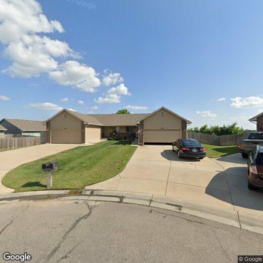
5236 N Lycee Cir

Favorites
5236 N Lycee Cir is a townhome located in Sedgwick County and the 67226 ZIP Code. This area is served by the Wichita attendance zone.
* Price shown is base rent and may not include non-optional fees and utilities.
Price, availability, fees, and any applicable rent special are subject to change without notice.
* Square footage definitions vary. Displayed square footage is approximate.
Townhome Features
- Dishwasher
Contact
- Listed by RKR LLC | RKR LLC
- Phone Number
- Contact
Location
Get Directions
Amenities
- Dishwasher
Northeast Wichita is situated just 10 miles outside of downtown, and provides a tranquil setting for those who enjoy the culture and excitement of the city, but want more space and relaxation in their daily lives. There’s a wide variety of homes and apartments in the area, particularly in and around Bel Aire.
Parks and country clubs contribute to the overall peaceful atmosphere, while shopping centers like Greenwich Place and Bradley Fair house a variety of restaurants and shops. Northeast Wichita residents enjoy short commutes to anywhere in the Wichita area, but may find it hard to leave the serenity of this charming suburb.
Learn more about living in Northeast Wichita
Education
| Colleges & Universities | Distance | ||
|---|---|---|---|
| Colleges & Universities | Distance | ||
| Drive: | 13 min | 7.9 mi | |
| Drive: | 23 min | 16.2 mi | |
| Drive: | 23 min | 16.6 mi | |
| Drive: | 27 min | 22.6 mi |
5236 N Lycee Cir is within 13 minutes or 7.9 miles from Wichita State University. It is also near Friends University and Newman University.
Schools


Public Elementary School
Grades PK-5
626 Students
Attendance Zone
Public Elementary, Middle & High School
181 Students
Attendance Zone
Public Middle School
Grades 6-8
585 Students
Attendance Zone
Public High School
Grades 9-12
1,292 Students
Attendance Zone
Private Elementary & Middle School
Grades PK-8
255 Students
Nearby
Private Elementary, Middle & High School
Grades PK-12
543 Students
Nearby
School data provided by
 The GreatSchools Rating helps parents compare schools within a state based on a variety of school quality indicators and provides a helpful picture of how effectively each school serves all of its students. Ratings are on a scale of 1 (below average) to 10 (above average) and can include test scores, college readiness, academic progress, advanced courses, equity, discipline and attendance data. We also advise parents to visit schools, consider other information on school performance and programs, and consider family needs as part of the school selection process.
View GreatSchools Rating Methodology
Data provided by GreatSchools.org © 2025. All rights reserved.
View GreatSchools Rating Methodology
Data provided by GreatSchools.org © 2025. All rights reserved.
You May Also Like
Similar Rentals Nearby


What Are Walk Score®, Transit Score®, and Bike Score® Ratings?
Walk Score® measures the walkability of any address. Transit Score® measures access to public transit. Bike Score® measures the bikeability of any address.
What is a Sound Score Rating?
A Sound Score Rating aggregates noise caused by vehicle traffic, airplane traffic and local sources

5236 N Lycee Cir
Bel Aire, KS 67226