

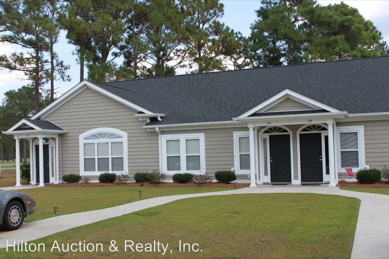
$675
/ Month
52 Teal Rd
Elizabethtown, NC 28337
2 Weeks Ago
|
Edit
Favorites
52 Teal Rd

Favorites
Check Back Soon for Upcoming Availability
| Beds | Baths | Average SF |
|---|---|---|
| 2 Bedrooms 2 Bedrooms 2 Br | 2 Baths 2 Baths 2 Ba | — |
About This Property
(910) 874-2324 - - (RLNE3916168)
52 Teal Rd is a house located in Bladen County and the 28337 ZIP Code. This area is served by the Bladen County School District attendance zone.
52 Teal Rd,
Elizabethtown,
NC
28337
Elizabethtown is a quaint Bladen County town set amongst the countryside of North Carolina. A friendly atmosphere coupled with a laidback vibe and popular locally owned businesses make Elizabethtown perfect for families. There’s a great number of diverse and affordable rentals in and around the town center, itself full of restaurant and retail options.
Elizabethtown also make for quick access to outdoor areas like Bladen Lakes State Forest and kid-friendly attraction like White Lake Water Park. Many residents commute to work in surrounding cities via U.S. Highway 701.
Learn more about living in Elizabethtown
Education
Schools


Public Elementary & Middle School
Grades K-8
320 Students
Attendance Zone
Public Elementary School
Grades PK-5
503 Students
Attendance Zone
Public High School
Grades 9-12
545 Students
Attendance Zone
Private Elementary & Middle School
Grades PK-8
60 Students
Nearby
Private Elementary, Middle & High School
Grades K-12
398 Students
Nearby
Private Elementary, Middle & High School
Grades PK-12
37 Students
Nearby
Private Elementary School
Grades K-5
91 Students
Nearby
School data provided by
 The GreatSchools Rating helps parents compare schools within a state based on a variety of school quality indicators and provides a helpful picture of how effectively each school serves all of its students. Ratings are on a scale of 1 (below average) to 10 (above average) and can include test scores, college readiness, academic progress, advanced courses, equity, discipline and attendance data. We also advise parents to visit schools, consider other information on school performance and programs, and consider family needs as part of the school selection process.
View GreatSchools Rating Methodology
Data provided by GreatSchools.org © 2026. All rights reserved.
View GreatSchools Rating Methodology
Data provided by GreatSchools.org © 2026. All rights reserved.
Walkability Near 52 Teal Rd Elizabethtown, NC 28337
Getting Around
 What do Walkability, Transit, Drivability, and Bikeability mean?
Walkability measures the walking distance to day-to-day needs.
Transit measures access to public transportation.
Drivability measures congestion, parking availability, and access to major roads.
Bikeability measures the suitability for cycling.
How It Works
What do Walkability, Transit, Drivability, and Bikeability mean?
Walkability measures the walking distance to day-to-day needs.
Transit measures access to public transportation.
Drivability measures congestion, parking availability, and access to major roads.
Bikeability measures the suitability for cycling.
How It Works
Not Walkable
Walkability
10
/ 100
Exceptionally Drivable
Drivability
100
/ 100
Not Bikeable
Bikeability
0
/ 100
Scores provided by
-
Soundscore™
-
/ 100
Traffic
-Airport
-Businesses
-Scores provided by
HowLoud What is a Sound Score Rating? A Sound Score Rating aggregates noise caused by vehicle traffic, airplane traffic and local sources. How It WorksSimilar Rentals Nearby


What Are Walk Score®, Transit Score®, and Bike Score® Ratings?
Walk Score® measures the walkability of any address. Transit Score® measures access to public transit. Bike Score® measures the bikeability of any address.
What is a Sound Score Rating?
A Sound Score Rating aggregates noise caused by vehicle traffic, airplane traffic and local sources.
52 Teal Rd
Elizabethtown, NC 28337