

$2,200 / Month
52 High St
Weymouth, MA 02189
2 Weeks Ago
Favorites
52 High St

Favorites
Check Back Soon for Upcoming Availability
| Beds | Baths | Average SF |
|---|---|---|
| 3 Bedrooms 3 Bedrooms 3 Br | 1 Bath 1 Bath 1 Ba | — |
About This Property
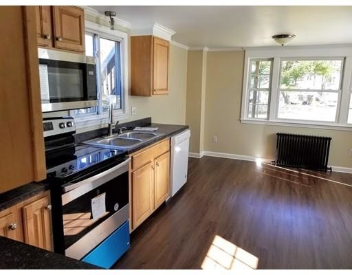
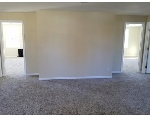
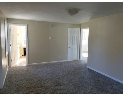
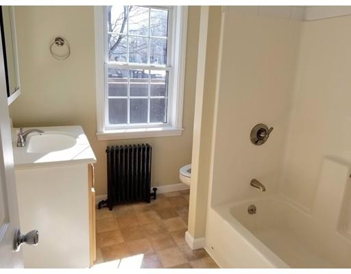
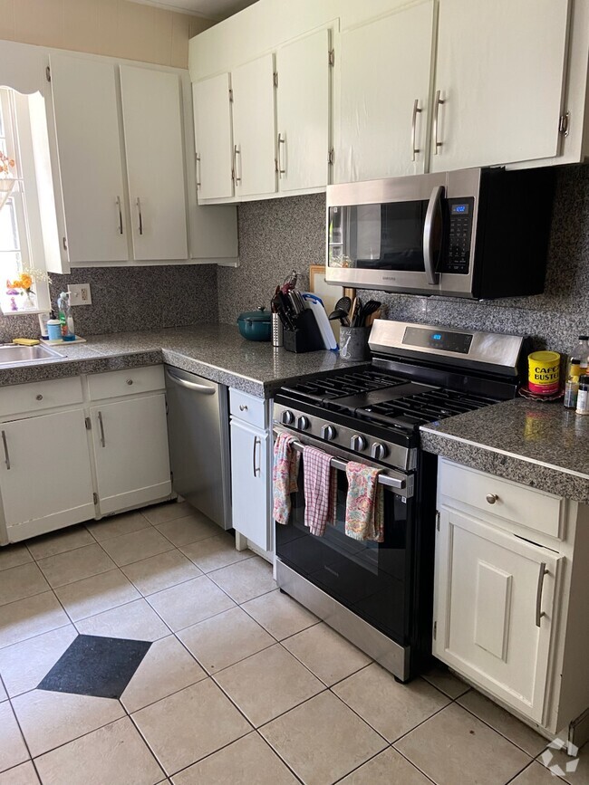
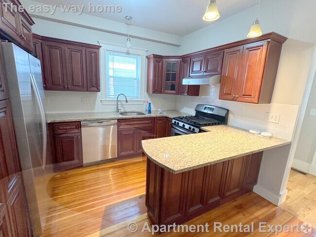
VERY NICE! Newly Renovated 3 bedroom apartment on the Hingham line. Short walk to the Commuter Rail. Close to shopping , schools etc... First floor unit with large rooms, updated kitchen with granite counters. Laundry in unit. Large Fenced in Yard, Off Street Parking. Must have good credit and work history.
52 High St is a townhome located in Norfolk County and the 02189 ZIP Code. This area is served by the Weymouth attendance zone.
Location
Get Directions
Nestled on the coast of the Massachusetts Bay, South Shore contains many beaches, wooded green spaces, and modern conveniences.
Locals prefer to shop for fresh produce at the Weir River Farm Market, which is just a short drive from World’s End Park. This park has amazing views of the Boston skyline and miles of scenic trails.
The South Shore’s wooded areas provide residents a natural setting near historic harbor sites and Rexhame Beach. Hatherly Country Club calls this neighborhood home, and residents can commute with ease thanks to an abundance of Massachusetts Bay Transit Authority train stations. South Shore is about one hour from Boston-Logan International Airport.
Learn more about living in South ShoreBelow are rent ranges for similar nearby apartments
Education
| Colleges & Universities | Distance | ||
|---|---|---|---|
| Colleges & Universities | Distance | ||
| Drive: | 22 min | 11.2 mi | |
| Drive: | 22 min | 12.0 mi | |
| Drive: | 23 min | 13.6 mi | |
| Drive: | 27 min | 14.7 mi |
52 High St is within 22 minutes or 11.2 miles from Massasoit C.C., Canton Campus. It is also near Massasoit C.C., Brockton and Curry College.
Schools


Public Elementary School
Grades PK-5
500 Students
Nearby
Public Elementary & Middle School
Grades 5-8
1,195 Students
Attendance Zone
Public Elementary School
Grades K-5
258 Students
Attendance Zone
Public Middle School
Grades 6-7
784 Students
Attendance Zone
Public High School
Grades 9-12
1,807 Students
Attendance Zone
Private Elementary, Middle & High School
Grades PK-12
274 Students
Nearby
Private Elementary & Middle School
Grades PK-8
146 Students
Nearby
School data provided by
 The GreatSchools Rating helps parents compare schools within a state based on a variety of school quality indicators and provides a helpful picture of how effectively each school serves all of its students. Ratings are on a scale of 1 (below average) to 10 (above average) and can include test scores, college readiness, academic progress, advanced courses, equity, discipline and attendance data. We also advise parents to visit schools, consider other information on school performance and programs, and consider family needs as part of the school selection process.
View GreatSchools Rating Methodology
View GreatSchools Rating Methodology
Transportation options available in Weymouth include Braintree Station, located 5.1 miles from 52 High St. 52 High St is near General Edward Lawrence Logan International, located 18.9 miles or 31 minutes away.
| Transit / Subway | Distance | ||
|---|---|---|---|
| Transit / Subway | Distance | ||
|
|
Drive: | 10 min | 5.1 mi |
|
|
Drive: | 12 min | 5.7 mi |
|
|
Drive: | 14 min | 7.4 mi |
|
|
Drive: | 17 min | 8.4 mi |
|
|
Drive: | 19 min | 10.2 mi |
| Commuter Rail | Distance | ||
|---|---|---|---|
| Commuter Rail | Distance | ||
|
|
Walk: | 7 min | 0.4 mi |
|
|
Drive: | 4 min | 2.0 mi |
| Drive: | 5 min | 2.8 mi | |
|
|
Drive: | 8 min | 4.3 mi |
|
|
Drive: | 9 min | 4.8 mi |
| Airports | Distance | ||
|---|---|---|---|
| Airports | Distance | ||
|
General Edward Lawrence Logan International
|
Drive: | 31 min | 18.9 mi |
Time and distance from 52 High St.
| Shopping Centers | Distance | ||
|---|---|---|---|
| Shopping Centers | Distance | ||
| Drive: | 3 min | 1.5 mi | |
| Drive: | 4 min | 2.0 mi | |
| Drive: | 4 min | 2.1 mi |
52 High St has 3 shopping centers within 2.1 miles, which is about a 4-minute drive. The miles and minutes will be for the farthest away property.
| Parks and Recreation | Distance | ||
|---|---|---|---|
| Parks and Recreation | Distance | ||
|
Wompatuck State Park
|
Drive: | 15 min | 4.5 mi |
|
Webb Memorial State Park
|
Drive: | 9 min | 4.5 mi |
|
Weir River Farm
|
Drive: | 11 min | 5.0 mi |
|
Adams National Historical Park
|
Drive: | 13 min | 6.7 mi |
|
South Shore Natural Science Center
|
Drive: | 12 min | 6.9 mi |
52 High St has 5 parks within 6.9 miles, including Webb Memorial State Park, Wompatuck State Park, and Weir River Farm.
| Hospitals | Distance | ||
|---|---|---|---|
| Hospitals | Distance | ||
| Drive: | 7 min | 3.8 mi | |
| Drive: | 19 min | 10.1 mi | |
| Drive: | 19 min | 10.3 mi |
52 High St has 3 hospitals within 10.3 miles, the nearest is South Shore Hospital which is 3.8 miles away and a 7 minute drive.
You May Also Like
Similar Rentals Nearby


What Are Walk Score®, Transit Score®, and Bike Score® Ratings?
Walk Score® measures the walkability of any address. Transit Score® measures access to public transit. Bike Score® measures the bikeability of any address.
What is a Sound Score Rating?
A Sound Score Rating aggregates noise caused by vehicle traffic, airplane traffic and local sources
52 High St
Weymouth, MA 02189