

$1,500
/ Month
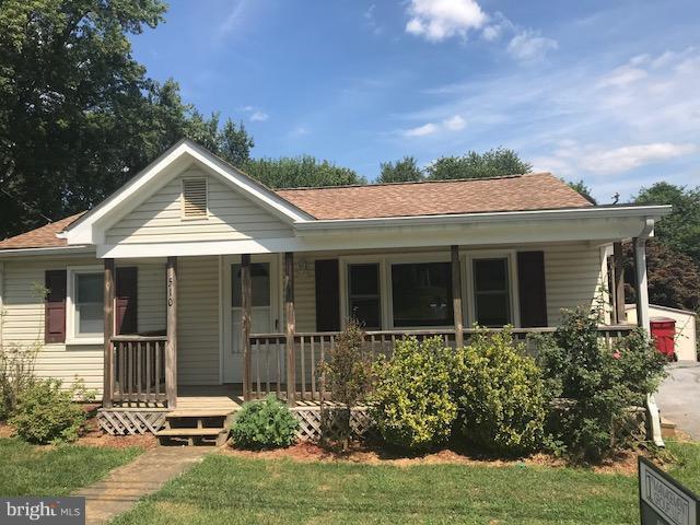
510 Burns St
Ranson, WV 25438
Today
|
Edit
Favorites
304-886-1618
-
Bedrooms
2
-
Bathrooms
1
-
Square Feet
--
-
Available
Available Now
510 Burns St

Favorites
About This Home
$1,500 deposit,
Available Now
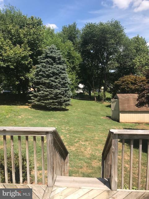
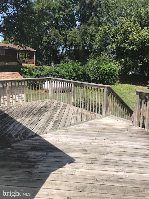
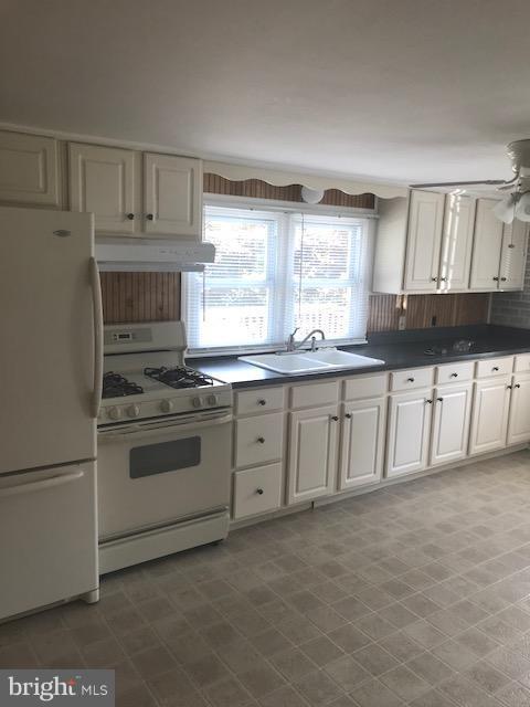
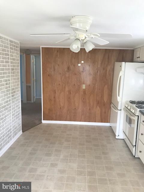
Charming 2 bedroom, 1 bath rancher on Burns St in Ranson. Spacious front and back porches, large back yard, storage shed and unfinished basement. Close to shopping in both downtown Ranson and Charles Town. No Pets, no smoking. Please contact property manager directly Detached 2 Br home on large fenced lot with unfinished basement
510 Burns St is a house located in Jefferson County and the 25438 ZIP Code. This area is served by the Jefferson County Schools attendance zone.
* Price shown is base rent. Excludes user-selected optional fees and variable or usage-based fees and required charges due at or prior to move-in or at move-out. Price, availability, fees, and any applicable rent special are subject to change without notice.
* Square footage definitions vary. Displayed square footage is approximate.
Fees and Policies
The fees listed below are community-provided and may exclude utilities or add-ons. All payments are made directly to the property and are non-refundable unless otherwise specified. Use the Cost Calculator to determine costs based on your needs.
-
One-Time Basics
-
Due at Move-In
-
Security Deposit - RefundableCharged per unit.$1,500
-
-
Due at Move-In
Property Fee Disclaimer: Based on community-supplied data and independent market research. Subject to change without notice. May exclude fees for mandatory or optional services and usage-based utilities.
Contact
- Listed by Ethan Williams
- Phone Number
- Contact
Location
Get Directions
Located on the Eastern Panhandle of West Virginia, Ranson exudes small-town charm with access to metropolitan amenities. About an hour’s drive from Washington, DC, Ranson is convenient to urban luxuries as well as the many recreational opportunities at nearby natural wonders like the Blue Ridge Mountains and the Shenandoah River.
Ranson shares a rich regional history with the surrounding area, situated within minutes of Harpers Ferry National Historical Park, Antietam National Battlefield, and Shepherdstown. A bevy of special events brings the community together in Ranson, including the annual Ranson Festival, Car Show, and Tree Lighting ceremony. Easy access to U.S. 340, Route 9, and Washington-Dulles International Airport makes getting around from Ranson simple.
Learn more about living in Ranson
Education
| Colleges & Universities | Distance | ||
|---|---|---|---|
| Colleges & Universities | Distance | ||
| Drive: | 21 min | 13.2 mi | |
| Drive: | 37 min | 24.3 mi | |
| Drive: | 42 min | 29.2 mi | |
| Drive: | 53 min | 33.9 mi |
510 Burns St is within 21 minutes or 13.2 miles from Shepherd University. It is also near Shenandoah University and Hood College.
Schools


Public Elementary School
Grades PK-5
250 Students
Attendance Zone
Public Middle School
Grades 6-8
425 Students
Attendance Zone
Public High School
Grades 9-12
1,444 Students
Attendance Zone
Private Elementary, Middle & High School
Grades PK-12
307 Students
Nearby
Private Elementary, Middle & High School
Grades K-12
22 Students
Nearby
Private Elementary School
Grades PK-5
83 Students
Nearby
Private Elementary & Middle School
Grades K-8
Nearby
School data provided by
 The GreatSchools Rating helps parents compare schools within a state based on a variety of school quality indicators and provides a helpful picture of how effectively each school serves all of its students. Ratings are on a scale of 1 (below average) to 10 (above average) and can include test scores, college readiness, academic progress, advanced courses, equity, discipline and attendance data. We also advise parents to visit schools, consider other information on school performance and programs, and consider family needs as part of the school selection process.
View GreatSchools Rating Methodology
Data provided by GreatSchools.org © 2026. All rights reserved.
View GreatSchools Rating Methodology
Data provided by GreatSchools.org © 2026. All rights reserved.
Getting Around
 What do Walkability, Transit, Drivability, and Bikeability mean?
Walkability measures the walking distance to day-to-day needs.
Transit measures access to public transportation.
Drivability measures congestion, parking availability, and access to major roads.
Bikeability measures the suitability for cycling.
How It Works
What do Walkability, Transit, Drivability, and Bikeability mean?
Walkability measures the walking distance to day-to-day needs.
Transit measures access to public transportation.
Drivability measures congestion, parking availability, and access to major roads.
Bikeability measures the suitability for cycling.
How It Works
Somewhat Walkable
Walkability
30
/ 100
Very Drivable
Drivability
80
/ 100
Fairly Bikeable
Bikeability
40
/ 100
Scores provided by
-
Soundscore™
-
/ 100
Traffic
-Airport
-Businesses
-Scores provided by
HowLoud What is a Sound Score Rating? A Sound Score Rating aggregates noise caused by vehicle traffic, airplane traffic and local sources. How It WorksYou May Also Like
Similar Rentals Nearby
-
-

-
-

-

-
 2 Beds, 1 Bath, 775 sq ft$1,695Total Monthly PriceTotal Monthly Price NewPrices include all required monthly fees.756 Wiltshire Rd
 -
 2 Beds, 1 Bath, 650 sq ft$1,100Total Monthly PriceTotal Monthly Price NewPrices include all required monthly fees.24 Ora Lee Ct
 -
 3 Beds, 2 Baths, 2,448 sq ft$2,100Total Monthly PriceTotal Monthly Price NewPrices include all required monthly fees.131 Obriens Cir
 -
 2 Beds, 1 Bath, 1,300 sq ft$1,700Total Monthly PriceTotal Monthly Price NewPrices include all required monthly fees.228 Opequon Ave
 -
 2 Beds, 1 Bath, 1,100 sq ft$1,500Total Monthly PriceTotal Monthly Price NewPrices include all required monthly fees.21 S Stewart St
What Are Walk Score®, Transit Score®, and Bike Score® Ratings?
Walk Score® measures the walkability of any address. Transit Score® measures access to public transit. Bike Score® measures the bikeability of any address.
What is a Sound Score Rating?
A Sound Score Rating aggregates noise caused by vehicle traffic, airplane traffic and local sources.
510 Burns St
Ranson, WV 25438