
$1,800 / Month
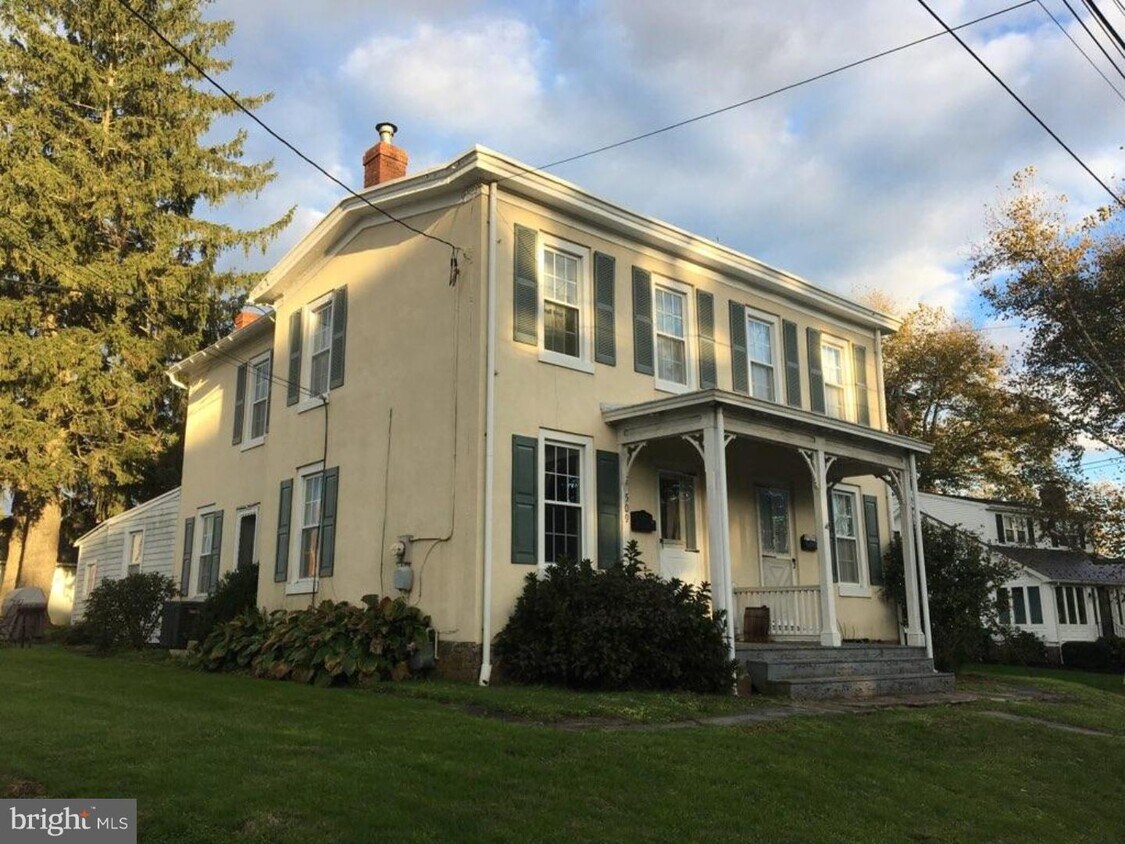
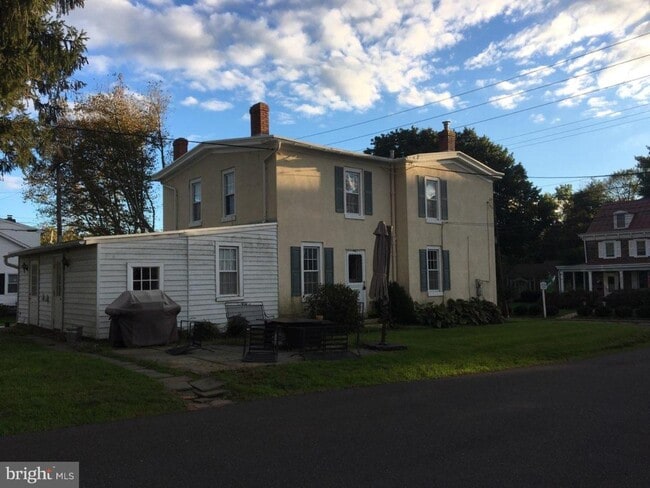
509 S State St
Newtown, PA 18940
2 Weeks Ago
Favorites
509 S State St

Favorites
Check Back Soon for Upcoming Availability
| Beds | Baths | Average SF |
|---|---|---|
| 2 Bedrooms 2 Bedrooms 2 Br | 1 Bath 1 Bath 1 Ba | — |
About This Property
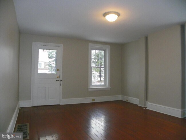
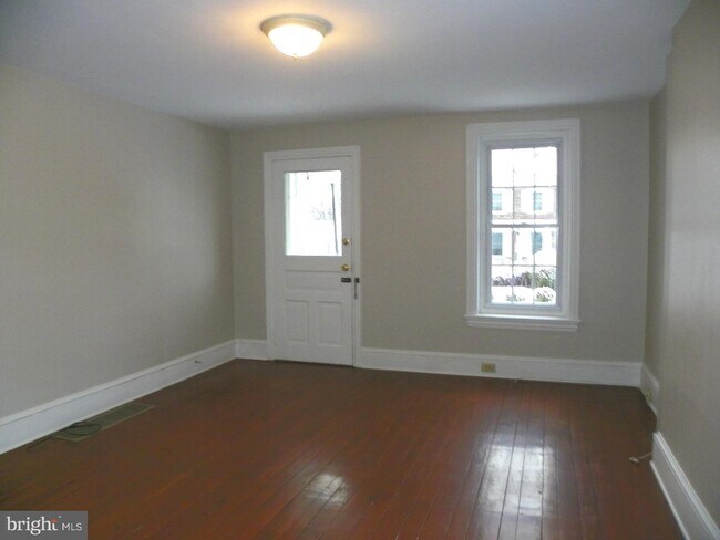
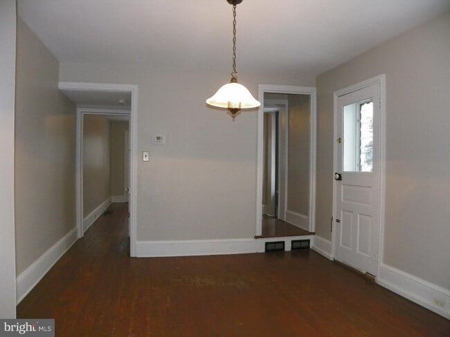
Adorable 2 bedroom twin on the edge of Historic Newtown Borough. Neutral and ready to move right in! There is parking available for up to two cars, nice rear patio, 1st floor has laundry room, eat-in kitchen, formal dining room, and living room. Upstairs there are two nice-sized bedrooms that share a hall bath. This location is somewhat walkable to nearby restaurants, shopping, and coffee in Newtown Borough. This property is located in the Council Rock School District. First, Last, and Security please. Make your appointment today!
509 S State St is a house located in Bucks County and the 18940 ZIP Code. This area is served by the Council Rock attendance zone.
House Features
- Basement
Location
Get Directions
Amenities
- Basement
Education
| Colleges & Universities | Distance | ||
|---|---|---|---|
| Colleges & Universities | Distance | ||
| Drive: | 6 min | 3.0 mi | |
| Drive: | 18 min | 10.3 mi | |
| Drive: | 18 min | 10.7 mi | |
| Drive: | 22 min | 13.6 mi |
509 S State St is within 6 minutes or 3.0 miles from Bucks County Community College. It is also near C.C. of Philadelphia, NE Ctr and Mercer Co. C.C., Kerney.
Schools


Public Elementary School
Grades K-5
777 Students
Nearby
Public Elementary School
Grades K-6
694 Students
Attendance Zone
Public Middle School
Grades 7-8
851 Students
Attendance Zone
Public High School
Grades 9-12
1,622 Students
Attendance Zone
Private Elementary & Middle School
Grades PK-8
254 Students
Nearby
Private Elementary School
Grades PK-K
148 Students
Nearby
Private High School
Grades 9-12
539 Students
Nearby
School data provided by
 The GreatSchools Rating helps parents compare schools within a state based on a variety of school quality indicators and provides a helpful picture of how effectively each school serves all of its students. Ratings are on a scale of 1 (below average) to 10 (above average) and can include test scores, college readiness, academic progress, advanced courses, equity, discipline and attendance data. We also advise parents to visit schools, consider other information on school performance and programs, and consider family needs as part of the school selection process.
View GreatSchools Rating Methodology
Data provided by GreatSchools.org © 2025. All rights reserved.
View GreatSchools Rating Methodology
Data provided by GreatSchools.org © 2025. All rights reserved.
Transportation options available in Newtown include Hamilton Avenue, located 11.4 miles from 509 S State St. 509 S State St is near Trenton Mercer, located 9.4 miles or 16 minutes away, and Philadelphia International, located 36.5 miles or 57 minutes away.
| Transit / Subway | Distance | ||
|---|---|---|---|
| Transit / Subway | Distance | ||
|
|
Drive: | 19 min | 11.4 mi |
|
|
Drive: | 19 min | 11.5 mi |
|
|
Drive: | 22 min | 12.9 mi |
| Commuter Rail | Distance | ||
|---|---|---|---|
| Commuter Rail | Distance | ||
|
|
Drive: | 8 min | 4.5 mi |
|
|
Drive: | 11 min | 6.6 mi |
|
|
Drive: | 10 min | 6.8 mi |
|
|
Drive: | 14 min | 8.1 mi |
|
|
Drive: | 15 min | 9.3 mi |
| Airports | Distance | ||
|---|---|---|---|
| Airports | Distance | ||
|
Trenton Mercer
|
Drive: | 16 min | 9.4 mi |
|
Philadelphia International
|
Drive: | 57 min | 36.5 mi |
Time and distance from 509 S State St.
| Shopping Centers | Distance | ||
|---|---|---|---|
| Shopping Centers | Distance | ||
| Walk: | 13 min | 0.7 mi | |
| Walk: | 14 min | 0.7 mi | |
| Walk: | 15 min | 0.8 mi |
509 S State St has 3 shopping centers within 0.8 mile, which is about a 15-minute walk. The miles and minutes will be for the farthest away property.
| Parks and Recreation | Distance | ||
|---|---|---|---|
| Parks and Recreation | Distance | ||
|
Core Creek Park
|
Drive: | 7 min | 3.3 mi |
|
Tyler State Park
|
Drive: | 9 min | 4.2 mi |
|
Churchville Nature Center
|
Drive: | 9 min | 5.1 mi |
|
Washington Crossing State Park
|
Drive: | 18 min | 8.5 mi |
|
Simpson Observatory
|
Drive: | 21 min | 9.1 mi |
509 S State St has 5 parks within 9.1 miles, including Core Creek Park, Tyler State Park, and Churchville Nature Center.
| Hospitals | Distance | ||
|---|---|---|---|
| Hospitals | Distance | ||
| Drive: | 16 min | 9.4 mi | |
| Drive: | 18 min | 10.0 mi | |
| Drive: | 20 min | 11.9 mi |
509 S State St has 3 hospitals within 11.9 miles, the nearest is Rothman Orthopaedic Specialty Hospital which is 9.4 miles away and a 16 minute drive.
| Military Bases | Distance | ||
|---|---|---|---|
| Military Bases | Distance | ||
| Drive: | 19 min | 10.2 mi | |
| Drive: | 29 min | 15.6 mi |
509 S State St is 10.2 miles from Naval Air Development Center, and is convenient to other military bases, including Willow Grove Naval Air Station.
You May Also Like
Similar Rentals Nearby


What Are Walk Score®, Transit Score®, and Bike Score® Ratings?
Walk Score® measures the walkability of any address. Transit Score® measures access to public transit. Bike Score® measures the bikeability of any address.
What is a Sound Score Rating?
A Sound Score Rating aggregates noise caused by vehicle traffic, airplane traffic and local sources

509 S State St
Newtown, PA 18940