

$950
/ Month
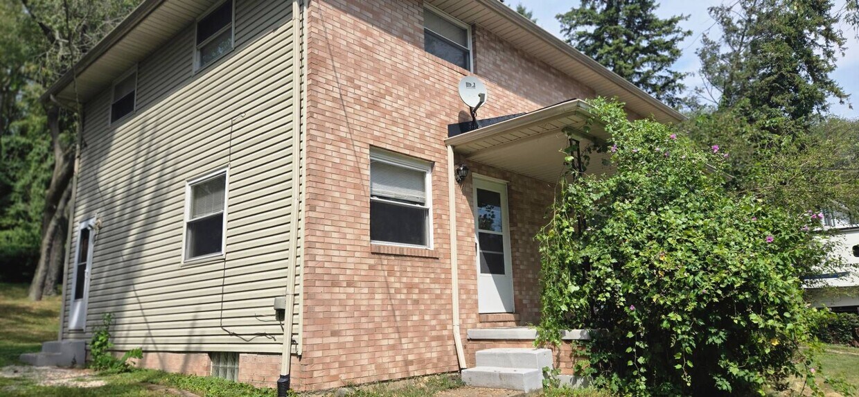
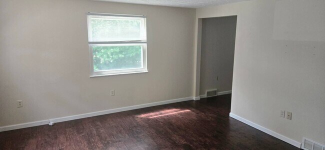
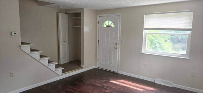
5085-5085 Quincy St NW Unit 5085
Canton, OH 44708
2 Weeks Ago
|
Edit
Favorites
-
Bedrooms
2
-
Bathrooms
1
-
Square Feet
--
5085-5085 Quincy St NW Unit 5085

Favorites
Contact
- Listed by B2B Property Management | B2B Property Management
Location
Get Directions
Canton, Ohio carries a distinct identity rooted in football history, Midwestern grit, and a downtown that has quietly been reinventing itself for years. Situated in Stark County about 25 miles south of Akron and 60 miles south of Cleveland, Canton serves as the county seat and anchors a metro area of roughly 400,000 people. The city is the recognized birthplace of the National Football League, and the Pro Football Hall of Fame remains its most prominent landmark, drawing visitors and anchoring the expanding Hall of Fame Village development nearby. Malone University adds an educational presence, while major employers like Aultman Hospital, TimkenSteel, and Cleveland Clinic Mercy Hospital give the local economy a steady, diversified foundation.
Learn more about living in Canton
Education
| Colleges & Universities | Distance | ||
|---|---|---|---|
| Colleges & Universities | Distance | ||
| Drive: | 13 min | 5.4 mi | |
| Drive: | 14 min | 5.7 mi | |
| Drive: | 13 min | 6.1 mi | |
| Drive: | 18 min | 9.7 mi |
5085-5085 Quincy St NW Unit 5085 is within 13 minutes or 5.4 miles from Malone University. It is also near Kent State University, Stark and Stark State College.
Getting Around
 What do Walkability, Transit, Drivability, and Bikeability mean?
Walkability measures the walking distance to day-to-day needs.
Transit measures access to public transportation.
Drivability measures congestion, parking availability, and access to major roads.
Bikeability measures the suitability for cycling.
How It Works
What do Walkability, Transit, Drivability, and Bikeability mean?
Walkability measures the walking distance to day-to-day needs.
Transit measures access to public transportation.
Drivability measures congestion, parking availability, and access to major roads.
Bikeability measures the suitability for cycling.
How It Works
Fairly Walkable
Walkability
40
/ 100
Minimal Public Transit
Transit
0
/ 100
Very Drivable
Drivability
80
/ 100
Fairly Bikeable
Bikeability
50
/ 100
Scores provided by
-
Soundscore™
-
/ 100
Traffic
-Airport
-Businesses
-Scores provided by
HowLoud What is a Sound Score Rating? A Sound Score Rating aggregates noise caused by vehicle traffic, airplane traffic and local sources. How It WorksYou May Also Like
Similar Rentals Nearby


What Are Walk Score®, Transit Score®, and Bike Score® Ratings?
Walk Score® measures the walkability of any address. Transit Score® measures access to public transit. Bike Score® measures the bikeability of any address.
What is a Sound Score Rating?
A Sound Score Rating aggregates noise caused by vehicle traffic, airplane traffic and local sources.

5085-5085 Quincy St NW
Canton, OH 44708