
$1,100
/ Month
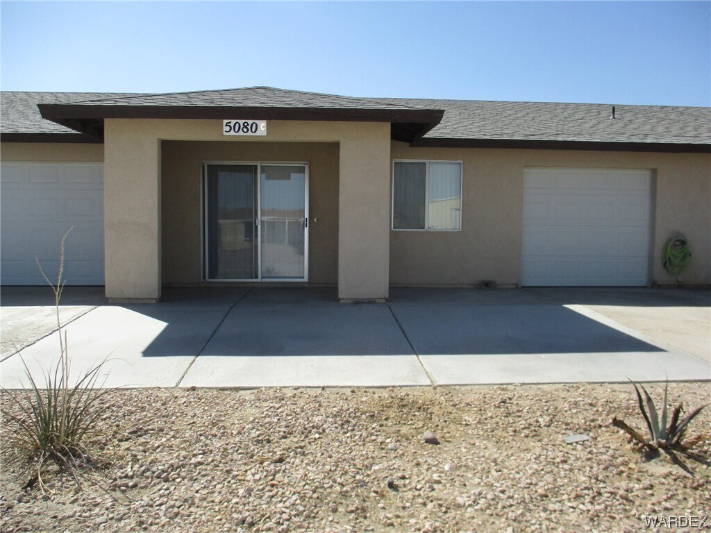
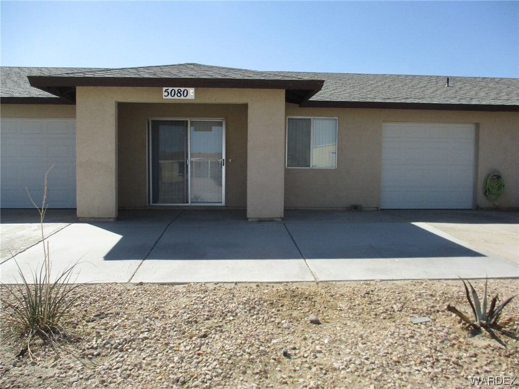
5080 La Calzada Rd
Fort Mohave, AZ 86426
Favorites
5080 La Calzada Rd

Favorites
Check Back Soon for Upcoming Availability
| Beds | Baths | Average SF |
|---|---|---|
| 2 Bedrooms 2 Bedrooms 2 Br | 1 Bath 1 Bath 1 Ba | 900 SF |
Fees and Policies
The fees listed below are community-provided and may exclude utilities or add-ons. All payments are made directly to the property and are non-refundable unless otherwise specified.
- Parking
-
Garage--
Details
Utilities Included
-
Water
-
Trash Removal
-
Sewer
About This Property
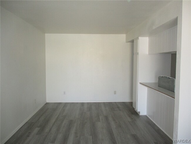
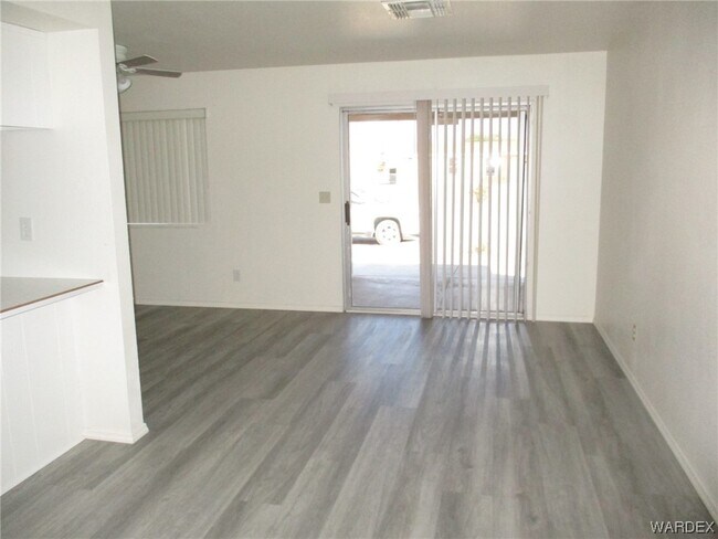
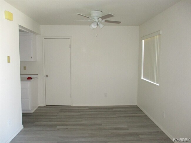
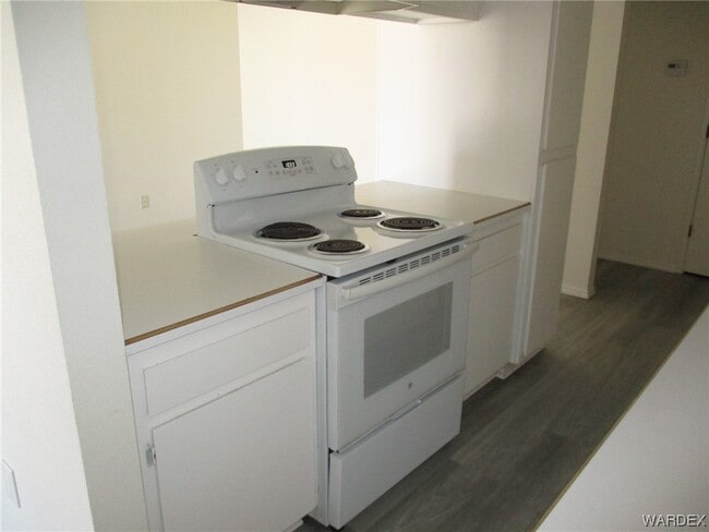
All Electric Unit with 2 bedrooms and 1 full bathroom. Open living room,dining room and kitchen. Laminate floors through out. 1 car garage with washer and dryer hook ups in the garage. NO PETS
5080 La Calzada Rd is a townhome located in Mohave County and the 86426 ZIP Code. This area is served by the Mohave Valley Elementary District attendance zone.
5080 La Calzada Rd,
Fort Mohave,
AZ
86426
Expenses
Utilities Included
Water, Trash Removal, Sewer
Included
Education
Schools


Public Elementary & Middle School
Grades K-8
362 Students
Attendance Zone
Public Elementary & Middle School
Grades PK-8
399 Students
Attendance Zone
Public Middle School
Grades 6-8
450 Students
Attendance Zone
Public High School
Grades 9-12
585 Students
Attendance Zone
Private Elementary, Middle & High School
Grades K-12
3 Students
Nearby
Private Elementary School
Grades PK-5
20 Students
Nearby
School data provided by
 The GreatSchools Rating helps parents compare schools within a state based on a variety of school quality indicators and provides a helpful picture of how effectively each school serves all of its students. Ratings are on a scale of 1 (below average) to 10 (above average) and can include test scores, college readiness, academic progress, advanced courses, equity, discipline and attendance data. We also advise parents to visit schools, consider other information on school performance and programs, and consider family needs as part of the school selection process.
View GreatSchools Rating Methodology
Data provided by GreatSchools.org © 2026. All rights reserved.
View GreatSchools Rating Methodology
Data provided by GreatSchools.org © 2026. All rights reserved.
Walkability Near 5080 La Calzada Rd Fort Mohave, AZ 86426
Getting Around
 What do Walkability, Transit, Drivability, and Bikeability mean?
Walkability measures the walking distance to day-to-day needs.
Transit measures access to public transportation.
Drivability measures congestion, parking availability, and access to major roads.
Bikeability measures the suitability for cycling.
How It Works
What do Walkability, Transit, Drivability, and Bikeability mean?
Walkability measures the walking distance to day-to-day needs.
Transit measures access to public transportation.
Drivability measures congestion, parking availability, and access to major roads.
Bikeability measures the suitability for cycling.
How It Works
Fairly Walkable
Walkability
40
/ 100
Minimal Public Transit
Transit
0
/ 100
Very Drivable
Drivability
80
/ 100
Somewhat Bikeable
Bikeability
30
/ 100
Scores provided by
-
Soundscore™
-
/ 100
Traffic
-Airport
-Businesses
-Scores provided by
HowLoud What is a Sound Score Rating? A Sound Score Rating aggregates noise caused by vehicle traffic, airplane traffic and local sources. How It WorksYou May Also Like
Similar Rentals Nearby
-
-

-
 3 Beds, 2 Baths, 1,702 sq ft$1,9752982 Camino Del Rio
 -

-

-

-

-

-

-

What Are Walk Score®, Transit Score®, and Bike Score® Ratings?
Walk Score® measures the walkability of any address. Transit Score® measures access to public transit. Bike Score® measures the bikeability of any address.
What is a Sound Score Rating?
A Sound Score Rating aggregates noise caused by vehicle traffic, airplane traffic and local sources.
5080 La Calzada Rd
Fort Mohave, AZ 86426