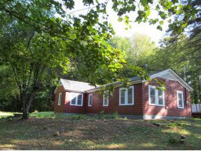
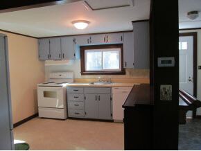
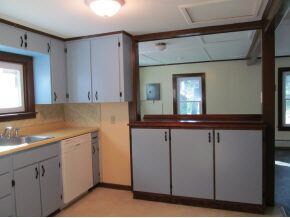
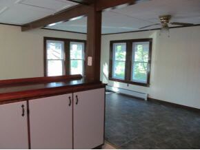
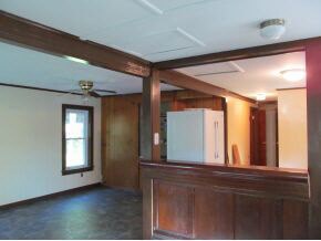
$1,300 / Month

491 John Stark Hwy

,

Newport, NH 03773

2 Weeks Ago
| Edit

Under 30 minutes

Commute Time is calculated at rush hour.
Share Listing
Favorites
491 John Stark Hwy
Share Listing
Favorites

Check Back Soon for Upcoming Availability

Beds Baths Average SF
2 Bedrooms 2 Bedrooms 2 Br 1 Bath 1 Bath 1 Ba 1,092 SF

Fees and Policies

The fees listed below are community-provided and may exclude utilities or add-ons. All payments are made directly to the property and are non-refundable unless otherwise specified.

  • Parking
  • Garage
    --

About This Property

Recently renovated - located on private 2.6 acre lot. Tenant pays all utilities,lawn maintenance and snow removal. Security Deposit and references required. $20 application fee. 24 hour notice needed to view property.

491 John Stark Hwy is a house located in Sullivan County and the 03773 ZIP Code. This area is served by the Newport School District attendance zone.

House Features

  • Basement
Location
491 John Stark Hwy, Newport,
NH 03773
Get Directions
Amenities
  • Basement
Education
Colleges & Universities Distance
Drive: 32 min 17.2 mi
Drive: 47 min 26.0 mi
Drive: 44 min 36.6 mi
Drive: 64 min 37.9 mi
491 John Stark Hwy is within 32 minutes or 17.2 miles from Colby-Sawyer College. It is also near New England College and Dartmouth College.
Schools
Public Elementary School
Grades 5-6
136 Students
Nearby
Public Elementary School
Grades PK-5
323 Students
Attendance Zone
Public Middle School
Grades 6-8
194 Students
Nearby
Grades 9-12
292 Students
Attendance Zone
Private Elementary & Middle School
Grades K-8
108 Students
Nearby
Private Middle & High School
Grades 6-12
37 Students
Nearby
Transportation
Commuter Rail Distance
Drive: 14 min 9.7 mi
Drive: 22 min 17.2 mi
Drive: 38 min 25.5 mi
Drive: 39 min 32.3 mi

Walkability Near 491 John Stark Hwy Newport, NH 03773

Getting Around
Not Walkable
Walkability
10 / 100
Exceptionally Drivable
Drivability
100 / 100
Fairly Bikeable
Bikeability
40 / 100

Scores provided by

What do Walkability, Transit, Drivability, and Bikeability mean? Walkability measures the walking distance to day-to-day needs. Transit measures access to public transportation. Drivability measures congestion, parking availability, and access to major roads. Bikeability measures the suitability for cycling. How It Works
-
Soundscore
- / 100

Traffic

-

Airport

-

Businesses

-

Scores provided by

HowLoud What is a Sound Score Rating? A Sound Score Rating aggregates noise caused by vehicle traffic, airplane traffic and local sources. How It Works
Points of Interest

Time and distance from 491 John Stark Hwy.

Shopping Centers Distance
Drive: 2 min 2.2 mi
Drive: 3 min 2.4 mi
Drive: 7 min 5.7 mi
491 John Stark Hwy has 3 shopping centers within 5.7 miles, which is about a 7-minute drive. The miles and minutes will be for the farthest away property.
Parks and Recreation Distance
The Fells Historic Estate and Gardens
Drive: 15 min 7.9 mi
Mount Sunapee Resort
Drive: 15 min 8.2 mi
Mount Sunapee State Park
Drive: 27 min 10.1 mi
Wilgus State Park
Drive: 16 min 12.9 mi
John Hay National Wildlife Refuge
Drive: 25 min 13.1 mi
491 John Stark Hwy has 5 parks within 13.1 miles, including The Fells Historic Estate and Gardens, Mount Sunapee Resort, and Mount Sunapee State Park.
Hospitals Distance
Hospitals Distance
Drive: 10 min 7.9 mi
491 John Stark Hwy is 7.9 miles and a 10 minute drive from Valley Regional Hospital.

You May Also Like

Similar Rentals Nearby