
Trestle
333 El Camino Real,
San Carlos, CA 94070
1-3 Beds $3,751 - $6,485
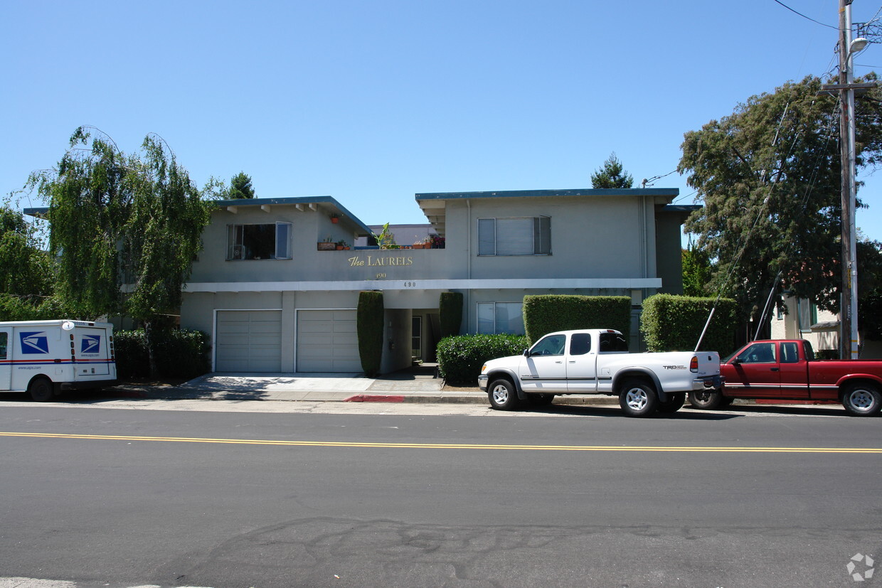
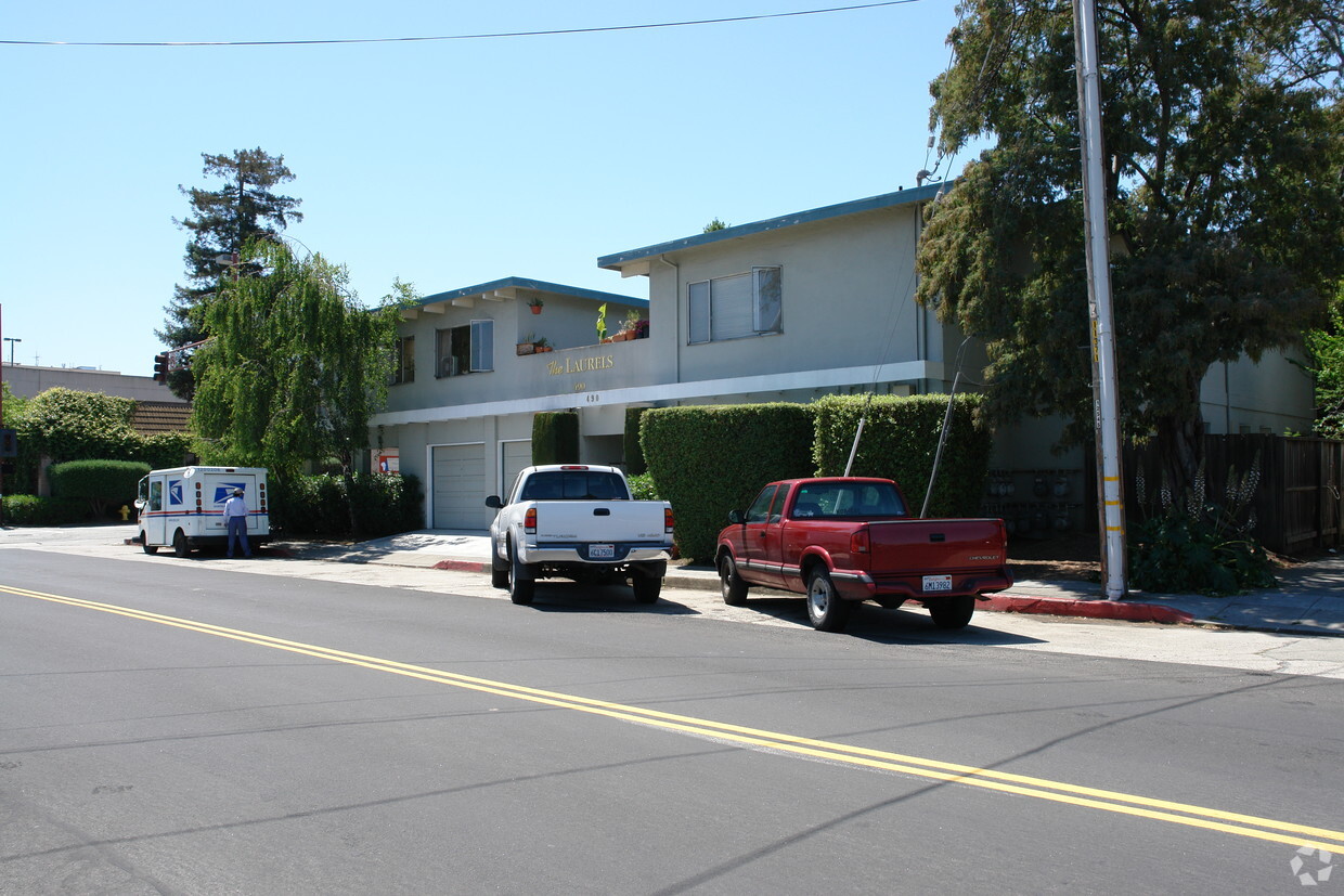
At 490 Laurel, find a great place to live. This apartment community is located on Laurel St. in the 94070 area of San Carlos. These apartments offer a variety of features. These include: convenient on-site parking options, rentable storage units, and smoke free options. The professional leasing staff is ready to help you find your perfect new home. Contact us or drop by to schedule a tour today and find your new home at 490 Laurel.
490 Laurel is an apartment community located in San Mateo County and the 94070 ZIP Code. This area is served by the San Carlos Elementary attendance zone.
Air Conditioning
High Speed Internet Access
Smoke Free
Heating
Nicknamed “The City of Good Living,” San Carlos is exactly that. With family-friendly entertainment, vibrant urban areas, and delicious eateries, San Carlos is a must-visit coastal destination. Nestled on the San Francisco Peninsula overlooking the bay with proximity to both San Francisco and San Jose, San Carlos offers a premier location on California’s coast.
A commuter-friendly city, San Carlos is near multiple interstate highways, making trips to neighboring cities a breeze. With pristine parks, great weather, a lively community, and family-friendly shopping and dining options, San Carlos is a wonderful place to put down roots.
Explore the Hiller Aviation Museum overlooking the San Carlos Airport, great for all ages, or try out one of the local hot spots around town. Blue Line Pizza offers high ceilings, an artsy vibe, casual digs, and even an outdoor patio that’s dog-friendly.
Learn more about living in San Carlos| Colleges & Universities | Distance | ||
|---|---|---|---|
| Colleges & Universities | Distance | ||
| Drive: | 13 min | 5.5 mi | |
| Drive: | 12 min | 7.8 mi | |
| Drive: | 15 min | 8.1 mi | |
| Drive: | 22 min | 9.0 mi |


Transportation options available in San Carlos include Millbrae Bart Station, located 11.1 miles from 490 Laurel. 490 Laurel is near San Francisco International, located 12.2 miles or 17 minutes away, and Metro Oakland International, located 27.8 miles or 36 minutes away.
| Transit / Subway | Distance | ||
|---|---|---|---|
| Transit / Subway | Distance | ||
|
|
Drive: | 16 min | 11.1 mi |
|
|
Drive: | 16 min | 11.1 mi |
| Commuter Rail | Distance | ||
|---|---|---|---|
| Commuter Rail | Distance | ||
| Walk: | 6 min | 0.3 mi | |
| Drive: | 3 min | 1.3 mi | |
| Drive: | 3 min | 1.3 mi | |
| Drive: | 6 min | 2.5 mi | |
| Drive: | 8 min | 3.5 mi |
| Airports | Distance | ||
|---|---|---|---|
| Airports | Distance | ||
|
San Francisco International
|
Drive: | 17 min | 12.2 mi |
|
Metro Oakland International
|
Drive: | 36 min | 27.8 mi |
Time and distance from 490 Laurel.
| Shopping Centers | Distance | ||
|---|---|---|---|
| Shopping Centers | Distance | ||
| Walk: | 14 min | 0.7 mi | |
| Walk: | 17 min | 0.9 mi | |
| Walk: | 19 min | 1.0 mi |
| Parks and Recreation | Distance | ||
|---|---|---|---|
| Parks and Recreation | Distance | ||
|
Red Morton Park
|
Drive: | 9 min | 3.6 mi |
|
Edgewood Park & Natural Preserve
|
Drive: | 7 min | 3.9 mi |
|
Stulsaft Park
|
Drive: | 12 min | 4.8 mi |
|
Pulgas Ridge Open Space Preserve
|
Drive: | 11 min | 5.3 mi |
|
Filoli Gardens
|
Drive: | 16 min | 6.3 mi |
| Hospitals | Distance | ||
|---|---|---|---|
| Hospitals | Distance | ||
| Drive: | 6 min | 2.8 mi | |
| Drive: | 7 min | 2.9 mi | |
| Drive: | 5 min | 2.9 mi |
| Military Bases | Distance | ||
|---|---|---|---|
| Military Bases | Distance | ||
| Drive: | 22 min | 15.1 mi |
What Are Walk Score®, Transit Score®, and Bike Score® Ratings?
Walk Score® measures the walkability of any address. Transit Score® measures access to public transit. Bike Score® measures the bikeability of any address.
What is a Sound Score Rating?
A Sound Score Rating aggregates noise caused by vehicle traffic, airplane traffic and local sources

490 Laurel St
San Carlos, CA 94070


