$3,500
Total Monthly Price
12 Month Lease
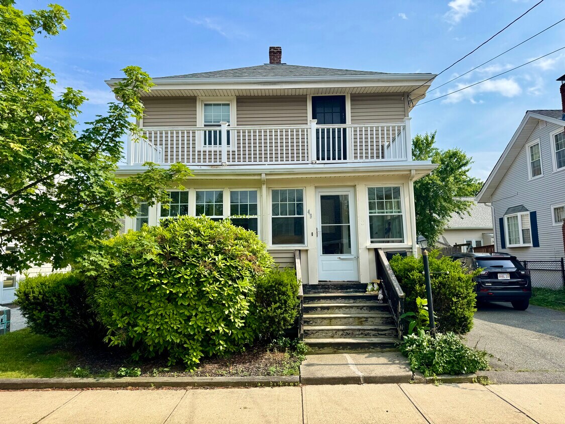
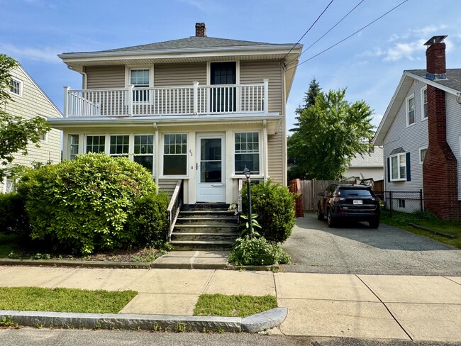
49 Conant Rd
Quincy, MA 02171
Favorites
857-799-3903
-
Bedrooms
3
-
Bathrooms
2
-
Square Feet
1,344 sq ft
-
Available
Available Sep 1
Highlights
- Pets Allowed
- Hardwood Floors
- Yard
- Basement
- Deck
49 Conant Rd

Favorites
About This Home
12 Month Lease,
$3,500 deposit,
Available Sep 1
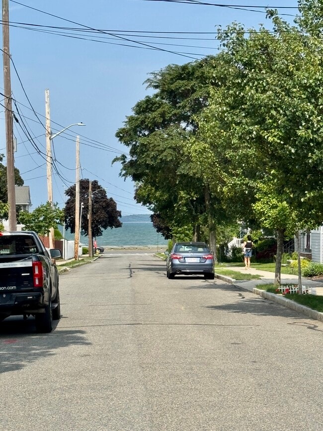
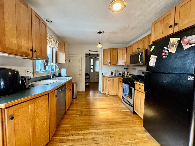
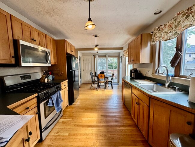
Available 9/1/26. Live just steps from the beach! Desirable North Quincy neighborhood, steps away from Wollaston Beach. Many updates including kitchen, bathroom, siding, windows, deck, and electric. Large eat-in kitchen with pantry and atrium doors to deck. First-floor bath. Hardwood flooring throughout. Sun room with deck above. Fenced in yard. Walk to North Quincy MBTA station, and steps away from Bus Stop. Easy access to I-93 North and South. 5-10 min from Routes 3 and 3A. Three bedrooms, two full baths, large kitchen with plenty of cabinets, dining room, living room. Gas heating system. Utilities not included. Washer/dryer available in basement. Two car parking in tandem. Dogs are an extra $50/dog/month.
49 Conant Rd is a house located in Norfolk County and the 02171 ZIP Code. This area is served by the Quincy School District attendance zone.
* Price shown is total price based on community-supplied monthly required fees. Excludes user-selected optional fees and variable or usage-based fees and required charges due at or prior to move-in or at move-out. Price, availability, fees, and any applicable rent special are subject to change without notice.
* Square footage definitions vary. Displayed square footage is approximate.
House Features
Washer/Dryer
High Speed Internet Access
Hardwood Floors
Wi-Fi
- High Speed Internet Access
- Wi-Fi
- Washer/Dryer
- Heating
- Cable Ready
- Storage Space
- Tub/Shower
- Pantry
- Eat-in Kitchen
- Kitchen
- Hardwood Floors
- Dining Room
- Basement
- Deck
- Yard
Fees and Policies
The fees listed below are community-provided and may exclude utilities or add-ons. All payments are made directly to the property and are non-refundable unless otherwise specified.
- One-Time Move-In Fees
-
Broker Fee$0
- Dogs Allowed
-
Fees not specified
- Cats Allowed
-
Fees not specified
- Parking
-
Surface Lot--
Contact
- Phone Number
- Contact
Location
Get Directions
Welcome to Quincy, Massachusetts, a historic coastal city eight miles south of Boston. As the "City of Presidents," Quincy combines centuries of American history with contemporary city living. The rental market remains competitive, with current average rents ranging from $2,252 for studios to $4,758 for four-bedroom units, reflecting modest year-over-year changes between -2.9% and 2% depending on unit size.
Each Quincy neighborhood offers its own distinctive appeal. Marina Bay features waterfront living with a scenic harbor and walking paths, while Wollaston encompasses residential streets alongside international markets and restaurants. The Blue Hills Reservation provides 2,485 acres of protected space for hiking, mountain biking, and seasonal skiing. For commuters, four Red Line T stations offer convenient access to downtown Boston. History enthusiasts can explore significant landmarks including the Adams National Historical Park, home to the birthplaces of two U.S. presidents.
Learn more about living in Quincy
Education
| Colleges & Universities | Distance | ||
|---|---|---|---|
| Colleges & Universities | Distance | ||
| Drive: | 9 min | 4.2 mi | |
| Drive: | 12 min | 6.6 mi | |
| Drive: | 13 min | 6.7 mi | |
| Drive: | 14 min | 7.1 mi |
49 Conant Rd is within 9 minutes or 4.2 miles from UMass Boston. It is also near Northeastern University and Tufts University, Boston.
Schools


Public Elementary & Middle School
Grades PK-8
833 Students
Nearby
Public Elementary School
Grades K-5
323 Students
Attendance Zone
Public Middle School
Grades 6-8
574 Students
Attendance Zone
Public High School
Grades 9-12
1,505 Students
Attendance Zone
Private Elementary & Middle School
Grades PK-8
329 Students
Nearby
Private Middle & High School
Grades 6-12
46 Students
Nearby
School data provided by
 The GreatSchools Rating helps parents compare schools within a state based on a variety of school quality indicators and provides a helpful picture of how effectively each school serves all of its students. Ratings are on a scale of 1 (below average) to 10 (above average) and can include test scores, college readiness, academic progress, advanced courses, equity, discipline and attendance data. We also advise parents to visit schools, consider other information on school performance and programs, and consider family needs as part of the school selection process.
View GreatSchools Rating Methodology
Data provided by GreatSchools.org © 2026. All rights reserved.
View GreatSchools Rating Methodology
Data provided by GreatSchools.org © 2026. All rights reserved.
Transportation options available in Quincy include North Quincy Station, located 1.2 miles from 49 Conant Rd. 49 Conant Rd is near General Edward Lawrence Logan International, located 9.6 miles or 17 minutes away.
| Transit / Subway | Distance | ||
|---|---|---|---|
| Transit / Subway | Distance | ||
|
|
Drive: | 4 min | 1.2 mi |
|
|
Drive: | 4 min | 1.7 mi |
|
|
Drive: | 6 min | 2.8 mi |
|
|
Drive: | 8 min | 3.4 mi |
|
|
Drive: | 7 min | 3.4 mi |
| Commuter Rail | Distance | ||
|---|---|---|---|
| Commuter Rail | Distance | ||
|
|
Drive: | 7 min | 2.8 mi |
|
|
Drive: | 7 min | 4.1 mi |
| Drive: | 11 min | 4.1 mi | |
| Drive: | 9 min | 4.3 mi | |
|
|
Drive: | 9 min | 4.6 mi |
| Airports | Distance | ||
|---|---|---|---|
| Airports | Distance | ||
|
General Edward Lawrence Logan International
|
Drive: | 17 min | 9.6 mi |
Getting Around
 What do Walkability, Transit, Drivability, and Bikeability mean?
Walkability measures the walking distance to day-to-day needs.
Transit measures access to public transportation.
Drivability measures congestion, parking availability, and access to major roads.
Bikeability measures the suitability for cycling.
How It Works
What do Walkability, Transit, Drivability, and Bikeability mean?
Walkability measures the walking distance to day-to-day needs.
Transit measures access to public transportation.
Drivability measures congestion, parking availability, and access to major roads.
Bikeability measures the suitability for cycling.
How It Works
Moderately Walkable
Walkability
60
/ 100
Some Public Transit
Transit
40
/ 100
Moderately Drivable
Drivability
70
/ 100
Moderately Bikeable
Bikeability
60
/ 100
Scores provided by
-
Soundscore™
-
/ 100
Traffic
-Airport
-Businesses
-Scores provided by
HowLoud What is a Sound Score Rating? A Sound Score Rating aggregates noise caused by vehicle traffic, airplane traffic and local sources. How It WorksTime and distance from 49 Conant Rd.
| Shopping Centers | Distance | ||
|---|---|---|---|
| Shopping Centers | Distance | ||
| Drive: | 4 min | 1.3 mi | |
| Drive: | 3 min | 1.4 mi | |
| Drive: | 5 min | 2.2 mi |
49 Conant Rd has 3 shopping centers within 2.2 miles, which is about a 5-minute drive. The miles and minutes will be for the farthest away property.
| Parks and Recreation | Distance | ||
|---|---|---|---|
| Parks and Recreation | Distance | ||
|
Squantum Point Park
|
Drive: | 6 min | 1.6 mi |
|
Adams National Historical Park
|
Drive: | 7 min | 2.8 mi |
|
Dorchester Shores Reservation
|
Drive: | 9 min | 4.2 mi |
|
Franklin Park Zoo
|
Drive: | 10 min | 5.9 mi |
|
Lower Neponset River Trail
|
Drive: | 11 min | 6.0 mi |
49 Conant Rd has 5 parks within 6.0 miles, including Squantum Point Park, Adams National Historical Park, and Dorchester Shores Reservation.
| Hospitals | Distance | ||
|---|---|---|---|
| Hospitals | Distance | ||
| Drive: | 6 min | 3.1 mi | |
| Drive: | 9 min | 4.2 mi | |
| Drive: | 10 min | 5.7 mi |
49 Conant Rd has 3 hospitals within 5.7 miles, the nearest is Carney Hospital which is 3.1 miles away and a 6 minute drive.
| Military Bases | Distance | ||
|---|---|---|---|
| Military Bases | Distance | ||
| Drive: | 41 min | 21.9 mi | |
| Drive: | 38 min | 22.1 mi | |
| Drive: | 42 min | 24.3 mi |
49 Conant Rd has 3 military bases within 24.3 miles, the nearest is Hanscom Air Force Base which is 21.9 miles away and a 41 minute drive.
Amenities
- High Speed Internet Access
- Wi-Fi
- Washer/Dryer
- Heating
- Cable Ready
- Storage Space
- Tub/Shower
- Pantry
- Eat-in Kitchen
- Kitchen
- Hardwood Floors
- Dining Room
- Basement
- Deck
- Yard
49 Conant Rd Photos
What Are Walk Score®, Transit Score®, and Bike Score® Ratings?
Walk Score® measures the walkability of any address. Transit Score® measures access to public transit. Bike Score® measures the bikeability of any address.
What is a Sound Score Rating?
A Sound Score Rating aggregates noise caused by vehicle traffic, airplane traffic and local sources.

49 Conant Rd
Quincy, MA 02171