
$3,500
/ Month
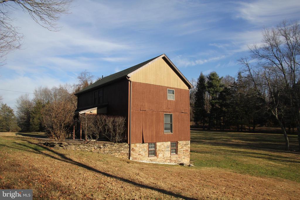
48 Poor Farm Rd
Pennington, NJ 08534
Today
|
Edit
Favorites
609-577-8012
-
Bedrooms
3
-
Bathrooms
1.5
-
Square Feet
2,000 sq ft
-
Available
Available Now
Highlights
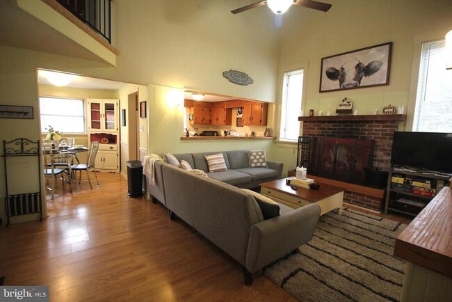
- Cathedral Ceiling
- Wood Flooring
- Furnished
- Cottage
- Cedar Closet
- Patio
48 Poor Farm Rd

Favorites
About This Home
Available Now
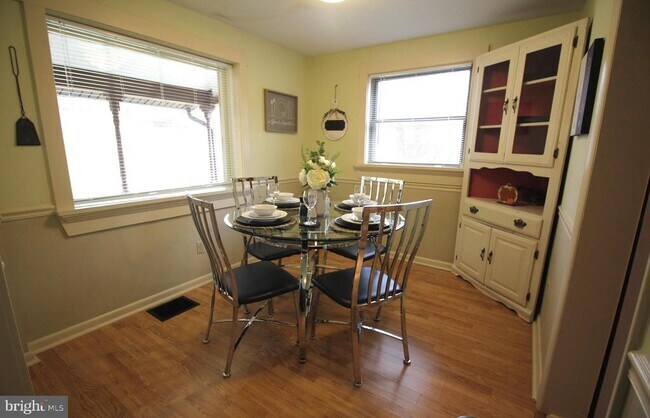
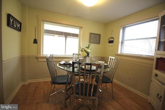
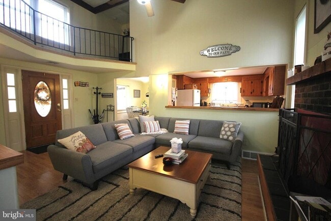
Welcome to this inviting furnished cottage, surrounded by the natural beauty of the MRC area. Conveniently located near downtown Pennington and Hopewell Boroughs, this serene country retreat offers approximately 2,000 sq. ft. of living space across two stories, complemented by ample attic and cellar storage. The main level features soaring two-story cathedral ceilings, a cozy living room, and an open layout that includes a spacious sleeping area, dining space, and a well-equipped kitchen. Upstairs, two comfortable bedrooms and a full bath provide elevated views of the picturesque property. A walk-out basement adds extra convenience with a laundry area and a half bath, making this home as practical as it is charming.
48 Poor Farm Rd is a house located in Mercer County and the 08534 ZIP Code. This area is served by the Hopewell Valley Regional attendance zone.
* Price shown is base rent. Excludes user-selected optional fees and variable or usage-based fees and required charges due at or prior to move-in or at move-out. Price, availability, fees, and any applicable rent special are subject to change without notice.
* Square footage definitions vary. Displayed square footage is approximate.
Home Details
Home Type
Single Family Detached Home
Bedrooms and Bathrooms
Cedar Closet
3 Bedrooms | 1 Main Level Bedroom
1.5 Bathrooms
Flooring
Wood
Carpet
Home Design
Cottage
Stone Siding
Interior Spaces
Cathedral Ceiling
Furnished
Dining Area
2,000 Sq Ft Home
Property has 2 Levels
Laundry
Laundry on lower level
Listing and Financial Details
Security Deposit $3,500
1-Month Min and 5-Month Max Lease Term
Available 1/1/26
Assessor Parcel Number 06-00031-00019 01-QFARM
No Smoking Allowed
Residential Lease
Lot Details
26.24 Acre Lot
Property is zoned MRC
Outdoor Features
Patio
Parking
Parking Lot
Unfinished Basement
Walk-Out Basement
Utilities
Forced Air Heating and Cooling System
Heating System Uses Oil
Well
Municipal Trash
Oil Water Heater
Septic Pump
Community Details
Overview
No Home Owners Association
Pet Policy
No Pets Allowed
Contact
- Listed by Chu Hseng Tai | Coldwell Banker Residential Brokerage - Princeton
- Phone Number
- Contact
-
Source
 Bright MLS, Inc.
Copyright © 2026 Bright MLS, Inc.
Location
Get Directions
Amenities
- Basement
Located in the heart of Hopewell Township, Pennington-Hopewell is a mixture of small-town suburbia with a city feel. Renters will enjoy numerous outdoor amenities, from teeing off at Hopewell Valley Golf and Country Club, exploring hiking trails at Baldwin State Wildlife Management Area, to touring the Hopewell Valley Vineyards. The city has a variety of authentic restaurants where there are a variety of authentic Italian eateries, deli’s, pubs.
This neighborhood has a selection of ranch and colonial-style houses along with modern apartment complexes available for rent. Families will surely appreciate the highly-rated public schools in Pennington-Hopewell.
Learn more about living in Pennington/Hopewell
Education
| Colleges & Universities | Distance | ||
|---|---|---|---|
| Colleges & Universities | Distance | ||
| Drive: | 23 min | 9.2 mi | |
| Drive: | 23 min | 10.5 mi | |
| Drive: | 33 min | 12.5 mi | |
| Drive: | 32 min | 17.9 mi |
48 Poor Farm Rd is within 23 minutes or 9.2 miles from The College of New Jersey. It is also near Rider Univ., Lawrenceville and Rider University, Princeton.
Schools


Public Elementary School
Grades PK-5
459 Students
Attendance Zone
Public Middle School
Grades 6-8
780 Students
Attendance Zone
Public High School
Grades 9-12
1,079 Students
Attendance Zone
Private Elementary & Middle School
Grades PK-8
Nearby
Private Elementary, Middle & High School
Grades 2-12
135 Students
Nearby
School data provided by
 The GreatSchools Rating helps parents compare schools within a state based on a variety of school quality indicators and provides a helpful picture of how effectively each school serves all of its students. Ratings are on a scale of 1 (below average) to 10 (above average) and can include test scores, college readiness, academic progress, advanced courses, equity, discipline and attendance data. We also advise parents to visit schools, consider other information on school performance and programs, and consider family needs as part of the school selection process.
View GreatSchools Rating Methodology
Data provided by GreatSchools.org © 2026. All rights reserved.
View GreatSchools Rating Methodology
Data provided by GreatSchools.org © 2026. All rights reserved.
You May Also Like
How do I access Social Services in New Jersey?
Statewide service is free, confidential, multilingual and always open. Three easy ways to reach Social Services in NJ: Dial 2-1-1; text your zip code to 898-211; or chat at https://www.nj211.org
Similar Rentals Nearby


What Are Walk Score®, Transit Score®, and Bike Score® Ratings?
Walk Score® measures the walkability of any address. Transit Score® measures access to public transit. Bike Score® measures the bikeability of any address.
What is a Sound Score Rating?
A Sound Score Rating aggregates noise caused by vehicle traffic, airplane traffic and local sources

48 Poor Farm Rd
Pennington, NJ 08534