

$2,000 / Month
48 Poor Farm Rd
Pennington, NJ 08534
2 Weeks Ago
Favorites
48 Poor Farm Rd

Favorites
Check Back Soon for Upcoming Availability
| Beds | Baths | Average SF |
|---|---|---|
| 2 Bedrooms 2 Bedrooms 2 Br | 2 Baths 2 Baths 2 Ba | 2,000 SF |
Fees and Policies
The fees below are based on community-supplied data and may exclude additional fees and utilities.
Details
Lease Options
-
Monthly
About This Property
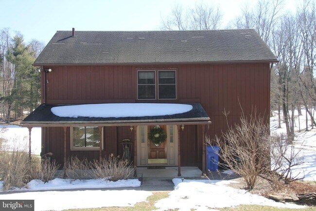
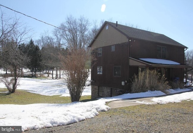
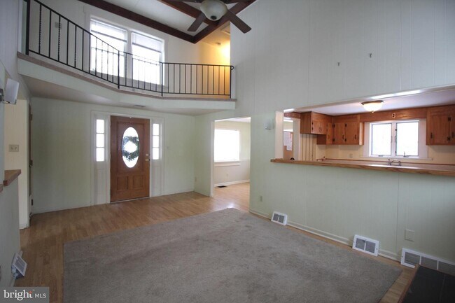
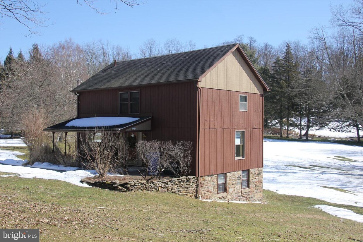
Welcome to this cozy cottage embraced by the bounty of nature. Close to downtown Pennington and Hopewell, this country retreat features approximately 2000 sq ft of living space built on 2 stories with ample attic and cellar storage as well as laundry facilities. The main floor invites you with 2 story cathedral ceilings and a wood fireplace, a great room, kitchen, dining room and a den which one may use for work, play or any other designation. 2 bedrooms and 1 full bath give a birds eye view of the property from the second floor. Welcome home!
48 Poor Farm Rd is a house located in Mercer County and the 08534 ZIP Code. This area is served by the Hopewell Valley Regional attendance zone.
House Features
- Air Conditioning
Location
Get Directions
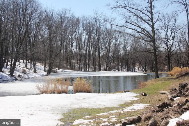
Located in the heart of Hopewell Township, Pennington-Hopewell is a mixture of small-town suburbia with a city feel. Renters will enjoy numerous outdoor amenities, from teeing off at Hopewell Valley Golf and Country Club, exploring hiking trails at Baldwin State Wildlife Management Area, to touring the Hopewell Valley Vineyards. The city has a variety of authentic restaurants where there are a variety of authentic Italian eateries, deli’s, pubs.
This neighborhood has a selection of ranch and colonial-style houses along with modern apartment complexes available for rent. Families will surely appreciate the highly-rated public schools in Pennington-Hopewell.
Learn more about living in Pennington/HopewellBelow are rent ranges for similar nearby apartments
Amenities
- Air Conditioning
Education
| Colleges & Universities | Distance | ||
|---|---|---|---|
| Colleges & Universities | Distance | ||
| Drive: | 23 min | 9.2 mi | |
| Drive: | 23 min | 10.5 mi | |
| Drive: | 33 min | 12.5 mi | |
| Drive: | 32 min | 17.9 mi |
48 Poor Farm Rd is within 23 minutes or 9.2 miles from The College of New Jersey. It is also near Rider Univ., Lawrenceville and Rider University, Princeton.
Schools


Public Elementary School
Grades PK-5
459 Students
Nearby
Public Elementary School
Grades PK-5
310 Students
Nearby
Public Middle School
Grades 6-8
780 Students
Nearby
Public High School
Grades 9-12
1,079 Students
Attendance Zone
Private Elementary & Middle School
Grades PK-8
Nearby
Private Elementary, Middle & High School
Grades 2-12
135 Students
Nearby
School data provided by
 The GreatSchools Rating helps parents compare schools within a state based on a variety of school quality indicators and provides a helpful picture of how effectively each school serves all of its students. Ratings are on a scale of 1 (below average) to 10 (above average) and can include test scores, college readiness, academic progress, advanced courses, equity, discipline and attendance data. We also advise parents to visit schools, consider other information on school performance and programs, and consider family needs as part of the school selection process.
View GreatSchools Rating Methodology
Data provided by GreatSchools.org © 2025. All rights reserved.
View GreatSchools Rating Methodology
Data provided by GreatSchools.org © 2025. All rights reserved.
You May Also Like
Similar Rentals Nearby
-
-

-

-

-

-

-

-

-
 $3,5003 Beds, 3.5 Baths, 2,000 sq ftHouse for Rent
 -

What Are Walk Score®, Transit Score®, and Bike Score® Ratings?
Walk Score® measures the walkability of any address. Transit Score® measures access to public transit. Bike Score® measures the bikeability of any address.
What is a Sound Score Rating?
A Sound Score Rating aggregates noise caused by vehicle traffic, airplane traffic and local sources
48 Poor Farm Rd
Pennington, NJ 08534