
58 Hamilton Ave
58 Hamilton Ave,
Passaic, NJ 07055
$3,275
3 Beds
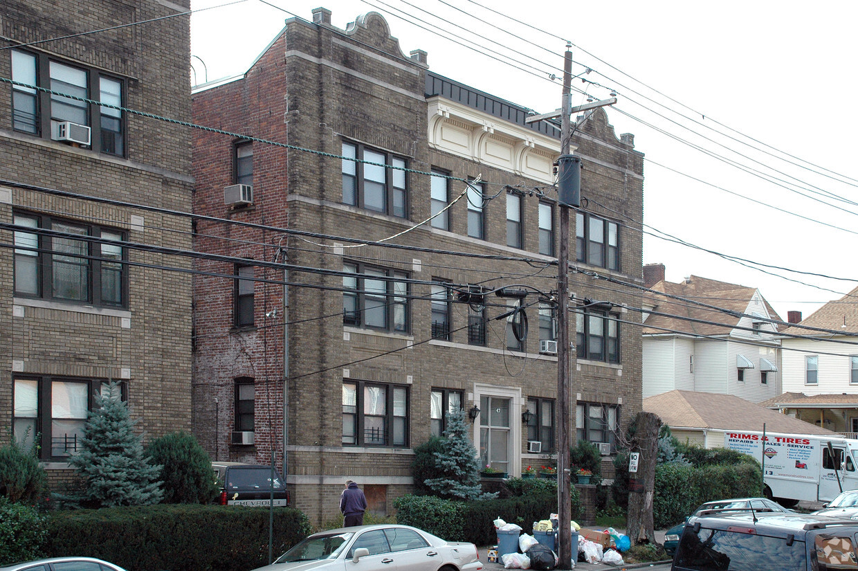
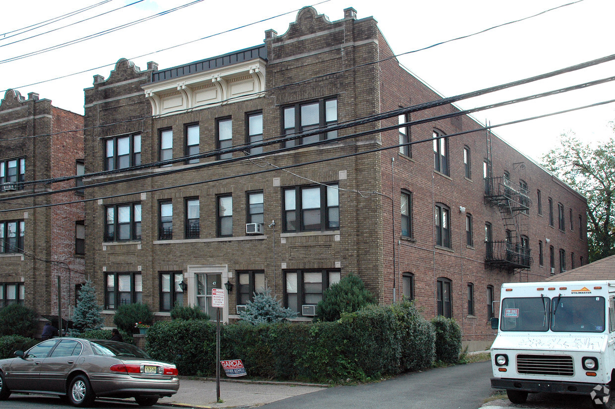

47 High St offers a blend of style and livability. The 07055 location in Passaic has much to offer its residents. Make sure you to check out the current floorplan options. Here at this community, the professional leasing team is ready to help you in finding your perfect new place. You're sure to live the good life at 47 High St. Contact or drop by the leasing office to schedule your tour.
47 High St is an apartment community located in Passaic County and the 07055 ZIP Code. This area is served by the Passaic City Public School District attendance zone.
Located about ten miles north of Newark, Passaic is a densely populated city strewn alongside the banks of the Passaic River. Passaic offers residents the best of urban and suburban living, from the bustle of Main Avenue to the natural beauty of the city’s many tranquil parks.
Main Avenue lies at the heart of Passaic, boasting an array of diverse restaurants, shops, and businesses in a vibrant, walkable locale. Passaic residents flock to the local Mayor Johnson Park, Third Ward Park, and Pulaski Park for outdoor recreation and to get in touch with nature close to home.
Residents have their choice of rentals in Passaic, which provides a broad range of apartments, condos, and townhomes available for rent. The city is often a popular choice for commuters, offering quick access to Route 21, Route 3, U.S. 46, and the Garden State Parkway as well as NJ Transit’s Port Jervis and Main/Bergen County lines.
Learn more about living in Passaic| Colleges & Universities | Distance | ||
|---|---|---|---|
| Colleges & Universities | Distance | ||
| Walk: | 5 min | 0.3 mi | |
| Drive: | 7 min | 2.6 mi | |
| Drive: | 6 min | 2.6 mi | |
| Drive: | 8 min | 4.7 mi |


Transportation options available in Passaic include Branch Brook Park, located 7.8 miles from 47 High St. 47 High St is near Newark Liberty International, located 15.1 miles or 19 minutes away, and LaGuardia, located 23.7 miles or 37 minutes away.
| Transit / Subway | Distance | ||
|---|---|---|---|
| Transit / Subway | Distance | ||
|
|
Drive: | 11 min | 7.8 mi |
|
|
Drive: | 12 min | 8.1 mi |
|
|
Drive: | 12 min | 8.2 mi |
|
|
Drive: | 12 min | 9.2 mi |
|
|
Drive: | 13 min | 10.0 mi |
| Commuter Rail | Distance | ||
|---|---|---|---|
| Commuter Rail | Distance | ||
|
|
Drive: | 2 min | 1.2 mi |
|
|
Drive: | 4 min | 1.9 mi |
|
|
Drive: | 4 min | 2.1 mi |
|
|
Drive: | 4 min | 2.3 mi |
| Drive: | 7 min | 3.0 mi |
| Airports | Distance | ||
|---|---|---|---|
| Airports | Distance | ||
|
Newark Liberty International
|
Drive: | 19 min | 15.1 mi |
|
LaGuardia
|
Drive: | 37 min | 23.7 mi |
Scores provided by
Traffic
-Airport
-Businesses
-Scores provided by
HowLoud What is a Sound Score Rating? A Sound Score Rating aggregates noise caused by vehicle traffic, airplane traffic and local sources. How It WorksTime and distance from 47 High St.
| Shopping Centers | Distance | ||
|---|---|---|---|
| Shopping Centers | Distance | ||
| Drive: | 3 min | 1.5 mi |
| Parks and Recreation | Distance | ||
|---|---|---|---|
| Parks and Recreation | Distance | ||
|
Meadowlands Environment Center
|
Drive: | 15 min | 6.4 mi |
|
McDowell Observatory
|
Drive: | 15 min | 6.4 mi |
|
Presby Memorial Iris Gardens
|
Drive: | 10 min | 6.5 mi |
|
Van Vleck House & Gardens
|
Drive: | 12 min | 6.6 mi |
|
Richard W. DeKorte Park
|
Drive: | 14 min | 8.0 mi |
| Hospitals | Distance | ||
|---|---|---|---|
| Hospitals | Distance | ||
| Walk: | 16 min | 0.9 mi | |
| Drive: | 6 min | 4.3 mi | |
| Drive: | 11 min | 7.2 mi |
| Military Bases | Distance | ||
|---|---|---|---|
| Military Bases | Distance | ||
| Drive: | 28 min | 17.4 mi | |
| Drive: | 25 min | 18.4 mi | |
| Drive: | 41 min | 26.5 mi |
What Are Walk Score®, Transit Score®, and Bike Score® Ratings?
Walk Score® measures the walkability of any address. Transit Score® measures access to public transit. Bike Score® measures the bikeability of any address.
What is a Sound Score Rating?
A Sound Score Rating aggregates noise caused by vehicle traffic, airplane traffic and local sources.

47 High St
Passaic, NJ 07055


