

$2,600
/ Month
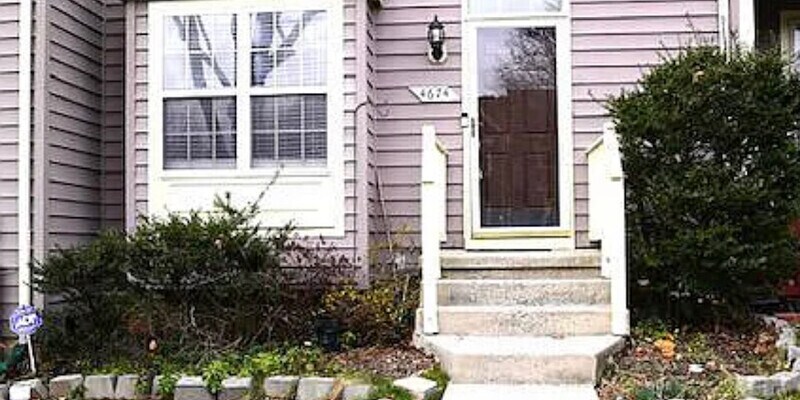
4674 Mews Dr
Owings Mills, MD 21117
2 Weeks Ago
|
Edit
Favorites
4674 Mews Dr

Favorites
Check Back Soon for Upcoming Availability
| Beds | Baths | Average SF |
|---|---|---|
| 3 Bedrooms 3 Bedrooms 3 Br | 3.5 Baths 3.5 Baths 3.5 Ba | 1,400 SF |
About This Property
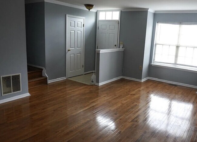
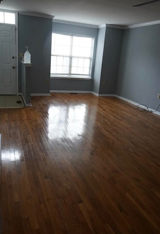
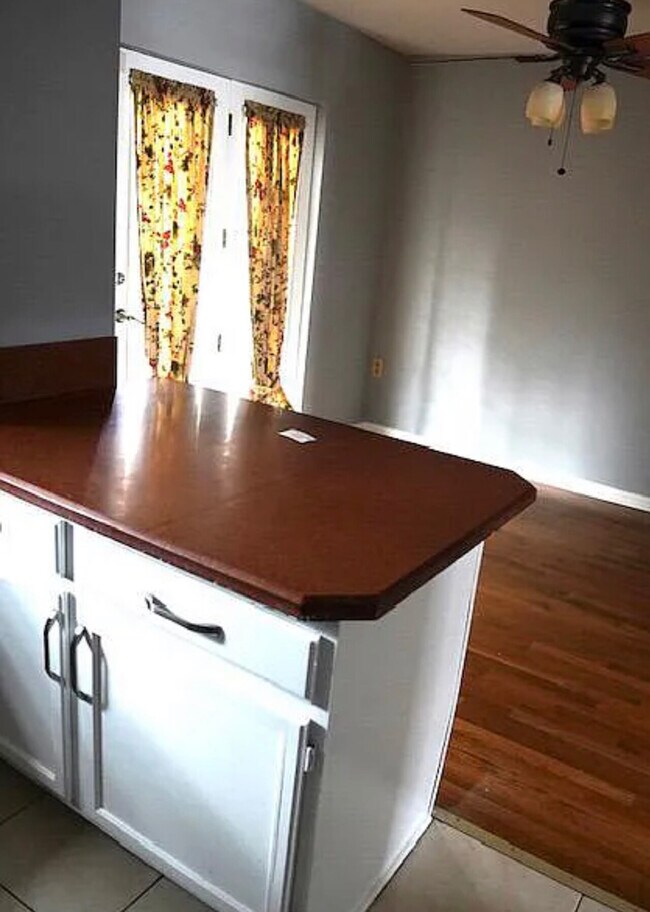
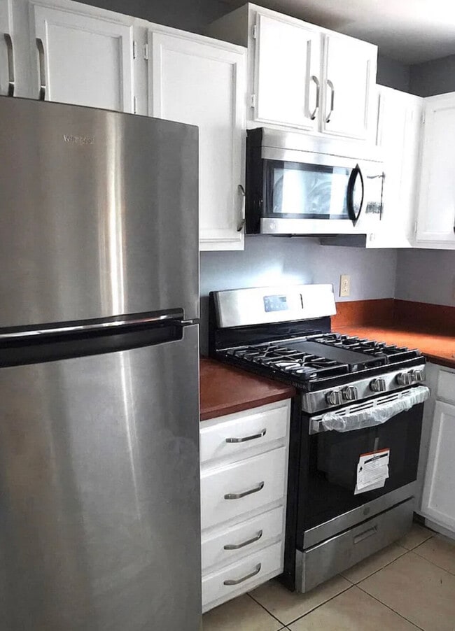
We have a 3 Bedroom 3.5 Bathroom property available in Owings Mills. We are actively accepting BRHP voucher recipients (For this property). For first-time BRHP voucher recipients, this property is in the census tract. Please contact our office ASAP as this property will not last long. The unit has central air/heat in addition to agreeable gray paint all throughout the home. Our number is .
4674 Mews Dr is a house located in Baltimore County and the 21117 ZIP Code. This area is served by the Baltimore County Public Schools attendance zone.
House Features
- Washer/Dryer
4674 Mews Dr,
Owings Mills,
MD
21117
Located in Baltimore County, Owings Mills combines suburban living with easy city access. This community northwest of Baltimore features natural attractions like Soldiers Delight Natural Environment Area, known for its rare serpentinite ecosystem. Residents enjoy convenient transportation via the Baltimore Metro Subway and shopping at Mill Station and Foundry Row, home to Wegmans and Costco. One-bedroom apartments in Owings Mills rent for $1,579 monthly, while two-bedroom units average $1,897, reflecting a 2.5% year-over-year increase.
The area is home to McDonogh School and Stevenson University, while major employers include T. Rowe Price, CareFirst, and the Baltimore Ravens' headquarters. Maryland Public Television studios adds to the community's media presence. With approximately 35,700 residents, Owings Mills offers various housing options from apartment communities to established neighborhoods, all within easy reach of Baltimore's attractions.
Learn more about living in Owings Mills
Amenities
- Washer/Dryer
Education
| Colleges & Universities | Distance | ||
|---|---|---|---|
| Colleges & Universities | Distance | ||
| Drive: | 9 min | 4.1 mi | |
| Drive: | 19 min | 8.7 mi | |
| Drive: | 29 min | 13.7 mi | |
| Drive: | 27 min | 16.4 mi |
4674 Mews Dr is within 9 minutes or 4.1 miles from Stevenson Univ., Owings Mills. It is also near Stevenson Univ., Greenspring and Coppin State University.
Schools


Public Elementary School
Grades PK-5
414 Students
Nearby
Public Elementary School
Grades PK-5
809 Students
Attendance Zone
Public Middle School
Grades 6-8
1,322 Students
Attendance Zone
Public High School
Grades 9-12
1,316 Students
Attendance Zone
Private Elementary & Middle School
Grades PK-8
95 Students
Nearby
Private Elementary, Middle & High School
Grades 2-12
174 Students
Nearby
School data provided by
 The GreatSchools Rating helps parents compare schools within a state based on a variety of school quality indicators and provides a helpful picture of how effectively each school serves all of its students. Ratings are on a scale of 1 (below average) to 10 (above average) and can include test scores, college readiness, academic progress, advanced courses, equity, discipline and attendance data. We also advise parents to visit schools, consider other information on school performance and programs, and consider family needs as part of the school selection process.
View GreatSchools Rating Methodology
Data provided by GreatSchools.org © 2026. All rights reserved.
View GreatSchools Rating Methodology
Data provided by GreatSchools.org © 2026. All rights reserved.
Transportation options available in Owings Mills include Old Court, located 6.3 miles from 4674 Mews Dr. 4674 Mews Dr is near Baltimore/Washington International Thurgood Marshall, located 21.3 miles or 34 minutes away.
| Transit / Subway | Distance | ||
|---|---|---|---|
| Transit / Subway | Distance | ||
| Drive: | 12 min | 6.3 mi | |
| Drive: | 18 min | 7.9 mi | |
| Drive: | 17 min | 9.7 mi | |
| Drive: | 21 min | 10.8 mi | |
| Drive: | 22 min | 11.6 mi |
| Commuter Rail | Distance | ||
|---|---|---|---|
| Commuter Rail | Distance | ||
| Drive: | 26 min | 16.7 mi | |
| Drive: | 26 min | 16.7 mi | |
| Drive: | 31 min | 17.2 mi | |
|
|
Drive: | 31 min | 19.8 mi |
| Drive: | 34 min | 21.3 mi |
| Airports | Distance | ||
|---|---|---|---|
| Airports | Distance | ||
|
Baltimore/Washington International Thurgood Marshall
|
Drive: | 34 min | 21.3 mi |
Time and distance from 4674 Mews Dr.
| Shopping Centers | Distance | ||
|---|---|---|---|
| Shopping Centers | Distance | ||
| Walk: | 7 min | 0.4 mi | |
| Drive: | 3 min | 1.5 mi | |
| Drive: | 5 min | 2.1 mi |
4674 Mews Dr has 3 shopping centers within 2.1 miles, which is about a 5-minute drive. The miles and minutes will be for the farthest away property.
| Parks and Recreation | Distance | ||
|---|---|---|---|
| Parks and Recreation | Distance | ||
|
Soldiers Delight Natural Environment Area (NEA)
|
Drive: | 6 min | 2.5 mi |
|
Irvine Nature Center
|
Drive: | 11 min | 5.1 mi |
|
Rodgers Farms
|
Drive: | 16 min | 8.0 mi |
|
Patapsco Valley State Park
|
Drive: | 23 min | 8.2 mi |
|
Mt Pleasant - Howard County Conservancy
|
Drive: | 24 min | 10.0 mi |
4674 Mews Dr has 5 parks within 10.0 miles, including Soldiers Delight Natural Environment Area (NEA), Irvine Nature Center, and Rodgers Farms.
| Hospitals | Distance | ||
|---|---|---|---|
| Hospitals | Distance | ||
| Drive: | 9 min | 4.8 mi | |
| Drive: | 19 min | 9.9 mi | |
| Drive: | 21 min | 12.1 mi |
4674 Mews Dr has 3 hospitals within 12.1 miles, the nearest is Northwest Hospital Center which is 4.8 miles away and a 9 minute drive.
| Military Bases | Distance | ||
|---|---|---|---|
| Military Bases | Distance | ||
| Drive: | 48 min | 29.3 mi |
4674 Mews Dr is 29.3 miles and a 48 minute drive from Fort George Meade.
You May Also Like
Similar Rentals Nearby


What Are Walk Score®, Transit Score®, and Bike Score® Ratings?
Walk Score® measures the walkability of any address. Transit Score® measures access to public transit. Bike Score® measures the bikeability of any address.
What is a Sound Score Rating?
A Sound Score Rating aggregates noise caused by vehicle traffic, airplane traffic and local sources
4674 Mews Dr
Owings Mills, MD 21117