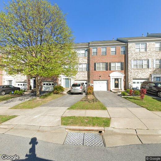
4641 Kings Mill Way
4641 Kings Mill Way
Owings Mills, MD 21117
2 Weeks Ago
|
Edit
Favorites
4641 Kings Mill Way

Favorites
Check Back Soon for Upcoming Availability
| Beds | Baths | Average SF |
|---|---|---|
| 3 Bedrooms 3 Bedrooms 3 Br | 2.5 Baths 2.5 Baths 2.5 Ba | — |
4641 Kings Mill Way,
Owings Mills,
MD
21117
Owings Mills is an unincorporated community in Baltimore County, sitting along Interstate 795 roughly 15 miles northwest of downtown Baltimore, where suburban scale and city access genuinely coexist. The Baltimore Metro Subway terminates here, making the commute into the city straightforward without requiring a car. Major employers with a local presence include T. Rowe Price, CareFirst BlueCross BlueShield, and the Baltimore Ravens' training and headquarters facility, giving the area a steady economic foundation. Maryland Public Television also operates its studios here, adding a notable media anchor to the community. Stevenson University calls Owings Mills home, contributing an academic presence that shapes the pace and personality of the area. Distinct pockets like New Town, Metro Centre, and the Foundry Row corridor each carry their own character, from walkable retail and dining to quieter, wooded residential streets.
Learn more about living in Owings Mills
Education
| Colleges & Universities | Distance | ||
|---|---|---|---|
| Colleges & Universities | Distance | ||
| Drive: | 8 min | 3.8 mi | |
| Drive: | 18 min | 7.7 mi | |
| Drive: | 28 min | 11.6 mi | |
| Drive: | 26 min | 14.0 mi |
4641 Kings Mill Way is within 8 minutes or 3.8 miles from Stevenson Univ., Owings Mills. It is also near Stevenson Univ., Greenspring and Coppin State University.
Transportation options available in Owings Mills include Old Court, located 5.4 miles from 4641 Kings Mill Way. 4641 Kings Mill Way is near Baltimore/Washington International Thurgood Marshall, located 21.0 miles or 33 minutes away.
| Transit / Subway | Distance | ||
|---|---|---|---|
| Transit / Subway | Distance | ||
| Drive: | 11 min | 5.4 mi | |
| Drive: | 17 min | 7.0 mi | |
| Drive: | 20 min | 8.7 mi | |
| Drive: | 16 min | 8.8 mi | |
| Drive: | 21 min | 9.5 mi |
| Commuter Rail | Distance | ||
|---|---|---|---|
| Commuter Rail | Distance | ||
| Drive: | 25 min | 16.4 mi | |
| Drive: | 25 min | 16.4 mi | |
| Drive: | 30 min | 16.9 mi | |
|
|
Drive: | 30 min | 17.4 mi |
| Drive: | 33 min | 21.0 mi |
| Airports | Distance | ||
|---|---|---|---|
| Airports | Distance | ||
|
Baltimore/Washington International Thurgood Marshall
|
Drive: | 33 min | 21.0 mi |
Walkability Near 4641 Kings Mill Way Owings Mills, MD 21117
Getting Around
 What do Walkability, Transit, Drivability, and Bikeability mean?
Walkability measures the walking distance to day-to-day needs.
Transit measures access to public transportation.
Drivability measures congestion, parking availability, and access to major roads.
Bikeability measures the suitability for cycling.
How It Works
What do Walkability, Transit, Drivability, and Bikeability mean?
Walkability measures the walking distance to day-to-day needs.
Transit measures access to public transportation.
Drivability measures congestion, parking availability, and access to major roads.
Bikeability measures the suitability for cycling.
How It Works
Fairly Walkable
Walkability
50
/ 100
Minimal Public Transit
Transit
10
/ 100
Very Drivable
Drivability
80
/ 100
Fairly Bikeable
Bikeability
40
/ 100
Scores provided by
-
Soundscore™
-
/ 100
Traffic
-Airport
-Businesses
-Scores provided by
HowLoud What is a Sound Score Rating? A Sound Score Rating aggregates noise caused by vehicle traffic, airplane traffic and local sources. How It WorksTime and distance from 4641 Kings Mill Way.
| Shopping Centers | Distance | ||
|---|---|---|---|
| Shopping Centers | Distance | ||
| Drive: | 3 min | 1.2 mi | |
| Drive: | 5 min | 1.7 mi | |
| Drive: | 4 min | 1.8 mi |
4641 Kings Mill Way has 3 shopping centers within 1.8 miles, which is about a 4-minute drive. The miles and minutes will be for the farthest away property.
| Parks and Recreation | Distance | ||
|---|---|---|---|
| Parks and Recreation | Distance | ||
|
Soldiers Delight Natural Environment Area (NEA)
|
Drive: | 6 min | 2.9 mi |
|
Irvine Nature Center
|
Drive: | 10 min | 4.8 mi |
|
Rodgers Farms
|
Drive: | 15 min | 7.0 mi |
|
Patapsco Valley State Park
|
Drive: | 20 min | 7.4 mi |
|
Mt Pleasant - Howard County Conservancy
|
Drive: | 21 min | 8.9 mi |
4641 Kings Mill Way has 5 parks within 8.9 miles, including Soldiers Delight Natural Environment Area (NEA), Irvine Nature Center, and Rodgers Farms.
| Hospitals | Distance | ||
|---|---|---|---|
| Hospitals | Distance | ||
| Drive: | 8 min | 3.9 mi | |
| Drive: | 20 min | 8.9 mi | |
| Drive: | 16 min | 9.1 mi |
4641 Kings Mill Way has 3 hospitals within 9.1 miles, the nearest is Northwest Hospital Center which is 3.9 miles away and a 8 minute drive.
| Military Bases | Distance | ||
|---|---|---|---|
| Military Bases | Distance | ||
| Drive: | 47 min | 28.9 mi |
4641 Kings Mill Way is 28.9 miles and a 47 minute drive from Fort George Meade.
You May Also Like
Similar Rentals Nearby


What Are Walk Score®, Transit Score®, and Bike Score® Ratings?
Walk Score® measures the walkability of any address. Transit Score® measures access to public transit. Bike Score® measures the bikeability of any address.
What is a Sound Score Rating?
A Sound Score Rating aggregates noise caused by vehicle traffic, airplane traffic and local sources.

4641 Kings Mill Way
Owings Mills, MD 21117