
$2,500 / Month
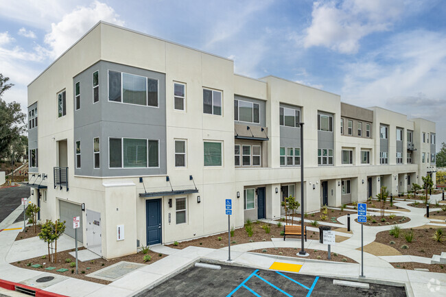
464 Margaret Ave
East Los Angeles, CA 90022
2 Weeks Ago
Favorites
464 Margaret Ave

Favorites
Check Back Soon for Upcoming Availability
| Beds | Baths | Average SF |
|---|---|---|
| 2 Bedrooms 2 Bedrooms 2 Br | 1 Bath 1 Bath 1 Ba | 800 SF |
Fees and Policies
The fees below are based on community-supplied data and may exclude additional fees and utilities.
- Parking
-
Street--Assigned Parking
-
Other--Assigned Parking
Details
Utilities Included
-
Trash Removal
Lease Options
-
12 Months
About This Property
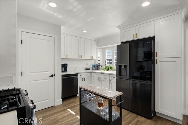
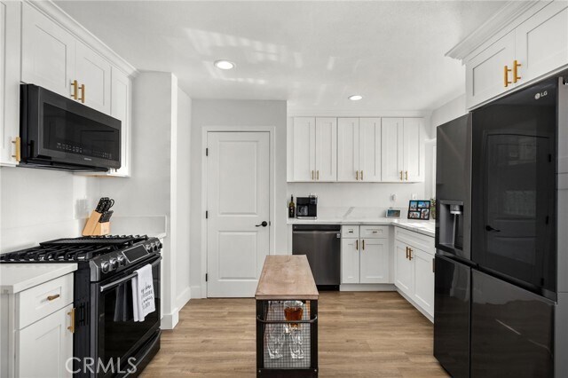
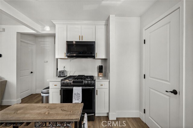
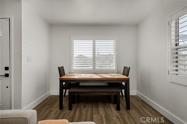
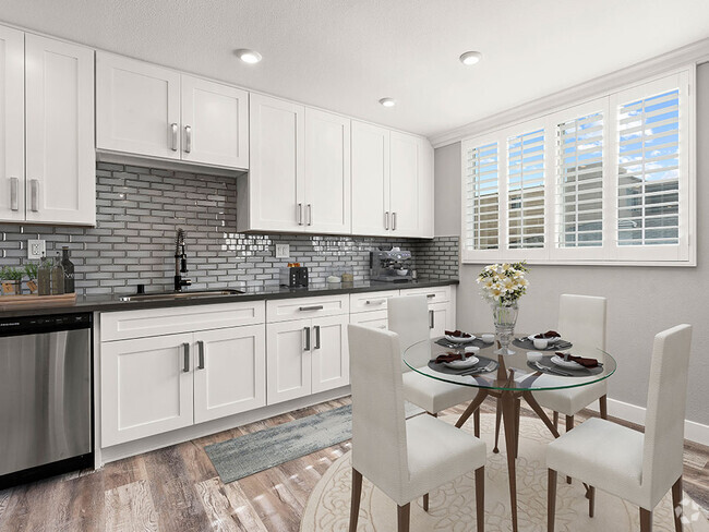
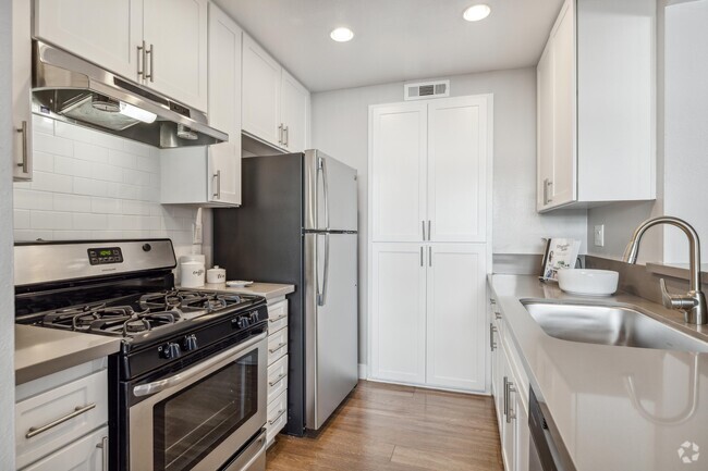
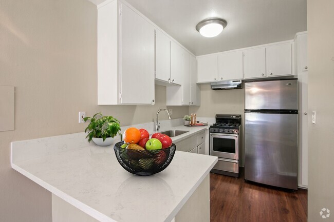
Come check out this cozy 2 bedroom 1 bathroom home in the heart of East Los Angeles. Located near the 60 freeway and only 10 minutes away from Downtown LA! Worried about traffic? Well don't be! You can walk to the gold line train station on Atlantic, which is only a few minutes away! Not to mention, local to shopping centers, grocery stores, and some amazing hole-in-the wall restaurants! This home is completely remodeled and move-in ready! This stunning home has laminate flooring, custom shutters, central air and heating, and a stackable washer and dryer room. This property includes 1 parking spot in the driveway. What more can you ask for ? This is the perfect place for you!
464 Margaret Ave is a townhome located in Los Angeles County and the 90022 ZIP Code. This area is served by the Los Angeles Unified attendance zone.
Townhome Features
Washer/Dryer
Air Conditioning
Dishwasher
Microwave
- Washer/Dryer
- Air Conditioning
- Heating
- Dishwasher
- Microwave
- Range
- Vinyl Flooring
- Dining Room
- Views
- Double Pane Windows
- Window Coverings
- Fenced Lot
- Patio
Location
Get Directions
Southeast Los Angeles is directly south of the Fashion District and east of the University of Southern California (USC). This large neighborhood is minutes from downtown Los Angeles, Hollywood, and Beverly Hills, with easy access to the 110 Freeway. This great location places you near sunny beaches, nature trails, and a bevy of leading employers. Students can access both USC and California State University Long Beach from their Southeast LA apartment.
This densely populated, diverse neighborhood features everything from food trucks and corner markets to wide sidewalks and residential areas filled with bungalows, ranch, and Spanish Colonial architecture. Southeast LA features palm trees and mountain views, tampered with gritty undertones to give it a cool, funky vibe.
As for outdoor fun, take your pick between Catalina Island, Venus Beach, or the Santa Monica Pier. Nearby, you’ll find more sunny beaches like White Point, Cabrillo, and Long Beach.
Learn more about living in Southeast Los AngelesBelow are rent ranges for similar nearby apartments
Amenities
- Washer/Dryer
- Air Conditioning
- Heating
- Dishwasher
- Microwave
- Range
- Vinyl Flooring
- Dining Room
- Views
- Double Pane Windows
- Window Coverings
- Fenced Lot
- Patio
Expenses
Utilities Included
Trash Removal
Included
Education
| Colleges & Universities | Distance | ||
|---|---|---|---|
| Colleges & Universities | Distance | ||
| Drive: | 3 min | 1.4 mi | |
| Drive: | 9 min | 4.5 mi | |
| Drive: | 12 min | 5.5 mi | |
| Drive: | 14 min | 6.5 mi |
464 Margaret Ave is within 3 minutes or 1.4 miles from East Los Angeles College. It is also near Cal State Los Angeles and USC, Health Sciences Campus.
Schools


Charter Elementary School
Grades K-5
75 Students
Nearby
Public Elementary School
Grades K-1
182 Students
Attendance Zone
Public Elementary School
Grades 2-5
295 Students
Attendance Zone
Public Middle School
Grades 6-8
1,189 Students
Attendance Zone
Public High School
Grades 9-12
218 Students
Attendance Zone
Private Elementary & Middle School
Grades PK-8
245 Students
Nearby
Private Elementary, Middle & High School
Grades K-12
15 Students
Nearby
Private Elementary & Middle School
Grades K-8
118 Students
Nearby
School data provided by
 The GreatSchools Rating helps parents compare schools within a state based on a variety of school quality indicators and provides a helpful picture of how effectively each school serves all of its students. Ratings are on a scale of 1 (below average) to 10 (above average) and can include test scores, college readiness, academic progress, advanced courses, equity, discipline and attendance data. We also advise parents to visit schools, consider other information on school performance and programs, and consider family needs as part of the school selection process.
View GreatSchools Rating Methodology
View GreatSchools Rating Methodology
Transportation options available in East Los Angeles include Atlantic, located 0.6 mile from 464 Margaret Ave. 464 Margaret Ave is near Long Beach (Daugherty Field), located 19.1 miles or 29 minutes away, and Los Angeles International, located 21.9 miles or 33 minutes away.
| Transit / Subway | Distance | ||
|---|---|---|---|
| Transit / Subway | Distance | ||
|
|
Walk: | 12 min | 0.6 mi |
|
|
Walk: | 17 min | 0.9 mi |
| Drive: | 3 min | 1.5 mi | |
|
|
Drive: | 6 min | 3.7 mi |
|
|
Drive: | 8 min | 5.0 mi |
| Commuter Rail | Distance | ||
|---|---|---|---|
| Commuter Rail | Distance | ||
|
|
Drive: | 6 min | 2.7 mi |
|
|
Drive: | 9 min | 4.0 mi |
|
|
Drive: | 12 min | 7.6 mi |
|
|
Drive: | 14 min | 7.8 mi |
| Drive: | 16 min | 11.5 mi |
| Airports | Distance | ||
|---|---|---|---|
| Airports | Distance | ||
|
Long Beach (Daugherty Field)
|
Drive: | 29 min | 19.1 mi |
|
Los Angeles International
|
Drive: | 33 min | 21.9 mi |
Time and distance from 464 Margaret Ave.
| Shopping Centers | Distance | ||
|---|---|---|---|
| Shopping Centers | Distance | ||
| Walk: | 12 min | 0.6 mi | |
| Walk: | 12 min | 0.7 mi | |
| Walk: | 13 min | 0.7 mi |
464 Margaret Ave has 3 shopping centers within 0.7 mile, which is about a 13-minute walk. The miles and minutes will be for the farthest away property.
| Parks and Recreation | Distance | ||
|---|---|---|---|
| Parks and Recreation | Distance | ||
|
Hollenbeck Lake
|
Drive: | 9 min | 5.2 mi |
|
Pio Pico State Historic Park
|
Drive: | 12 min | 6.0 mi |
|
Whittier Narrows Recreation Area
|
Drive: | 12 min | 6.8 mi |
|
Augustus Hawkins Natural Park
|
Drive: | 14 min | 9.2 mi |
|
Audubon Center at Debs Park
|
Drive: | 16 min | 10.6 mi |
464 Margaret Ave has 5 parks within 10.6 miles, including Hollenbeck Lake, Pio Pico State Historic Park, and Whittier Narrows Recreation Area.
| Hospitals | Distance | ||
|---|---|---|---|
| Hospitals | Distance | ||
| Drive: | 4 min | 2.0 mi | |
| Drive: | 6 min | 2.4 mi | |
| Drive: | 6 min | 2.7 mi |
464 Margaret Ave has 3 hospitals within 2.7 miles, the nearest is Monterey Park Hospital which is 2.0 miles away and a 4 minute drive.
| Military Bases | Distance | ||
|---|---|---|---|
| Military Bases | Distance | ||
| Drive: | 31 min | 20.7 mi | |
| Drive: | 31 min | 23.5 mi |
464 Margaret Ave is 20.7 miles from Los Alamitos Army Airfield, and is convenient to other military bases, including Los Angeles Air Force Base.
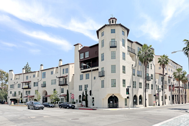
You May Also Like
Similar Rentals Nearby
-
-
-
-
-
1 / 50
-
-
-
-
-

What Are Walk Score®, Transit Score®, and Bike Score® Ratings?
Walk Score® measures the walkability of any address. Transit Score® measures access to public transit. Bike Score® measures the bikeability of any address.
What is a Sound Score Rating?
A Sound Score Rating aggregates noise caused by vehicle traffic, airplane traffic and local sources
464 Margaret Ave
East Los Angeles, CA 90022