450 N Civic Dr Unit 502
Walnut Creek, CA 94596
Check Back Soon for Upcoming Availability
| Beds | Baths | Average SF |
|---|---|---|
| 3 Bedrooms 3 Bedrooms 3 Br | 2 Baths 2 Baths 2 Ba | 1,328 SF |
About This Property
Condo for Rent! Rare 3 bed/2 bath penthouse with fireplace in The Keys complex. One big patio and two balconies with a view of Mount Diablo give you the feeling of resort style living right in your home. Amenities include: basketball court,BBQ/picnic area,bike & walking paths,clubhouse,gym,ponds,spa/jacuzzi,swimming pool & tennis court. The ideal location with the best of Walnut Creek right down the street with several parks and public schools nearby. Residents enjoy prime access to the wealth of shopping,dining,and entertainment in the city center,from the high-end Broadway Plaza open-air mall to the eclectic cafes and bars along Main Street. With convenient access to Interstate 680 and the Pleasant Hill/Walnut Creek BART stations,living in The Keys puts the entire bay area at your fingertips. To apply go to:
450 N Civic Dr is a condo located in Contra Costa County and the 94596 ZIP Code. This area is served by the Walnut Creek Elementary School District attendance zone.
The Keys is a small suburban neighborhood located just a few blocks north of Downtown Walnut Creek. The neighborhood itself is almost entirely residential, with several parks and public schools nearby. Residents enjoy prime access to the wealth of shopping, dining, and entertainment in the city center, from the high-end Broadway Plaza open-air mall to the eclectic cafes and bars along Main Street. With convenient access to Interstate 680 and the Pleasant Hill/Contra Costa Centre BART station, living in The Keys puts the entire bay area at your fingertips.
Learn more about living in The KeysBelow are rent ranges for similar nearby apartments
| Colleges & Universities | Distance | ||
|---|---|---|---|
| Colleges & Universities | Distance | ||
| Drive: | 11 min | 4.6 mi | |
| Drive: | 18 min | 7.7 mi | |
| Drive: | 25 min | 15.3 mi | |
| Drive: | 29 min | 19.1 mi |
The GreatSchools Rating helps parents compare schools within a state based on a variety of school quality indicators and provides a helpful picture of how effectively each school serves all of its students. Ratings are on a scale of 1 (below average) to 10 (above average) and can include test scores, college readiness, academic progress, advanced courses, equity, discipline and attendance data. We also advise parents to visit schools, consider other information on school performance and programs, and consider family needs as part of the school selection process.
View GreatSchools Rating Methodology
Data provided by GreatSchools.org © 2026. All rights reserved.
Transportation options available in Walnut Creek include Walnut Creek, located 1.0 miles from 450 N Civic Dr Unit 502. 450 N Civic Dr Unit 502 is near Metro Oakland International, located 25.1 miles or 35 minutes away, and San Francisco International, located 37.1 miles or 53 minutes away.
| Transit / Subway | Distance | ||
|---|---|---|---|
| Transit / Subway | Distance | ||
|
|
Walk: | 19 min | 1.0 mi |
|
|
Walk: | 20 min | 1.1 mi |
|
|
Drive: | 8 min | 5.1 mi |
|
|
Drive: | 10 min | 5.5 mi |
|
|
Drive: | 11 min | 7.1 mi |
| Commuter Rail | Distance | ||
|---|---|---|---|
| Commuter Rail | Distance | ||
|
|
Drive: | 16 min | 11.0 mi |
| Drive: | 25 min | 16.5 mi | |
|
|
Drive: | 25 min | 18.2 mi |
|
|
Drive: | 27 min | 19.7 mi |
| Drive: | 36 min | 25.9 mi |
| Airports | Distance | ||
|---|---|---|---|
| Airports | Distance | ||
|
Metro Oakland International
|
Drive: | 35 min | 25.1 mi |
|
San Francisco International
|
Drive: | 53 min | 37.1 mi |
Time and distance from 450 N Civic Dr Unit 502.
| Shopping Centers | Distance | ||
|---|---|---|---|
| Shopping Centers | Distance | ||
| Walk: | 10 min | 0.5 mi | |
| Walk: | 11 min | 0.6 mi | |
| Drive: | 3 min | 1.1 mi |
| Parks and Recreation | Distance | ||
|---|---|---|---|
| Parks and Recreation | Distance | ||
|
Civic Park
|
Walk: | 18 min | 1.0 mi |
|
Butterfly Habitat Gardens
|
Walk: | 18 min | 1.0 mi |
|
Contra Costa Canal Regional Trail
|
Drive: | 3 min | 1.5 mi |
|
Gardens at Heather Farm
|
Drive: | 5 min | 2.2 mi |
|
Heather Farm Park
|
Drive: | 5 min | 2.3 mi |
| Hospitals | Distance | ||
|---|---|---|---|
| Hospitals | Distance | ||
| Drive: | 3 min | 1.8 mi | |
| Drive: | 4 min | 1.8 mi | |
| Drive: | 9 min | 6.0 mi |
| Military Bases | Distance | ||
|---|---|---|---|
| Military Bases | Distance | ||
| Drive: | 28 min | 10.9 mi | |
| Drive: | 18 min | 13.0 mi | |
| Drive: | 35 min | 18.2 mi |
You May Also Like
Similar Rentals Nearby
-
3 Beds, 2 Baths, 1,154 sq ft$3,800Total Monthly Price12 Month LeaseTotal Monthly Price NewPrices include all required monthly fees.
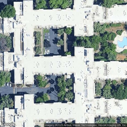
1121 40th St Unit Andante
-
3 Beds, 1.5 Baths, 1,450 sq ft$3,095Total Monthly Price12 Month LeaseTotal Monthly Price NewPrices include all required monthly fees.695 30th St
-
5 Beds, 3 Baths, 1,500 sq ft$4,195Total Monthly Price12 Month LeaseTotal Monthly Price NewPrices include all required monthly fees.1303 Adeline St Unit 1303
-
3 Beds, 2 Baths, 1,400 sq ft$9,995Total Monthly Price12 Month LeaseTotal Monthly Price NewPrices include all required monthly fees.1810 20th St Unit 1810
-
-
-
-
-
-
What Are Walk Score®, Transit Score®, and Bike Score® Ratings?
Walk Score® measures the walkability of any address. Transit Score® measures access to public transit. Bike Score® measures the bikeability of any address.
What is a Sound Score Rating?
A Sound Score Rating aggregates noise caused by vehicle traffic, airplane traffic and local sources.