

$4,400
/ Month
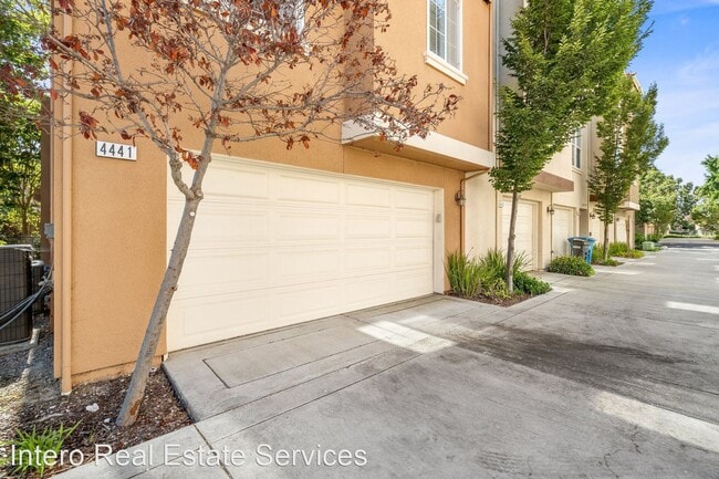
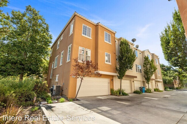
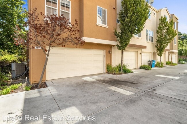
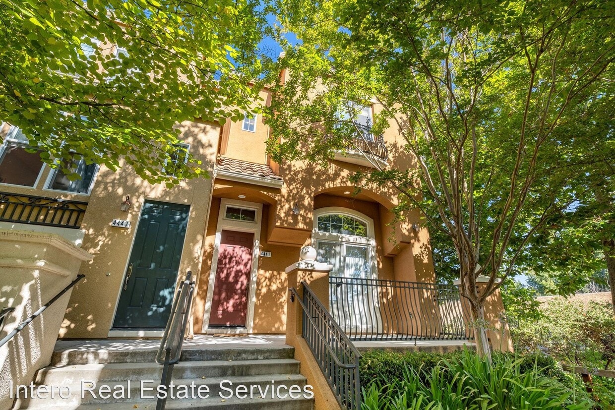
4441 Laird Cir
Santa Clara, CA 95054
2 Weeks Ago
Favorites
4441 Laird Cir

Favorites
Check Back Soon for Upcoming Availability
| Beds | Baths | Average SF |
|---|---|---|
| 3 Bedrooms 3 Bedrooms 3 Br | 2.5 Baths 2.5 Baths 2.5 Ba | 1,700 SF |
About This Property
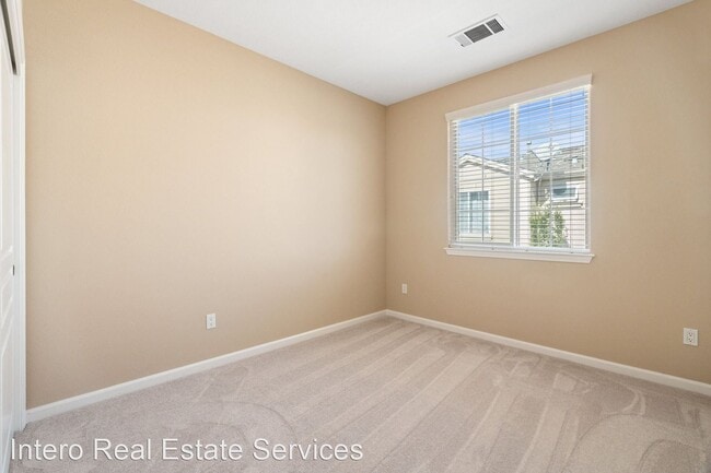
- PEACEFUL CORNER HOME OVERLOOKS GUADALUPE RIVER TRAIL - Offering perhaps the most private setting in all of Rivermark, this end-unit townhome follows the Park Plan III and enjoys a window-lined layout with views of Guadalupe River Trail. Bright, breezy, and spacious interiors include a living room with central fireplace overlooked by an open-concept dining room. A family/breakfast room flows into the large and well-appointed kitchen. Upstairs, a convenient laundry center joins three bedrooms, including a luxurious primary suite with walk-in closet, dual vanities, soaking tub, and separate shower. The attached two-car garage boasts extensive storage. Details include recessed lights, transom windows, and central AC. This location between Thamien Park and Ulistac Natural Area places you just moments from recreation, the community pool, Live Oak Park, Don Callejon School (K-8), and shopping and dining at Rivermark Village. Near Oracle, Intel, Google, Levi’s Stadium, and much more! Updates include: new paint, updated kitchen, new carpet, and more. • 3 Bedrooms • 2.5 Bathrooms • House | 1,700 SF (RLNE8226829)
4441 Laird Cir is a house located in Santa Clara County and the 95054 ZIP Code. This area is served by the Santa Clara Unified attendance zone.
Location
Get Directions
Folks around the Bay Area most likely know Santa Clara as the location of Levi’s Stadium, home field for the San Francisco 49ers and host venue for college bowl games and various concerts. While the stadium has certainly redefined the city’s public image, the community retains a diverse palette of cultural offerings.
Like much of Silicon Valley, the tech sector is heavily represented in Santa Clara, and serves as one of the most prominent industries in town. The Triton and DeSaissit Museums bring unique art exhibits to the city, while attractions like California’s Great America and Central Park provide excellent opportunities for family-friendly outdoor fun. With San Jose right next door, the options for shopping, dining, and entertainment become nearly endless.
Learn more about living in Santa Clara
Education
| Colleges & Universities | Distance | ||
|---|---|---|---|
| Colleges & Universities | Distance | ||
| Drive: | 5 min | 2.2 mi | |
| Drive: | 10 min | 4.8 mi | |
| Drive: | 14 min | 6.9 mi | |
| Drive: | 15 min | 7.1 mi |
4441 Laird Cir is within 5 minutes or 2.2 miles from Palmer College of Chiropractic West Campus. It is also near Santa Clara University and San Jose State University.
Schools


Public Elementary, Middle & High School
Grades K-12
912 Students
Nearby
Public Elementary & Middle School
Grades K-8
581 Students
Attendance Zone
Public High School
Grades 9-12
1,849 Students
Attendance Zone
Private Elementary, Middle & High School
Grades PK-12
244 Students
Nearby
School data provided by
 The GreatSchools Rating helps parents compare schools within a state based on a variety of school quality indicators and provides a helpful picture of how effectively each school serves all of its students. Ratings are on a scale of 1 (below average) to 10 (above average) and can include test scores, college readiness, academic progress, advanced courses, equity, discipline and attendance data. We also advise parents to visit schools, consider other information on school performance and programs, and consider family needs as part of the school selection process.
View GreatSchools Rating Methodology
Data provided by GreatSchools.org © 2025. All rights reserved.
View GreatSchools Rating Methodology
Data provided by GreatSchools.org © 2025. All rights reserved.
Transportation options available in Santa Clara include River Oaks Station, located 1.5 miles from 4441 Laird Cir. 4441 Laird Cir is near Norman Y Mineta San Jose International, located 3.7 miles or 8 minutes away, and Metro Oakland International, located 33.2 miles or 44 minutes away.
| Transit / Subway | Distance | ||
|---|---|---|---|
| Transit / Subway | Distance | ||
|
|
Drive: | 4 min | 1.5 mi |
| Drive: | 3 min | 1.5 mi | |
|
|
Drive: | 4 min | 1.7 mi |
| Drive: | 4 min | 1.7 mi | |
|
|
Drive: | 4 min | 1.9 mi |
| Commuter Rail | Distance | ||
|---|---|---|---|
| Commuter Rail | Distance | ||
| Drive: | 4 min | 1.7 mi | |
| Drive: | 9 min | 4.5 mi | |
| Drive: | 10 min | 4.6 mi | |
| Drive: | 9 min | 4.8 mi | |
| Drive: | 11 min | 6.0 mi |
| Airports | Distance | ||
|---|---|---|---|
| Airports | Distance | ||
|
Norman Y Mineta San Jose International
|
Drive: | 8 min | 3.7 mi |
|
Metro Oakland International
|
Drive: | 44 min | 33.2 mi |
Time and distance from 4441 Laird Cir.
| Shopping Centers | Distance | ||
|---|---|---|---|
| Shopping Centers | Distance | ||
| Walk: | 11 min | 0.6 mi | |
| Walk: | 19 min | 1.0 mi | |
| Drive: | 5 min | 2.1 mi |
4441 Laird Cir has 3 shopping centers within 2.1 miles, which is about a 5-minute walk. The miles and minutes will be for the farthest away property.
| Parks and Recreation | Distance | ||
|---|---|---|---|
| Parks and Recreation | Distance | ||
|
Live Oak Park - Santa Clara
|
Walk: | 9 min | 0.5 mi |
|
Ulistac Natural Area
|
Walk: | 12 min | 0.7 mi |
|
Alviso Marina County Park
|
Drive: | 6 min | 2.8 mi |
|
Sunnyvale Baylands Park
|
Drive: | 10 min | 4.0 mi |
|
Penitencia Creek County Park
|
Drive: | 13 min | 7.0 mi |
4441 Laird Cir has 5 parks within 7.0 miles, including Live Oak Park - Santa Clara, Ulistac Natural Area, and Alviso Marina County Park.
| Hospitals | Distance | ||
|---|---|---|---|
| Hospitals | Distance | ||
| Drive: | 13 min | 6.8 mi | |
| Drive: | 12 min | 7.2 mi | |
| Drive: | 13 min | 7.3 mi |
4441 Laird Cir has 3 hospitals within 7.3 miles, the nearest is Santa Clara Valley Medical Center which is 6.8 miles away and a 13 minute drive.
| Military Bases | Distance | ||
|---|---|---|---|
| Military Bases | Distance | ||
| Drive: | 16 min | 9.1 mi |
4441 Laird Cir is 9.1 miles and a 16 minute drive from Ames Research Center.
You May Also Like
Similar Rentals Nearby


What Are Walk Score®, Transit Score®, and Bike Score® Ratings?
Walk Score® measures the walkability of any address. Transit Score® measures access to public transit. Bike Score® measures the bikeability of any address.
What is a Sound Score Rating?
A Sound Score Rating aggregates noise caused by vehicle traffic, airplane traffic and local sources
4441 Laird Cir
Santa Clara, CA 95054