$6,495
/ Month
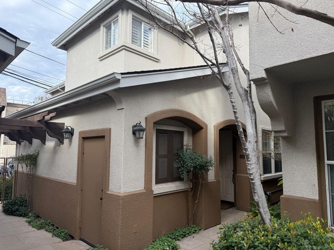
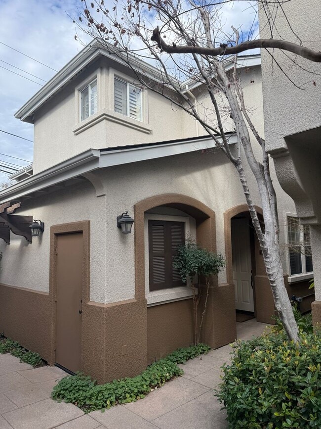
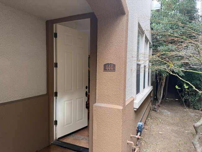
444 Tyndall St
Los Altos, CA 94022
1 Day Ago
|
Edit
Favorites
408-689-7759
-
Bedrooms
3
-
Bathrooms
2.5
-
Square Feet
1,700 sq ft
-
Available
Available Now
444 Tyndall St

Favorites
About This Home
$6,495 deposit,
Available Now
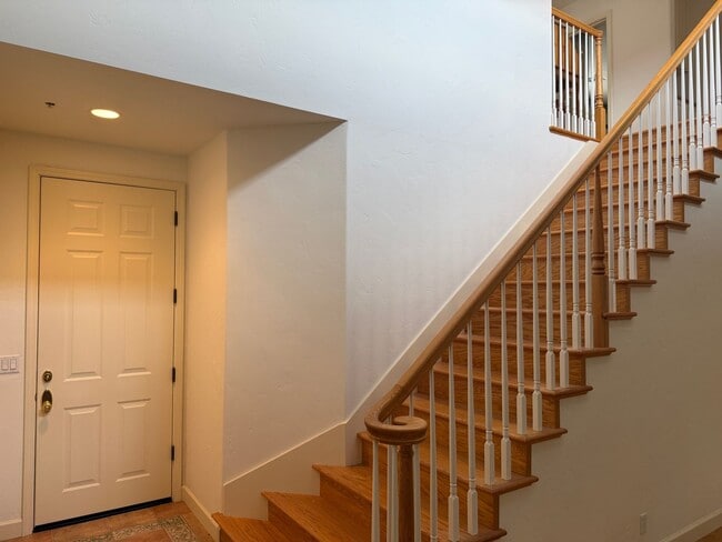
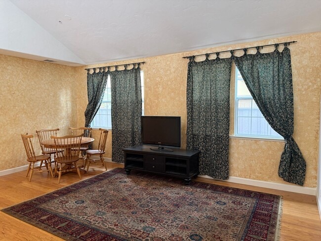
Great townhouse in a prime Los Altos location. Walking distance to the downtown area with all of the shopping and restaurants. This home has furniture in it that can stay or we will remove everything at tenant request. 3 bedrooms including a large master suite with custom bath. Upstairs also features a reading/study nook for work from home or school. Big kitchen with island and adjacent family room with fireplace. Comfortable and private patio for the warm summer evenings. No pets. Tenant insurance required. Application fee is $45. Easy application process on our website at We are a property management company located in San Jose, CA. Please be aware of frauds and scams. We will never ask for funds in advance or to wire any money. We will meet you at the property to personally show you the home.
444 Tyndall St is a house located in Santa Clara County and the 94022 ZIP Code. This area is served by the Los Altos Elementary attendance zone.
* Price shown is base rent. Excludes user-selected optional fees and variable or usage-based fees and required charges due at or prior to move-in or at move-out. Price, availability, fees, and any applicable rent special are subject to change without notice.
* Square footage definitions vary. Displayed square footage is approximate.
Contact
- Listed by Fireside Property Management | Fireside Property Management
- Phone Number
- Contact
Location
Get Directions
North Los Altos contains the city’s vibrant commercial centers. The many shops and eateries of Main Street are in the southern portion of North Los Altos, while the diverse restaurants and cafes of San Antonio Road are in the northern stretches near San Antonio Center.
Outside of these commercial areas, North Los Altos is predominantly residential, offering an array of apartments available for rent along tree-lined avenues. Many of the rentals in North Los Altos feature stunning mountain views, as well as close proximity to Mountain View, Foothill College, Stanford University, and Palo Alto. Getting around from North Los Altos is simple with access to El Camino Real, Interstate 280, and San Antonio Station.
Learn more about living in North Los Altos
Education
| Colleges & Universities | Distance | ||
|---|---|---|---|
| Colleges & Universities | Distance | ||
| Drive: | 5 min | 1.7 mi | |
| Drive: | 8 min | 3.4 mi | |
| Drive: | 12 min | 5.6 mi | |
| Drive: | 12 min | 6.2 mi |
444 Tyndall St is within 5 minutes or 1.7 miles from Foothill Coll., Los Altos. It is also near Foothill College, Middlefield and Stanford University.
Schools


Public Elementary School
Grades K-6
404 Students
Attendance Zone
Public Elementary School
Grades K-5
407 Students
Nearby
Public Middle School
Grades 7-8
517 Students
Attendance Zone
Public High School
Grades 9-12
2,170 Students
Attendance Zone
Private Elementary School
Grades K-6
67 Students
Nearby
Private Elementary & Middle School
Grades 1-8
282 Students
Nearby
Private High School
Grades 9-12
1,745 Students
Nearby
School data provided by
 The GreatSchools Rating helps parents compare schools within a state based on a variety of school quality indicators and provides a helpful picture of how effectively each school serves all of its students. Ratings are on a scale of 1 (below average) to 10 (above average) and can include test scores, college readiness, academic progress, advanced courses, equity, discipline and attendance data. We also advise parents to visit schools, consider other information on school performance and programs, and consider family needs as part of the school selection process.
View GreatSchools Rating Methodology
Data provided by GreatSchools.org © 2026. All rights reserved.
View GreatSchools Rating Methodology
Data provided by GreatSchools.org © 2026. All rights reserved.
Transportation options available in Los Altos include Whisman Station, located 4.2 miles from 444 Tyndall St. 444 Tyndall St is near Norman Y Mineta San Jose International, located 12.0 miles or 21 minutes away, and San Francisco International, located 26.1 miles or 36 minutes away.
| Transit / Subway | Distance | ||
|---|---|---|---|
| Transit / Subway | Distance | ||
|
|
Drive: | 11 min | 4.2 mi |
| Drive: | 8 min | 4.3 mi | |
|
|
Drive: | 10 min | 4.5 mi |
| Drive: | 12 min | 5.3 mi | |
| Drive: | 13 min | 6.2 mi |
| Commuter Rail | Distance | ||
|---|---|---|---|
| Commuter Rail | Distance | ||
| Drive: | 6 min | 2.7 mi | |
| Drive: | 8 min | 3.1 mi | |
| Drive: | 11 min | 4.7 mi | |
| Drive: | 13 min | 5.4 mi | |
| Drive: | 14 min | 6.3 mi |
| Airports | Distance | ||
|---|---|---|---|
| Airports | Distance | ||
|
Norman Y Mineta San Jose International
|
Drive: | 21 min | 12.0 mi |
|
San Francisco International
|
Drive: | 36 min | 26.1 mi |
Time and distance from 444 Tyndall St.
| Shopping Centers | Distance | ||
|---|---|---|---|
| Shopping Centers | Distance | ||
| Drive: | 5 min | 1.5 mi | |
| Drive: | 3 min | 1.6 mi | |
| Drive: | 4 min | 1.8 mi |
444 Tyndall St has 3 shopping centers within 1.8 miles, which is about a 4-minute drive. The miles and minutes will be for the farthest away property.
| Parks and Recreation | Distance | ||
|---|---|---|---|
| Parks and Recreation | Distance | ||
|
Redwood Grove
|
Drive: | 4 min | 1.4 mi |
|
Foothill College Observatory
|
Drive: | 5 min | 2.0 mi |
|
Terman Park
|
Drive: | 6 min | 2.9 mi |
|
Esther Clark Nature Preserve
|
Drive: | 6 min | 2.9 mi |
|
Byrne Preserve
|
Drive: | 8 min | 3.3 mi |
444 Tyndall St has 5 parks within 3.3 miles, including Redwood Grove, Foothill College Observatory, and Esther Clark Nature Preserve.
| Hospitals | Distance | ||
|---|---|---|---|
| Hospitals | Distance | ||
| Drive: | 6 min | 2.4 mi | |
| Drive: | 13 min | 6.4 mi | |
| Drive: | 14 min | 6.6 mi |
444 Tyndall St has 3 hospitals within 6.6 miles, the nearest is El Camino Hospital which is 2.4 miles away and a 6 minute drive.
| Military Bases | Distance | ||
|---|---|---|---|
| Military Bases | Distance | ||
| Drive: | 15 min | 6.6 mi |
444 Tyndall St is 6.6 miles and a 15 minute drive from Ames Research Center.
You May Also Like
Similar Rentals Nearby


What Are Walk Score®, Transit Score®, and Bike Score® Ratings?
Walk Score® measures the walkability of any address. Transit Score® measures access to public transit. Bike Score® measures the bikeability of any address.
What is a Sound Score Rating?
A Sound Score Rating aggregates noise caused by vehicle traffic, airplane traffic and local sources

444 Tyndall St
Los Altos, CA 94022