
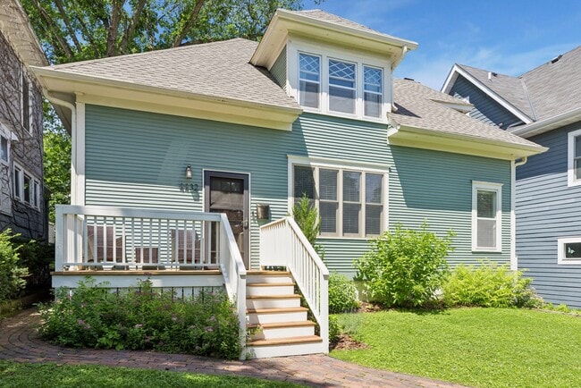
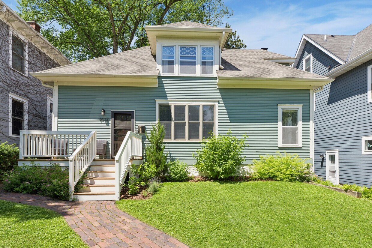
4432 Upton Ave S
Minneapolis, MN 55410
-
Bedrooms
3
-
Bathrooms
2
-
Square Feet
1,660 sq ft
-
Available
Available Jul 1

Contact
- Contact
Minneapolis lives up to its “City of Lakes” nickname, with thirteen lakes woven into the city, all connected by the Grand Rounds National Scenic Byway. Miles of trails make it easy to bike, run, or relax outdoors, while neighborhoods bring their own distinct personality. Uptown sits near Bde Maka Ska and Lake of the Isles, the North Loop features trendy shops and warehouse-style apartments near Target Field, and the Northeast Arts District blends galleries with lively taprooms. Near the Mississippi River, Dinkytown borders the University of Minnesota campus, while Downtown’s enclosed skyway system helps residents stay connected during the city’s freezing winters.
The Minneapolis rental market offers a range of options, from modern high-rise apartments and loft-style communities in the Mill District to classic townhomes in Longfellow.
Learn more about living in Minneapolis| Colleges & Universities | Distance | ||
|---|---|---|---|
| Colleges & Universities | Distance | ||
| Drive: | 14 min | 4.5 mi | |
| Drive: | 14 min | 5.6 mi | |
| Drive: | 14 min | 5.7 mi | |
| Drive: | 16 min | 6.9 mi |
Transportation options available in Minneapolis include Lake Street/Midtown Station, located 5.4 miles from 4432 Upton Ave S. 4432 Upton Ave S is near Minneapolis-St Paul International/Wold-Chamberlain, located 10.5 miles or 20 minutes away.
| Transit / Subway | Distance | ||
|---|---|---|---|
| Transit / Subway | Distance | ||
|
|
Drive: | 16 min | 5.4 mi |
|
|
Drive: | 17 min | 5.4 mi |
|
|
Drive: | 16 min | 6.0 mi |
|
|
Drive: | 17 min | 6.3 mi |
|
|
Drive: | 17 min | 6.7 mi |
| Commuter Rail | Distance | ||
|---|---|---|---|
| Commuter Rail | Distance | ||
|
|
Drive: | 17 min | 5.7 mi |
|
|
Drive: | 25 min | 15.3 mi |
|
|
Drive: | 25 min | 15.9 mi |
|
|
Drive: | 39 min | 23.3 mi |
|
|
Drive: | 40 min | 26.4 mi |
| Airports | Distance | ||
|---|---|---|---|
| Airports | Distance | ||
|
Minneapolis-St Paul International/Wold-Chamberlain
|
Drive: | 20 min | 10.5 mi |
Scores provided by
Traffic
-Airport
-Businesses
-Scores provided by
HowLoud What is a Sound Score Rating? A Sound Score Rating aggregates noise caused by vehicle traffic, airplane traffic and local sources. How It WorksTime and distance from 4432 Upton Ave S.
| Shopping Centers | Distance | ||
|---|---|---|---|
| Shopping Centers | Distance | ||
| Walk: | 13 min | 0.7 mi | |
| Walk: | 16 min | 0.8 mi | |
| Drive: | 4 min | 1.5 mi |
| Parks and Recreation | Distance | ||
|---|---|---|---|
| Parks and Recreation | Distance | ||
|
Beard's Plaisance Park
|
Walk: | 6 min | 0.3 mi |
|
Dell Park
|
Walk: | 6 min | 0.3 mi |
|
Linden Hills Park
|
Walk: | 8 min | 0.4 mi |
|
Pershing Field Park
|
Walk: | 16 min | 0.8 mi |
|
William Berry Park
|
Walk: | 19 min | 1.0 mi |
| Hospitals | Distance | ||
|---|---|---|---|
| Hospitals | Distance | ||
| Drive: | 8 min | 2.9 mi | |
| Drive: | 8 min | 3.0 mi | |
| Drive: | 13 min | 4.4 mi |
| Military Bases | Distance | ||
|---|---|---|---|
| Military Bases | Distance | ||
| Drive: | 16 min | 8.6 mi |
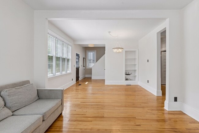
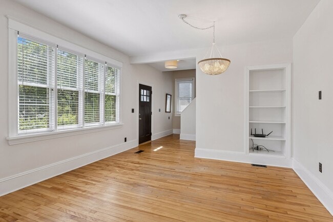
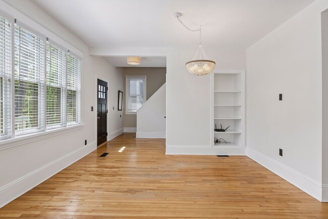
4432 Upton Ave S Photos
What Are Walk Score®, Transit Score®, and Bike Score® Ratings?
Walk Score® measures the walkability of any address. Transit Score® measures access to public transit. Bike Score® measures the bikeability of any address.
What is a Sound Score Rating?
A Sound Score Rating aggregates noise caused by vehicle traffic, airplane traffic and local sources.
4432 Upton Ave S
Minneapolis, MN 55410