$1,100
Total Monthly Price5 Beds, 3 Baths, 2,800 sq ft


Bedrooms
5
Bathrooms
2.5
Square Feet
3,150 sq ft

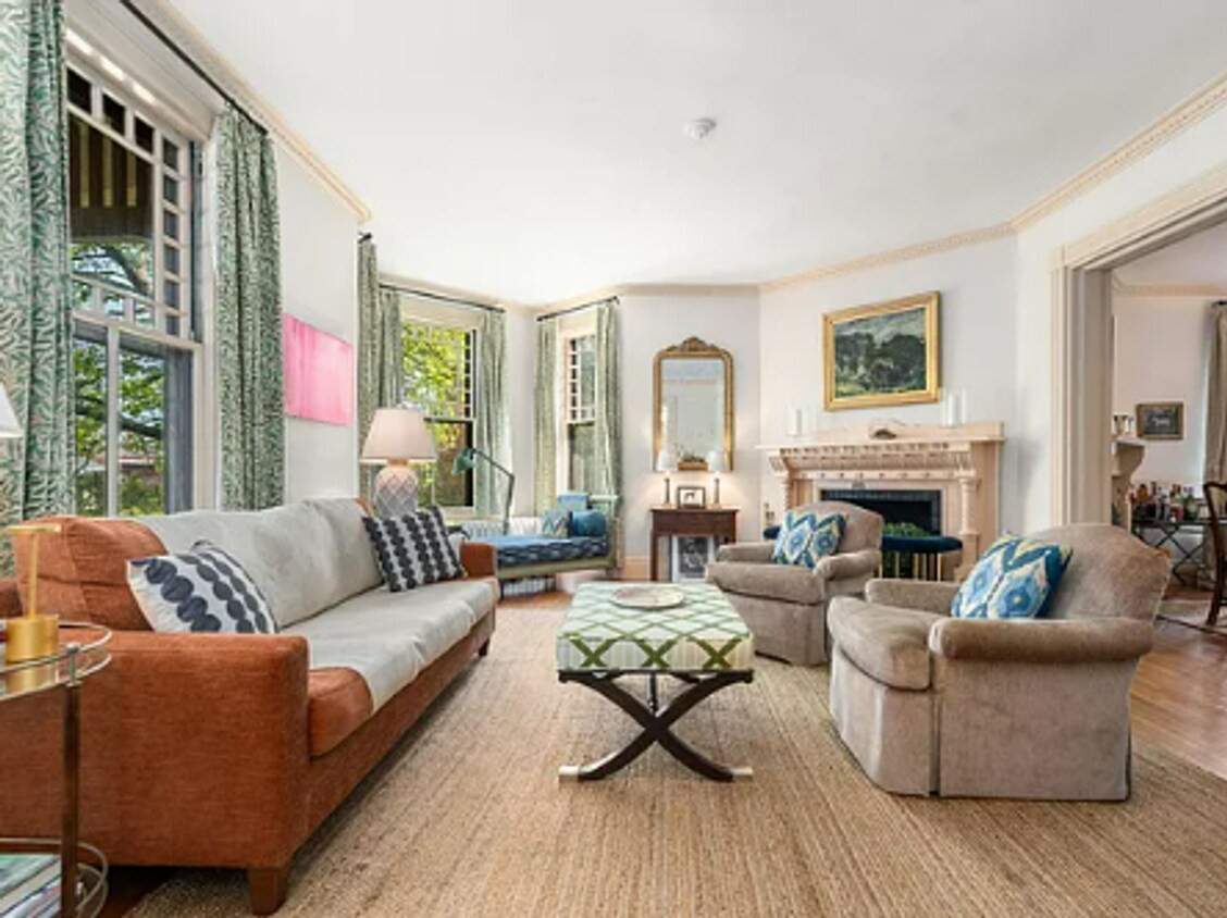
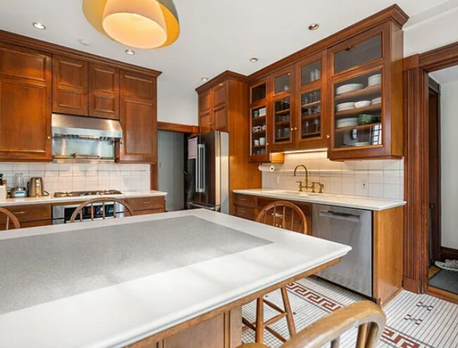
Available JULY 1 Elegant, fully furnished Victorian rental in Brookline's sought-after Pill Hill neighborhood. This sun-filled 5-bedroom, 2.5-bathroom single-family home offers over 3,150 square feet of updated living space, a beautifully landscaped private garden and bluestone terrace, and parking for six vehicles. Near Brookline Village, Coolidge Corner, Jamaica Plain, and Longwood Medical Area. Unit features: -Hardwood floors -Fully renovated chef's kitchen with higher-end appliances, quartz counters, kitchen island, custom mosaic subway tile flooring -Large living room -Separate dining room -Five bedrooms ranging from medium to extra large in size -Two full modern baths plus an additional half bath -Free laundry -Driveway parking -Beautifully landscaped yard and patio area -Cats negotiable (no dog)
44 High St is a house located in Norfolk County and the 02445 ZIP Code.
Brookline Village is an opulent neighborhood about five miles outside of Boston by car or train. This historic district is known for its beautiful homes and eclectic shopping destinations along Harvard Street and Washington Street. The other parts of Brookline Village feature lush community parks and residential homes. Renters have an abundance of moderately priced to luxury apartments and condos as well as spacious single-family homes for rent. Just outside of the neighborhood, residents enjoy parks like Olmsted Park, resort-like golf courses, and all the attractions offered by the big city.
Learn more about living in Brookline Village| Colleges & Universities | Distance | ||
|---|---|---|---|
| Colleges & Universities | Distance | ||
| Drive: | 2 min | 1.2 mi | |
| Drive: | 2 min | 1.6 mi | |
| Drive: | 3 min | 1.6 mi | |
| Drive: | 4 min | 1.6 mi |
Transportation options available in Brookline include Brookline Village Station, located 0.2 mile from 44 High St. 44 High St is near General Edward Lawrence Logan International, located 7.8 miles or 15 minutes away.
| Transit / Subway | Distance | ||
|---|---|---|---|
| Transit / Subway | Distance | ||
|
|
Walk: | 4 min | 0.2 mi |
|
|
Walk: | 7 min | 0.4 mi |
|
|
Walk: | 9 min | 0.5 mi |
|
|
Walk: | 12 min | 0.7 mi |
|
|
Walk: | 12 min | 0.7 mi |
| Commuter Rail | Distance | ||
|---|---|---|---|
| Commuter Rail | Distance | ||
|
|
Drive: | 3 min | 1.8 mi |
|
|
Drive: | 6 min | 2.6 mi |
|
|
Drive: | 8 min | 2.9 mi |
|
|
Drive: | 9 min | 4.1 mi |
| Drive: | 14 min | 6.2 mi |
| Airports | Distance | ||
|---|---|---|---|
| Airports | Distance | ||
|
General Edward Lawrence Logan International
|
Drive: | 15 min | 7.8 mi |
Time and distance from 44 High St.
| Shopping Centers | Distance | ||
|---|---|---|---|
| Shopping Centers | Distance | ||
| Walk: | 17 min | 0.9 mi | |
| Drive: | 3 min | 1.2 mi | |
| Drive: | 4 min | 1.6 mi |
| Parks and Recreation | Distance | ||
|---|---|---|---|
| Parks and Recreation | Distance | ||
|
Frederick Law Olmsted National Historic Site
|
Walk: | 19 min | 1.0 mi |
|
John Fitzgerald Kennedy National Historic Site
|
Drive: | 4 min | 1.3 mi |
|
Roxbury Heritage State Park
|
Drive: | 4 min | 1.8 mi |
|
Coit Observatory
|
Drive: | 5 min | 2.4 mi |
|
Charles River Reservation
|
Drive: | 6 min | 2.9 mi |
| Hospitals | Distance | ||
|---|---|---|---|
| Hospitals | Distance | ||
| Walk: | 15 min | 0.8 mi | |
| Walk: | 20 min | 1.0 mi | |
| Walk: | 20 min | 1.0 mi |
| Military Bases | Distance | ||
|---|---|---|---|
| Military Bases | Distance | ||
| Drive: | 25 min | 14.0 mi | |
| Drive: | 30 min | 15.7 mi |
$1,100
Total Monthly Price5 Beds, 3 Baths, 2,800 sq ft
$4,500
Total Monthly Price4 Beds, 2 Baths, 1,800 sq ft
$5,000
Total Monthly Price4 Beds, 2 Baths, 3,000 sq ft
What Are Walk Score®, Transit Score®, and Bike Score® Ratings?
Walk Score® measures the walkability of any address. Transit Score® measures access to public transit. Bike Score® measures the bikeability of any address.
What is a Sound Score Rating?
A Sound Score Rating aggregates noise caused by vehicle traffic, airplane traffic and local sources