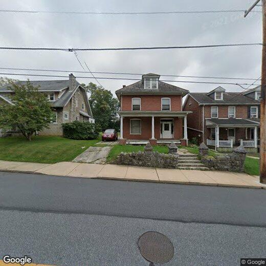
434 S State St

434 S State St

,

Ephrata, PA 17522

Share Listing
Favorites
434 S State St
Share Listing
Favorites

Check Back Soon for Upcoming Availability

Beds Baths Average SF
1 Bedroom 1 Bedroom 1 Br 1 Bath 1 Bath 1 Ba
Location
434 S State St, Ephrata,
PA 17522
Get Directions
| Edit

Under 30 minutes

Commute Time is calculated at rush hour.
City - Ephrata

Sitting roughly halfway between Lancaster and Reading, Ephrata is the kind of Lancaster County borough where downtown still has a real pulse and the surrounding countryside gives you room to breathe. The small-town feel shows up in everyday life—whether you're picking up fresh produce at a local farmers market, strolling past well-kept historic architecture near the State and Main intersection, or heading north to Middle Creek Wildlife Management Area for a morning hike. Philadelphia is close enough for a day trip, and both Lancaster and Reading are reachable in under 30 minutes.

Ephrata carries a genuinely fascinating past as home to the Ephrata Cloister, an 18th-century religious community and one of America's earliest communal societies. That heritage still shapes the borough's character today. Renters will find a solid mix of options here, from cozy townhomes and garden-style apartment communities to multi-bedroom units suited for roommates or extra space.

Learn more about living in Ephrata 
Education
Colleges & Universities Distance
Drive: 21 min 12.8 mi
Drive: 29 min 17.3 mi
Drive: 30 min 19.4 mi
Drive: 32 min 21.1 mi
434 S State St is within 21 minutes or 12.8 miles from Franklin and Marshall College. It is also near Millersville University and Alvernia University.
Transportation

434 S State St is near Harrisburg International, located 41.4 miles or 54 minutes away.

Commuter Rail Distance
Drive: 19 min 12.0 mi
Drive: 31 min 21.9 mi
Drive: 45 min 25.0 mi
Drive: 50 min 28.8 mi
Drive: 42 min 29.6 mi
Airports Distance
Airports Distance
Harrisburg International
Drive: 54 min 41.4 mi

Walkability Near 434 S State St Ephrata, PA 17522

Getting Around
Fairly Walkable
Walkability
50 / 100
Minimal Public Transit
Transit
10 / 100
Very Drivable
Drivability
80 / 100
Fairly Bikeable
Bikeability
50 / 100

Scores provided by

What do Walkability, Transit, Drivability, and Bikeability mean? Walkability measures the walking distance to day-to-day needs. Transit measures access to public transportation. Drivability measures congestion, parking availability, and access to major roads. Bikeability measures the suitability for cycling. How It Works
-
Soundscore
- / 100

Traffic

-

Airport

-

Businesses

-

Scores provided by

HowLoud What is a Sound Score Rating? A Sound Score Rating aggregates noise caused by vehicle traffic, airplane traffic and local sources. How It Works
Points of Interest

Time and distance from 434 S State St.

Shopping Centers Distance
Drive: 3 min 1.1 mi
Drive: 3 min 1.2 mi
Drive: 4 min 1.6 mi
434 S State St has 3 shopping centers within 1.6 miles, which is about a 4-minute drive. The miles and minutes will be for the farthest away property.
Parks and Recreation Distance
Landis Valley Museum
Drive: 14 min 8.5 mi
Children's Museum of Lancaster
Drive: 14 min 8.6 mi
Speedwell Forge Park
Drive: 21 min 11.0 mi
434 S State St has 3 parks within 11.0 miles, including Landis Valley Museum, Children's Museum of Lancaster, and Speedwell Forge Park.
Hospitals Distance
Hospitals Distance
Walk: 18 min 1.0 mi
Drive: 15 min 8.1 mi
434 S State St is 1.0 mile from Wellspan Ephrata Community Hospital, and is convenient to other hospitals, including UPMC Lititz.
Military Bases Distance
Drive: 56 min 33.3 mi
Drive: 71 min 40.2 mi
Drive: 70 min 50.9 mi
434 S State St has 3 military bases within 50.9 miles, the nearest is Fort Indiantown Gap Union which is 33.3 miles away and a 56 minute drive.

You May Also Like

Similar Rentals Nearby