$2,685
/ Month
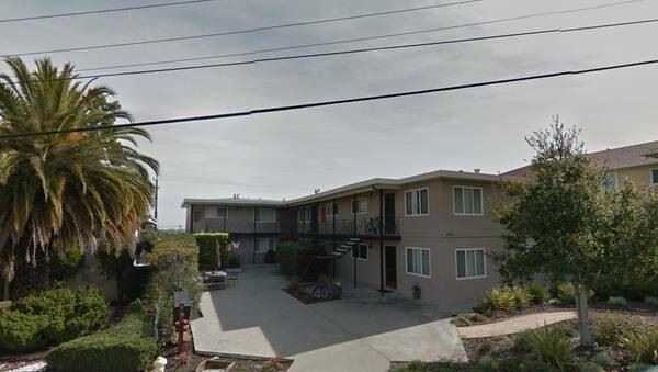
4333 Beresford St
San Mateo, CA 94403
2 Weeks Ago
|
Edit
Favorites
4333 Beresford St

Favorites
Check Back Soon for Upcoming Availability
| Beds | Baths | Average SF |
|---|---|---|
| 2 Bedrooms 2 Bedrooms 2 Br | 1 Bath 1 Bath 1 Ba | — |
About This Property
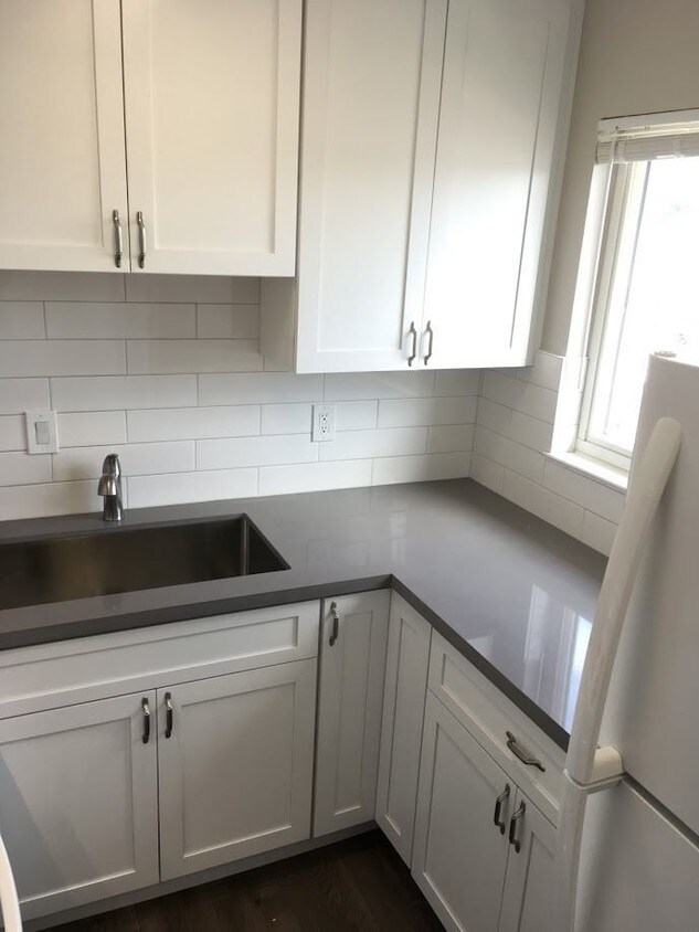
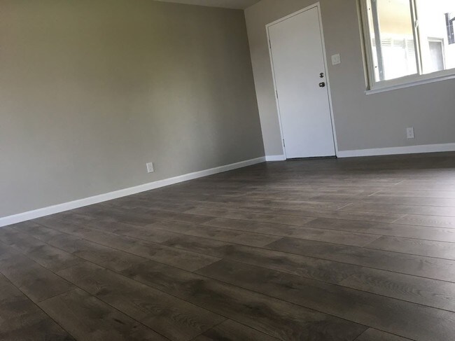
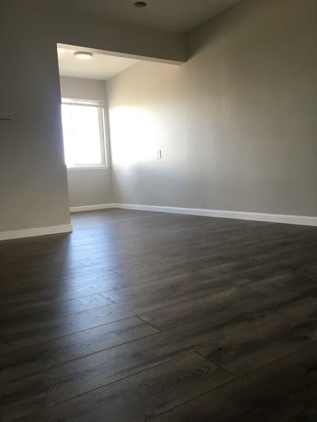
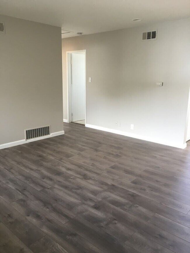
(650) 344-4198 x1 - Newly remodeled unit, all new appliances - Close to CalTrain 101 Freeway & Hillsdale Mall - Newly remodeled unit!! Only two blocks to Mollie Stone, Walgreens, and CVS. Five-minute bike ride to Hillsdale Caltrain Station. Three-minute bike ride to San Mateo Medical Center. Two bedrooms with a living room and an eat-in kitchen. Full-size stove and oven. Hardwood like floors throughout. Off-street reserved covered parking. Laundry on-site and storage space in the laundry room. Many shops, a bowling alley, and restaurants nearby. Hillsdale Mall, with Barnes & Noble bookstore, Starbucks, The Counter and Nordstrom are only .08 miles from your new home. Ten-minute drive to Foster City and Downtown San Mateo. Redwood city is only 13 minutes away by car. Rent $2,685.00 Deposit equals a month's rent. Tenant is responsible for all utilities. The lease term is one year. No pets, No smoking. Onsite laundry room. Credit and background check required for all applicants. No smoking Call Mayra at (650) 344-4198 to see your new home. (RLNE3265712)
4333 Beresford St is an apartment community located in San Mateo County and the 94403 ZIP Code.
Location
Get Directions
Located about halfway between San Francisco and San Jose, Sugarloaf is a peaceful, suburban neighborhood in San Mateo. Sugarloaf is predominantly residential, touting an array of single-family houses and apartment buildings atop scenic hillsides. However, Sugarloaf also provides plenty of shopping opportunities, from the extensive retail offerings of the Hillsdale Shopping Center to the unique finds in local shops along 37th Avenue.
Sugarloaf residents enjoy ample outdoor activities at the sprawling Laurelwood Park in addition to quick commutes for those working at the San Mateo Medical Center and the College of San Mateo. Convenience to El Camino Real, J. Arthur Younger Freeway, the Hillsdale CalTrain Station, and San Francisco International Airport makes getting around from Sugarloaf a breeze.
Learn more about living in SugarloafBelow are rent ranges for similar nearby apartments
Education
| Colleges & Universities | Distance | ||
|---|---|---|---|
| Colleges & Universities | Distance | ||
| Drive: | 7 min | 3.5 mi | |
| Drive: | 18 min | 9.9 mi | |
| Drive: | 20 min | 12.2 mi | |
| Drive: | 26 min | 15.5 mi |
4333 Beresford St is within 7 minutes or 3.5 miles from College of San Mateo. It is also near Menlo College and Canada College.
Transportation options available in San Mateo include Millbrae Bart Station, located 9.4 miles from 4333 Beresford St. 4333 Beresford St is near San Francisco International, located 10.4 miles or 16 minutes away, and Metro Oakland International, located 26.1 miles or 35 minutes away.
| Transit / Subway | Distance | ||
|---|---|---|---|
| Transit / Subway | Distance | ||
|
|
Drive: | 15 min | 9.4 mi |
|
|
Drive: | 15 min | 9.4 mi |
| Drive: | 16 min | 10.1 mi | |
|
|
Drive: | 16 min | 10.3 mi |
|
|
Drive: | 16 min | 10.4 mi |
| Commuter Rail | Distance | ||
|---|---|---|---|
| Commuter Rail | Distance | ||
| Drive: | 3 min | 1.3 mi | |
| Drive: | 4 min | 1.4 mi | |
| Drive: | 4 min | 1.5 mi | |
| Drive: | 6 min | 2.3 mi | |
| Drive: | 6 min | 2.4 mi |
| Airports | Distance | ||
|---|---|---|---|
| Airports | Distance | ||
|
San Francisco International
|
Drive: | 16 min | 10.4 mi |
|
Metro Oakland International
|
Drive: | 35 min | 26.1 mi |
Time and distance from 4333 Beresford St.
| Shopping Centers | Distance | ||
|---|---|---|---|
| Shopping Centers | Distance | ||
| Walk: | 1 min | 0.1 mi | |
| Walk: | 5 min | 0.3 mi | |
| Walk: | 10 min | 0.6 mi |
4333 Beresford St has 3 shopping centers within 0.6 mile, which is about a 10-minute walk. The miles and minutes will be for the farthest away property.
| Parks and Recreation | Distance | ||
|---|---|---|---|
| Parks and Recreation | Distance | ||
|
San Mateo Arboretum
|
Drive: | 7 min | 3.0 mi |
|
Japanese Tea Garden (San Mateo)
|
Drive: | 8 min | 3.4 mi |
|
Shoreline Parks
|
Drive: | 9 min | 5.0 mi |
|
Edgewood Park & Natural Preserve
|
Drive: | 13 min | 6.1 mi |
|
Pulgas Ridge Open Space Preserve
|
Drive: | 16 min | 7.5 mi |
4333 Beresford St has 5 parks within 7.5 miles, including San Mateo Arboretum, Japanese Tea Garden (San Mateo), and Shoreline Parks.
| Hospitals | Distance | ||
|---|---|---|---|
| Hospitals | Distance | ||
| Walk: | 12 min | 0.6 mi | |
| Drive: | 12 min | 5.0 mi | |
| Drive: | 9 min | 5.2 mi |
4333 Beresford St has 3 hospitals within 5.2 miles, the nearest is San Mateo Medical Center which is 0.6 mile away and a 12 minute walk.
| Military Bases | Distance | ||
|---|---|---|---|
| Military Bases | Distance | ||
| Drive: | 26 min | 17.4 mi |
4333 Beresford St is 17.4 miles and a 26 minute drive from Ames Research Center.
You May Also Like
Similar Rentals Nearby


What Are Walk Score®, Transit Score®, and Bike Score® Ratings?
Walk Score® measures the walkability of any address. Transit Score® measures access to public transit. Bike Score® measures the bikeability of any address.
What is a Sound Score Rating?
A Sound Score Rating aggregates noise caused by vehicle traffic, airplane traffic and local sources

4333 Beresford St
San Mateo, CA 94403