
$515
/ Month
433 W Saunders Ave Unit 6
Lincoln, NE 68521
Favorites
433 W Saunders Ave Unit 6

Favorites
Check Back Soon for Upcoming Availability
| Beds | Baths | Average SF |
|---|---|---|
| 1 Bedroom 1 Bedroom 1 Br | 1 Bath 1 Bath 1 Ba | — |
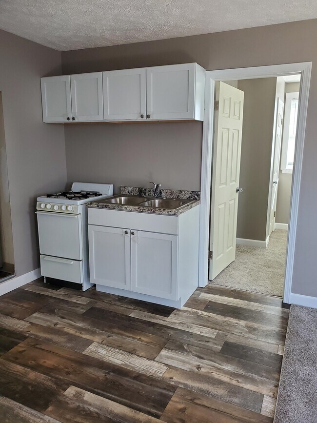
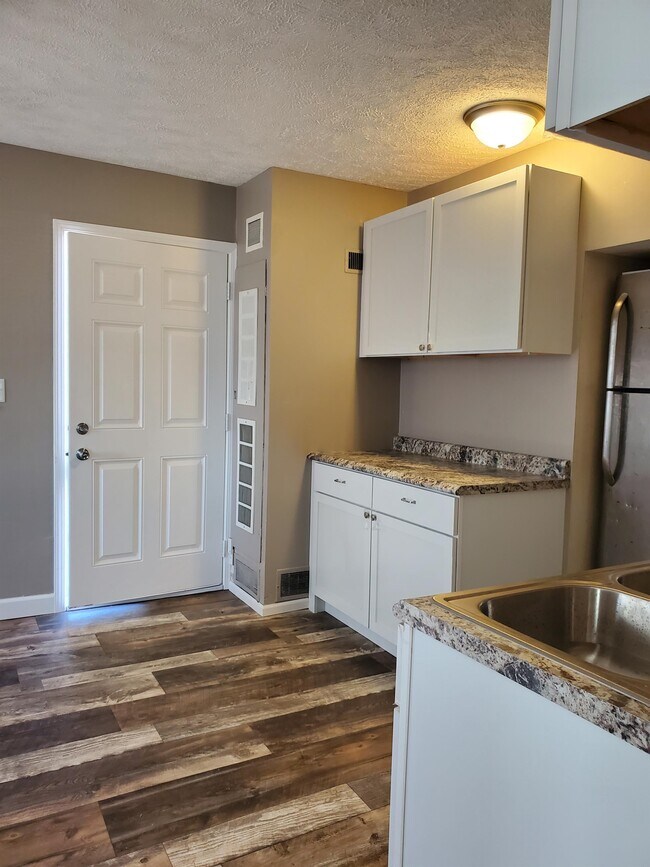
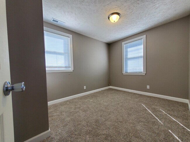
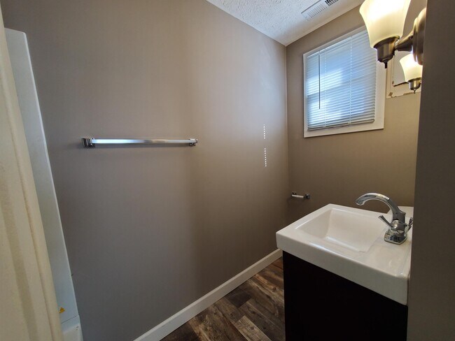
About This Property
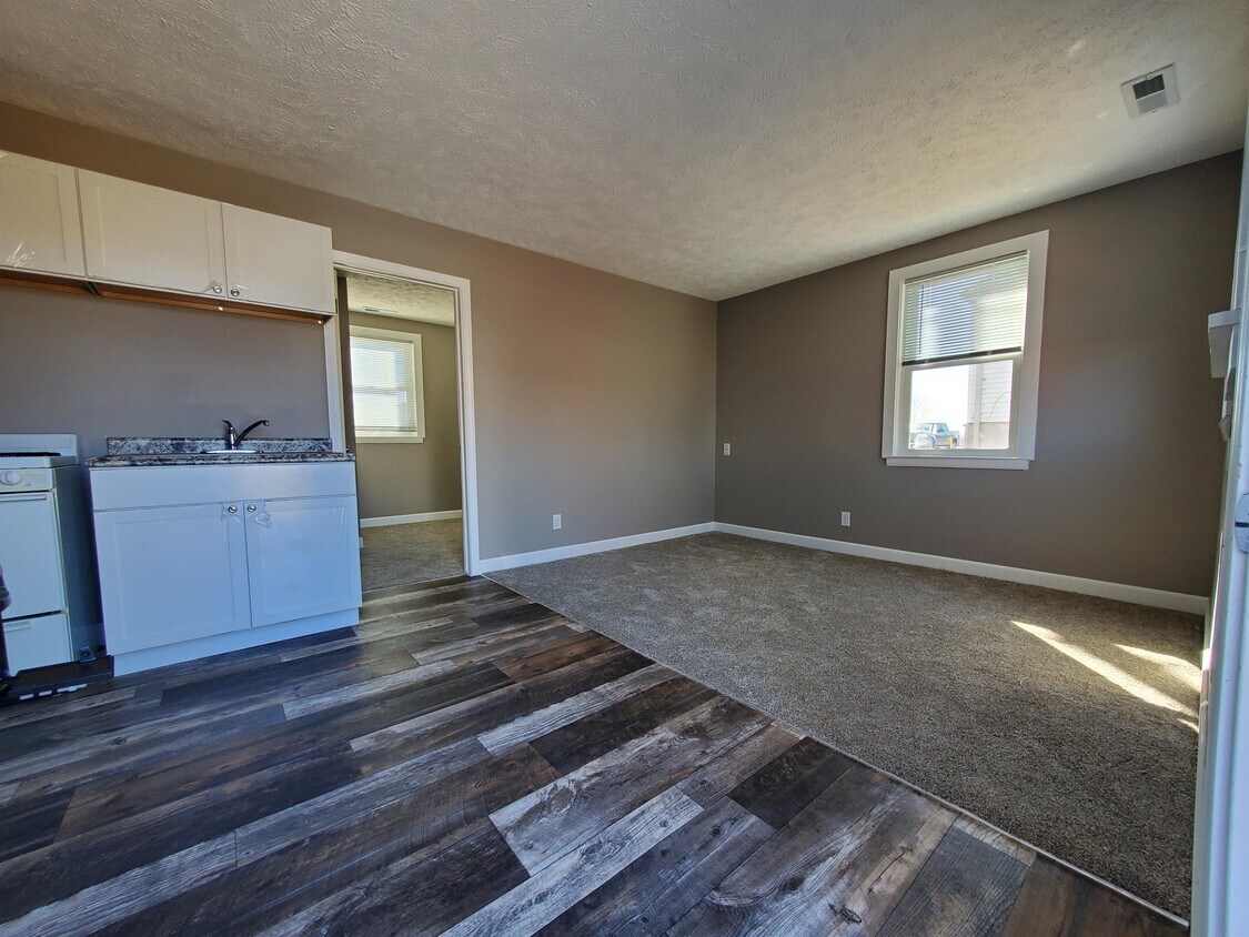
Updated 1 bedroom, 1 bathroom apartment. Please visit arrowlincoln.com to apply and schedule a showing. Pets negotiable
433 W Saunders Ave is an apartment community located in Lancaster County and the 68521 ZIP Code.
433 W Saunders Ave,
Lincoln,
NE
68521
West Lincoln is a predominantly residential neighborhood situated just three miles northwest of Downtown Lincoln. West Lincoln residents enjoy the tranquility of suburban living along with easy access to urban amenities.
Numerous parks offer abundant options for outdoor recreation around West Lincoln, including Oak Lake Park, Roper Park, and West Lincoln Park. Area attractions such as the Pinnacle Bank Arena, University of Nebraska Lincoln, Haymarket District, Nebraska State Capitol, and the Lincoln Children’s Zoo are all located within a short drive from West Lincoln.
Commuting and traveling from West Lincoln is a breeze with convenience to I-80, I-180, and the Lincoln Airport.
Learn more about living in West LincolnBelow are rent ranges for similar nearby apartments
Education
| Colleges & Universities | Distance | ||
|---|---|---|---|
| Colleges & Universities | Distance | ||
| Drive: | 5 min | 2.5 mi | |
| Drive: | 9 min | 4.7 mi | |
| Drive: | 17 min | 9.1 mi | |
| Drive: | 27 min | 22.4 mi |
433 W Saunders Ave Unit 6 is within 5 minutes or 2.5 miles from University of Nebraska-Lincoln. It is also near Nebraska Wesleyan University and Southeast C.C., Lincoln Campus.
Walkability Near 433 W Saunders Ave Lincoln, NE 68521
Getting Around
 What do Walkability, Transit, Drivability, and Bikeability mean?
Walkability measures the walking distance to day-to-day needs.
Transit measures access to public transportation.
Drivability measures congestion, parking availability, and access to major roads.
Bikeability measures the suitability for cycling.
How It Works
What do Walkability, Transit, Drivability, and Bikeability mean?
Walkability measures the walking distance to day-to-day needs.
Transit measures access to public transportation.
Drivability measures congestion, parking availability, and access to major roads.
Bikeability measures the suitability for cycling.
How It Works
Fairly Walkable
Walkability
40
/ 100
Limited Public Transit
Transit
30
/ 100
Exceptionally Drivable
Drivability
100
/ 100
Moderately Bikeable
Bikeability
70
/ 100
Scores provided by
-
Soundscore™
-
/ 100
Traffic
-Airport
-Businesses
-Scores provided by
HowLoud What is a Sound Score Rating? A Sound Score Rating aggregates noise caused by vehicle traffic, airplane traffic and local sources. How It WorksYou May Also Like
Similar Rentals Nearby


What Are Walk Score®, Transit Score®, and Bike Score® Ratings?
Walk Score® measures the walkability of any address. Transit Score® measures access to public transit. Bike Score® measures the bikeability of any address.
What is a Sound Score Rating?
A Sound Score Rating aggregates noise caused by vehicle traffic, airplane traffic and local sources.
433 W Saunders Ave
Lincoln, NE 68521